 Example 1
Observations from instruments flown on satellites are extensively used in weather analysis. There are two types of orbits that weather satellites fly in:
Flown on-board these satellites are instruments that measure electromagnetic energy that is either reflected or emitted by our planet. These instruments are called radiometers. There are two common types of radiometers used in satellite meteorology. One type measures the amount of visible light from the sun reflected back to space by the earth's surface or by clouds. The second measures the amount of radiation emitted by these entities.
The radiometers flown on satellites are not cameras. Moving Mirrors make the radiometer view different regions of the earth. The instrument begins by looking off in one direction and then scans across a scene making observations as it proceeds. In this manner the radiometer scans a scene line-by-line. Data is recorded in a two-dimensional format (line and element) which, when displayed on a computer monitor or television screen, makes up an image. The smallest part of this image is the pixel -- which stands for "picture element." The radiation coming from each pixel is presented in an image format in terms of a grayscale. An image consists of 256 gray shades, ranging from 0 for pure black to 255 for pure white.
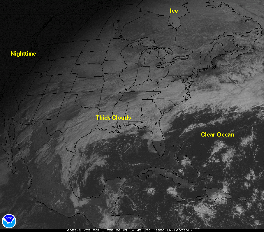
Dark areas in a visible image represent geographic regions were small amounts of visible light from the sun are reflected back to space. Whiter regions are objects that are highly reflective.
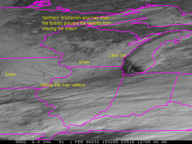
The oceans are usually dark while snow and thick clouds are bright.
Don't be fooled by visible imagery.
All objects emit electromagnetic radiation. The infrared radiometers on satellites measure radiation with wavelengths of 11 microns. For easy interpretation, the radiant energy measured by infrared radiometers is converted to a temperature.
Cold objects are white and hot surfaces appear black.
Time sequences of infrared images are animated and shown on television news stations.
Don't be fooled by infrared imagery.
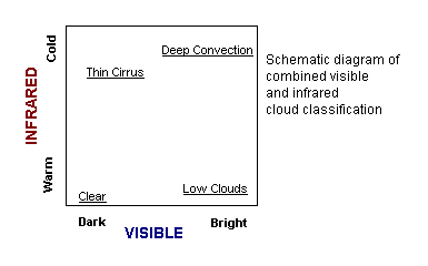
The best way to interpret satellite images to view visible and infrared imagery together.
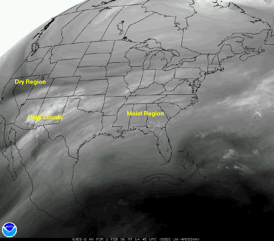
Meteorologists make extensive use of observations from radiometers that measure radiation with wavelengths of 6.7 microns. These images are referred to as water vapor images as the radiometers are measuring radiation emitted by atmospheric water vapor. Unlike the 11 micron radiometers, the water vapor radiometers measure radiation that is coming from the 200 to 600 mb layer of the atmosphere. The grayscale represents the relative humidity of the midtroposphere.
Moist regions of the midtroposphere are gray, and dark areas in the image represent dry regions.
Satellite loops of water vapor images give an indication of the circulation of the midtroposphere.
Latest GOES-8 water vapor image.
Latest GOES-9 water vapor image.
By compositing all the geostationary observations into one image, you can view the cloud cover of the world! Latest Composite (updated every 3 hours) from SSEC. Movie loop