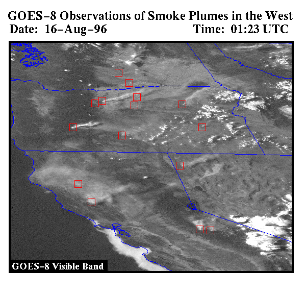
If you watch the evening weather report you will see a satellite 'loop' of the weather. We will discuss how to interpret this satellite images later in the course. We will also be analyzing satellite images to study different weather phenomena. Satellites can do more than just monitor the weather. For example, observations from a satellite are also used to study and monitor fires! The picture below is of a visible image taken from a weather satellite on August 16, 1996. You generally don't see visible images on the nightly news because the sun has set by 10:00 pm and so it is dark over the United States. This image was made during the daylight hours. Notice the smoke plumes. The fires are marked by red boxes. This was a bad summer for fires in the west because of the dry weather this summer, and the wet weather in the spring. Continue reading to learn how we know where the fires are.
Observations at a wavelength of approximately 4 microns are used by researchers and weather forecasters to detect fog at night, discriminate between water clouds and ice clouds and snow, detect fires and volcanic eruptions, and to measure the temperature of the ocean during the night. Fires are evident in an image of data collected by an instrument that observes radiation with a wavelength of 4 microns (by the way, visible light has a wavelength between .4 and .7 microns.) The fires show up as 'hot spots' and in the image below this is denoted by the red squares.
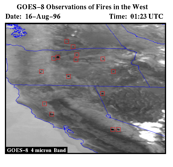
Researchers use observations at 4 microns to monitor biomass burning in North and South America. Why do you think it would be better to use observations at 4 microns rather than the visible wavelengths? More on monitoring fires from space.
Thanks to Elaine Prins for the satellite images.
You can send me comments