 |
WEATHER FOR PILOTS REAL-TIME WEATHER DATA PAGE |
 |
|
WEATHER FOR PILOTS REAL-TIME WEATHER DATA PAGE |
|
| SURFACE OBSERVATIONS
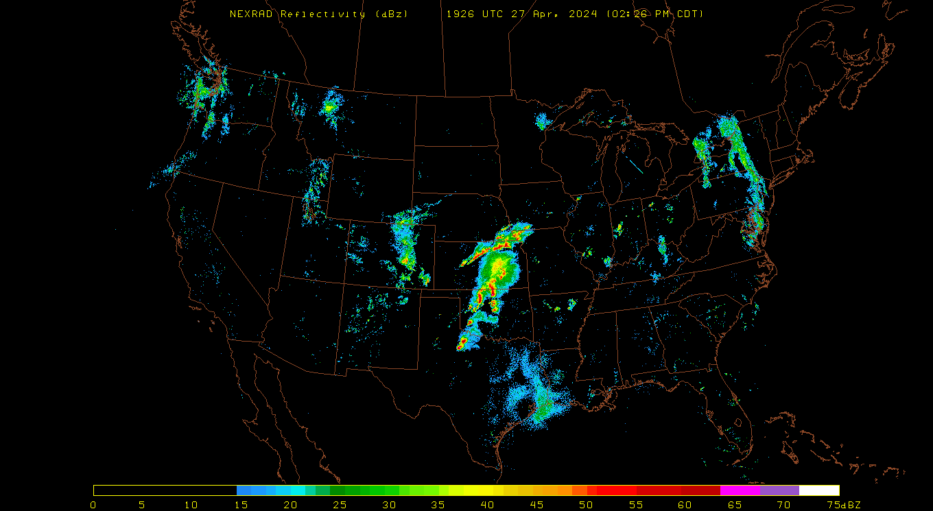
Real-Time Satellite Images
|
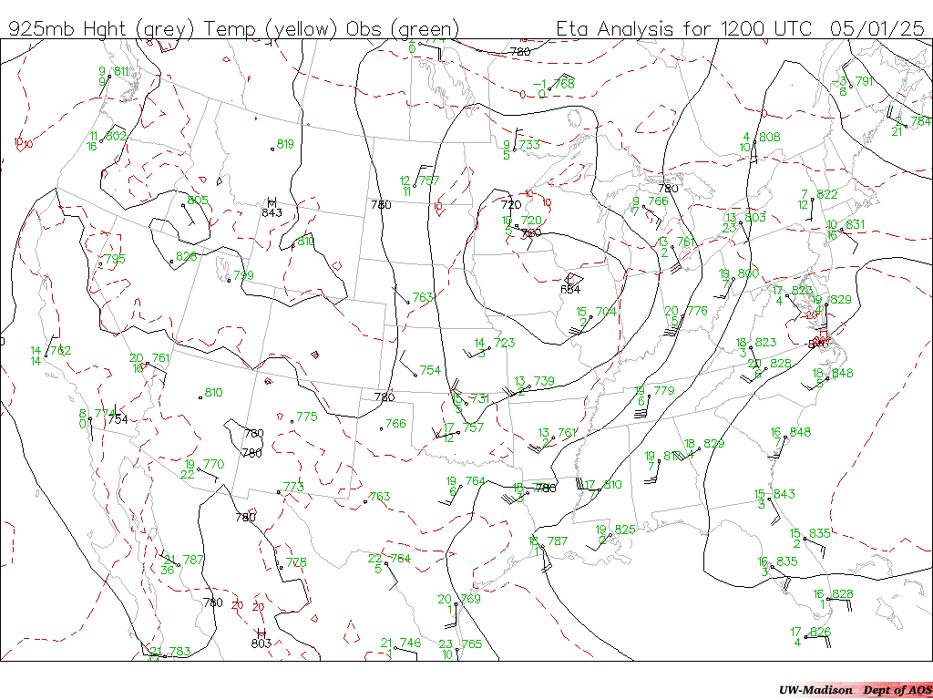
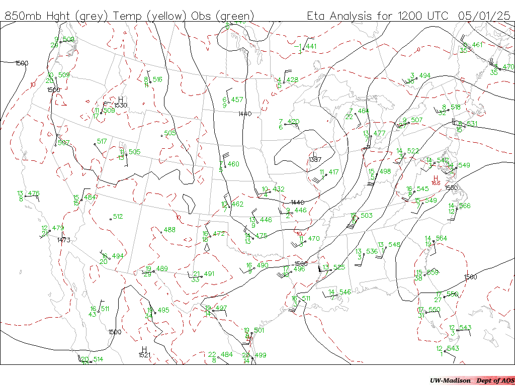
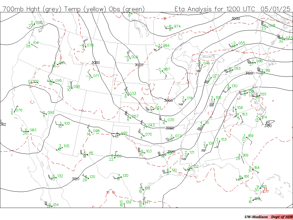
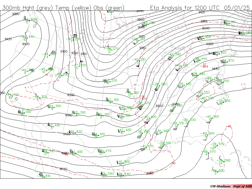
UPPER AIR MAPS
Weather For Pilots
|
| Updated 3 February 2009 | Cooperative
Institute for Meteorological Satellite Studies
CIMSS Weather University of Wisconsin-Madison AOS AOS Weather |