The NOAA/CIMSS ProbSevere model heavily leverages the Multi-Radar Multi-Sensor (MRMS) products developed at NOAA-NSSL and OU-CIMMS. By using multiple radars to sample weather, gaps in radar coverage due to things such as terrain blockage, the "cone of silence", and the radar beam overshooting weather at far ranges may be mitigated. Furthermore, combining multiple estimates of radar moments at any particular point can give a better final estimate. Multiple radar surveillance of weather can also provide more frequent updates. The ProbSevere model updates at the MRMS frequency, which is approximately every 2 minutes.
MRMS merged reflectivity is used to identify and track storms in radar imagery, using the Warning Decision Support System -- Integrated Information (WDSS-II). WDSS-II automatically identifies storms using an enhanced watershed algorithm and tracks storms by using methods to match identified objects in consecutive image pairs.
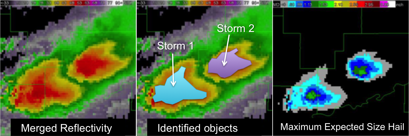
Figure is adapted from OU-CIMMS images.
Once storm objects are tracked in radar imagery, the Maximum Expected Size of Hail (MESH) is extracted from the spatial bounds of the objects. MESH is empirically derived from the Severe Hail Index (SHI), which is essentially a thermally weighted vertical integration of reflectivity above the melting level. Several recent studies have shown that MESH has some skill for identifying the presence of severe hail in storms. Please see Witt et al. (1998) for a more complete description of MESH and SHI.
The instantaneous maximum MESH is used as a predictor in the ProbSevere model.