
Monitoring the Global Environment

How Satellites tracked oil during and after the 2010 oil rig explosion in the Gulf of Mexico
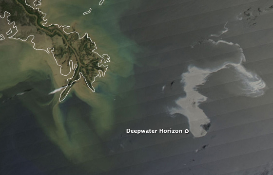
Deepwater Disaster
On April 20, 2010, a deadly explosion at the Deepwater Horizon offshore drilling platform started a catastrophic oil leak into the waters of the Gulf of Mexico that went unabated for several months. An estimated 42,000 gallons of oil leaked from the well each day!
Initial satellite images showed a plume of smoke spreading eastward from the rig until it capsized and sank. For months afterwards, satellites tracked the oil slick, most often via the Moderate Resolution Imaging Spectroradiometer (MODIS) on the Terra satellite. The oil slick was made visible to the satellite sensor by sunglint—the reflection of the Sun off the water which outlined the dull grey oil polluting the ecosystem.
| 14/ 15 |