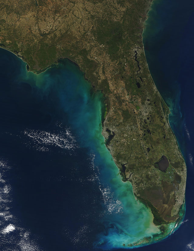
Below is an image of Florida from an instrument flying on a polar orbiting satellite (December 2002). Due to their relatively low orbit elevation, polar orbiting satellites are able to produce strikingly vivid images with fantastic details.
Select Modules to start your adventure in Satellite Meteorology.