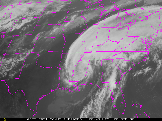
Below is an infrared image from a geostationary
satellite of the eastern US (September 2002).
You'll learn more about infrared images, as well as visible and water
vapor images, in the "Satellite Images" module.
Select Modules to start your adventure in Satellite Meteorology.