


|
|
|
Sea Breeze Circulation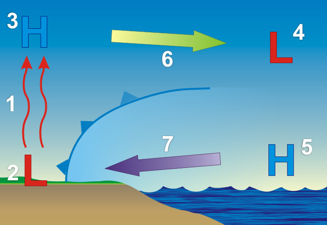 At the surface, the sun warms both the ground and ocean at the same rate. However, since the heat in the ground is not absorbed well it returns it heat to warm the air. The warmed air, with its decreased density, begins to rise (1). The rising air creates a weak low pressure area (called a thermal low) due to a decrease in air mass at the surface (2). Typically, from 3,000 to 5,000 feet (1,000 to 1,500 meters) above this low pressure, as the air cools, it begins to collect resulting in an increase in pressure, creating a "high" (3). |
Back: The Sea Breeze |
|
| National Weather Service Southern Region Headquarters 819 Taylor Street Fort Worth, Texas 76102 |
www.srh.weather.gov Updated: March 29, 2006 |
| NATIONAL WEATHER SERVICE: for Safety, for Work, for Fun - FOR LIFE |