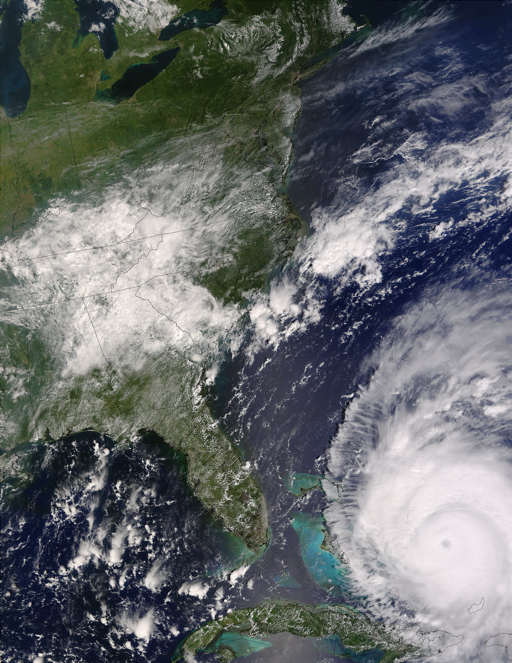
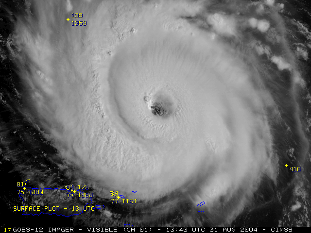
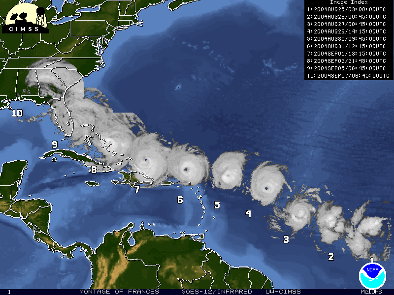
Meteorologists first detected Frances on satellite images on August 24th over the far eastern tropical Atlantic Ocean but the storm didnt become a hurricane until August 26th in the central Atlantic. Hurricane Frances reached category 4 strength with sustained winds of 145 mph on September 2nd as it moved westward near the Bahamas.
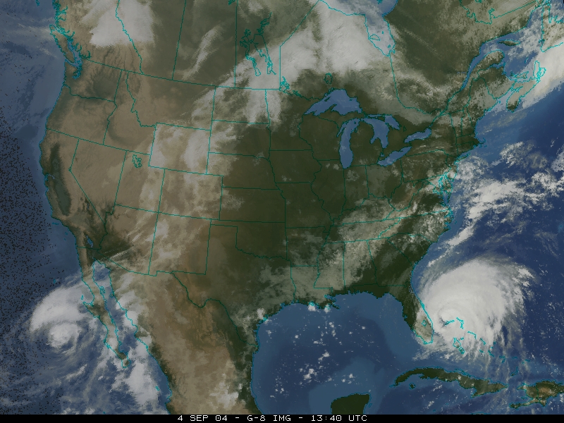
Fortunately, Frances weakened before making landfall on Floridas east coast near Sewalls as a category 2 hurricane on September 5th. Frances continued slowly west-northwest across central Florida and out into the Gulf of Mexico on September 6th. When Frances made landfall again near St Marks Florida it was no longer a hurricane. Frances moved northward across the eastern United States before dissipating over Canada on September 9th. The slow movement left a broad trail of damage through the Bahamas, Florida and the southeastern U.S., resulting in 23 deaths.
Continue to learn about Hurricane Ivan Go back to the previous page |