Why is the detection of thin cirrus overlying a lower-level water cloud important?
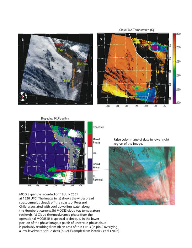
Cloud properties are inferred from satellite data under the assumption that any individual pixel, or field of view, contains a single cloud layer. This assumption is made primarily because of the large data volumes associated with satellite imagers. For example, a 5-minute granule of MODIS daytime data has a volume of approximately 350 MB. As shown in the example below, however, the presence of optically thin cirrus over a lower-level water cloud causes confusion in the retrieval algorithms...