|
Satellite-Derived Proxy ABI Data SetsContents:
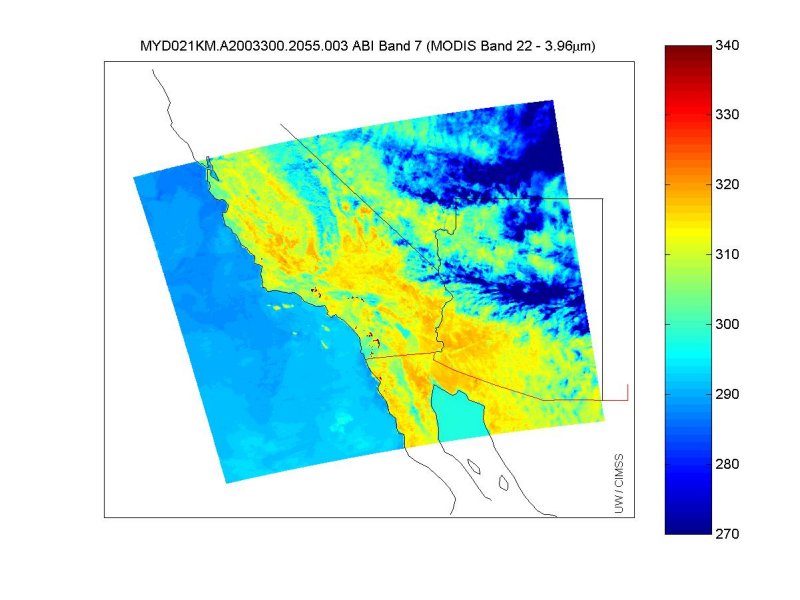
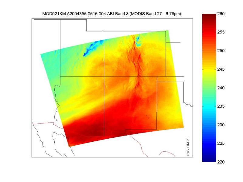
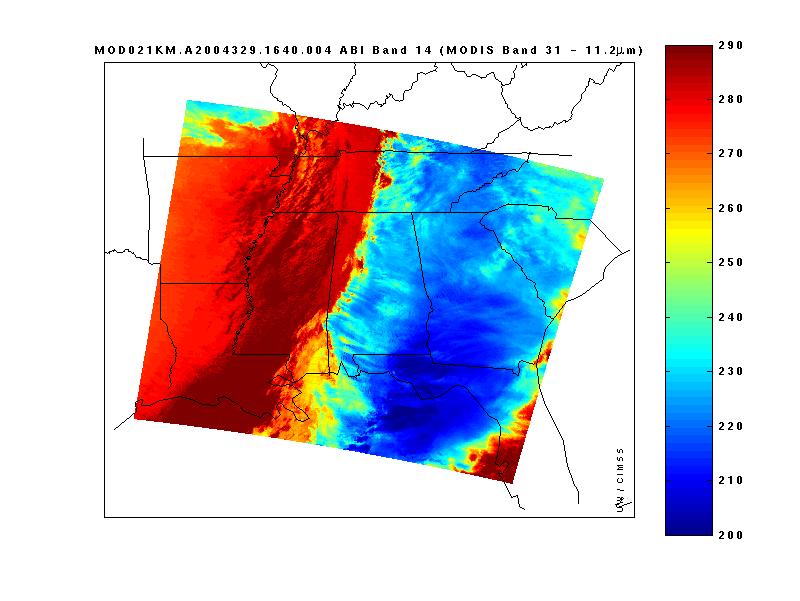
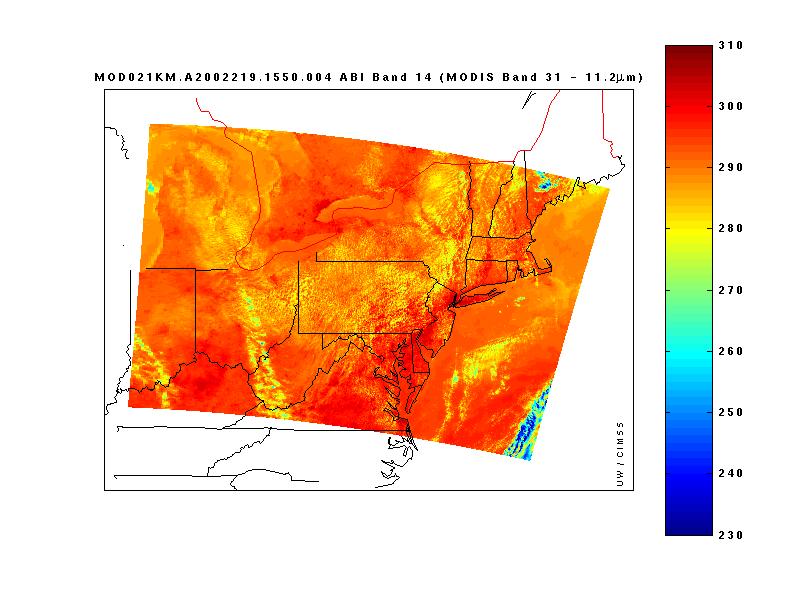
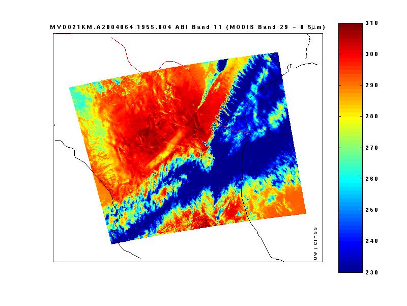
Bit-depth simulated ABI data sets:The data files are provided as Matlab .mat files on an ftp site. There is a separate .mat file for each ABI band, the navigation data, and the lookup tables to convert the scaled radiances (integers) to real radiances (modis radiances units). There is also a data file that contains all of the bands and navigation data (you still need the lookup tables). The 1.6 µm band on Aqua MODIS has a number of bad detectors which cause striping. This corresponds to band 05 on ABI. As such, for Aqua daytime cases, there is no ABI band 05 data provided since the striping would alter results in a way not anticipated to occur with ABI. That band is still provided for cases derived from Terra MODIS. Aqua MODIS data files begin with "MYD"; Terra MODIS data files begin with "MOD". There is a sample Matlab .m script that shows how to load the data and will display an image of a band of interest for that case. You must have the mapping toolbox for Matlab for the figure to display or find another way to display the data. This m-file calls another m-file which converts MODIS radiances to brightness temperatures for the purposes of displaying. Strictly speaking, these m-files aren't needed for most studies though they may give the user some insight as to what data is stored in what files.
Alternatively, there is a NetCDF file containing all of the data, navigation, and lookup tables for each band. The variables contained in this NetCDF file look similar to this for a day time case:
For a nighttime case, there won't be any visible data (variables related to ABI Bands 1-6 won't appear in those files, including navigational parameters for 1km and hkm data).
Unaltered MODIS dataThe unaltered MODIS data for the above cases can be obtained from the NASA Goddard Earth Sciences Data and Information Services Center (GES DISC) Distrubuted Active Archive Center (DAAC) or specifically from their MODIS Data Support page. Unaltered MET-8 Full Disk ImagesThese are on anonymous ftp at ftp.ssec.wisc.edu There are 11 bands for 3 sequential (at 15 minutes) images for those interested in simulation of full disk images. There has been nothing done to these images other than to take them from McIDAS AREA format and convert them (via McIDAS) to netCDF. The .mat versions were made by reading in the netCDF files into Matlab and then saving them as individual bands: they are structured arrays which include for latitude, longitude, and data (which are MET-8 counts). MET-8 data are 10-bit. See the EUMETSAT page for more information on Seviri (MET-8). Unaltered GOES-12 Imager Full Disk Images
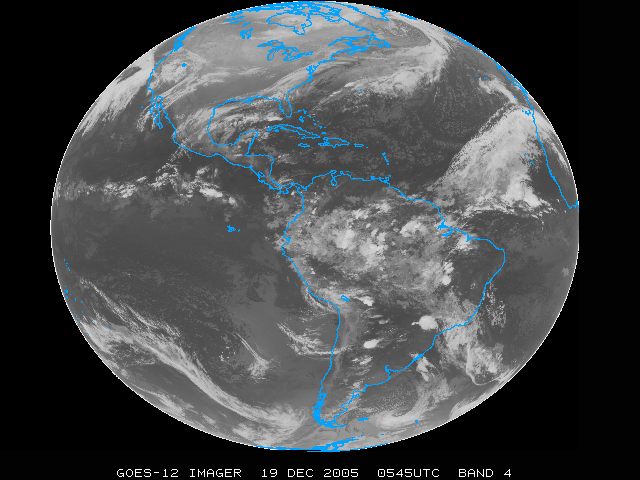
These are on anonymous ftp at ftp.ssec.wisc.edu There are 5 bands for 2 separate images (05:45Z and 17:45Z from 19Dec2005) for those interested in simulation of full disk images from the current GOES Imager. The times are representative of a "night" and "day" case. These files contain latitude, longitude, and GVAR Counts. They have not been altered in any way other than to convert them from McIdas format to netCDF to Matlab .mat files. They are structured arrays with the fields latitude, longitude, and raw (counts). Lats and Lons in space are saved as NaN in the .mat file. The bands are saved individually. See the GOES Imager Info Page for more information on the GOES Imager bands. See the GVAR Conversion page to learn how to convert GVAR counts. Unaltered MTSAT-1R 10-bit Full Disk Images
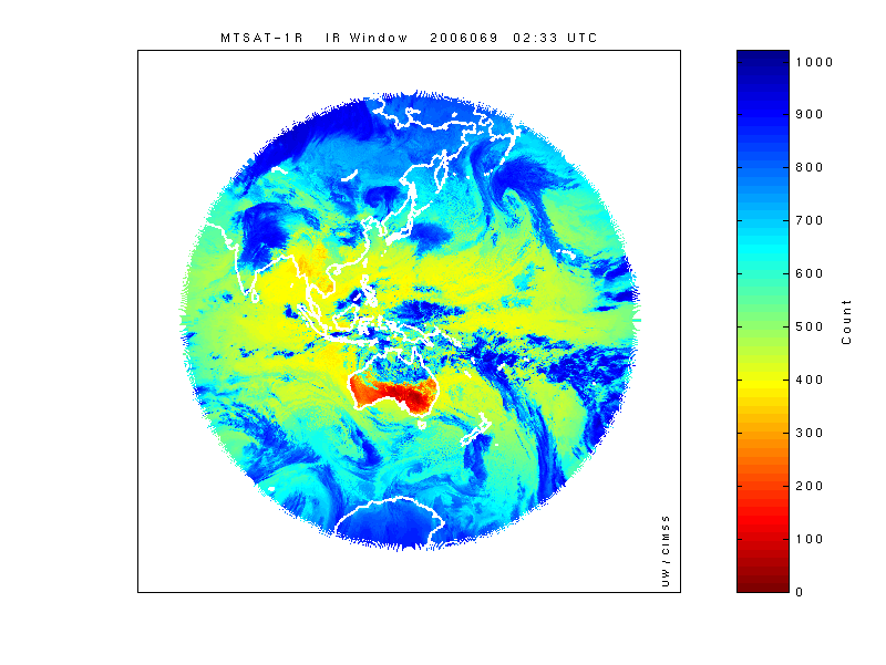
These are on anonymous ftp at ftp.ssec.wisc.edu There are 5 bands for one image time (2:33 UTC on 10 March 2006 for those interested in 10-bit full disk MTSAT-1R Infrared data. Visible data is 6-bit but has been stretched to 8-bit in this image. The band lineup is as follows: Band 01 is visible; Band 02 is the ~11 micron IR window band (IR1); Band 3 is the 12 micron dirty window band (IR2); Band 4 is the 6.75 micron water vapor band (IR3); and Band 05 is the 3.75 micron shortwave window band (IR4). The .mat files contain MTSAT data as a structured array with data=counts and latitude & longitude values in space are saved as NaN. The NetCDF versions of the files have lat/lons in space of an unreasonably high number (don't use anything over 180 for longitude for instance). Bands are saved individually. See the About MTSAT and its system page for more information on the MTSAT. NOTICE: The images, text, and other information on these web pages are proprietary information belonging to The Cooperative Institute for Meteorological Satellite Studies at the University of Wisconsin-Madison. If the informationis of use to you, please give proper credit to CIMSS. Thanks! |