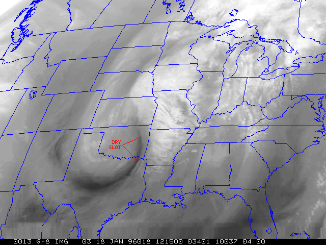
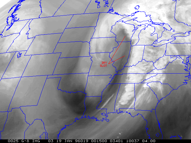
An intensifying cyclone was moving northeastward from the southern and central Plains toward the Great Lakes region on 18 January 1996. A mid-level jet streak and associated dry slot raced rapidly northeastward across Oklahoma, Arkansas, Missouri, Iowa and Illinois, finally reaching Wisconsin and shutting off precipitation. A Winter Storm Warning was issued for much of southcentral Wisconsin early in the day (03 UT 18 Jan), forecasting snow amounts of 8 to 12 inches -- this Winter Storm Warning was carried until early evening (01 UT 19 Jan), even after the dry slot had entered southern Wisconsin. Actual snow totals at Madison were less than an inch. The 18 January/00UT ETA model run looked suspect, and it appears that the midnight shift forecasters placed too much confidence in that particular ETA run.