07 October 1999 | Eruption of the Guagua Pichincha Volcano in Ecuador
|
|
|
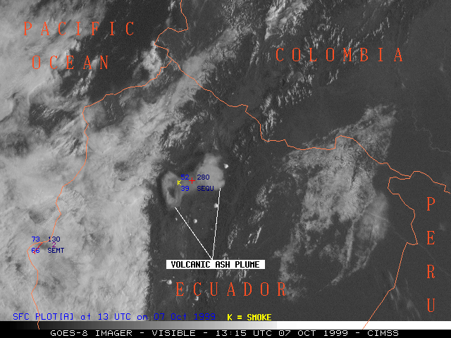
NOAA GOES-8 visible imagery (above) showed the ash plume following the eruption of the Guagua Pichincha Volcano in Ecuador during the morning of 07 October 1999. Due to directional wind shear with height, the plume was being advected in two directions: the highest portion (near 50,000 feet in altitude) was drifting eastward away from the capitol city of Quito (station identifier SEQU), while a lower portion (near 40,000 feet in altitude) was drifting to the west of Quito. The airport at Quito was closed following this and other eruptions a few days earlier, since volcanic ash is a hazard to aviation concerns.
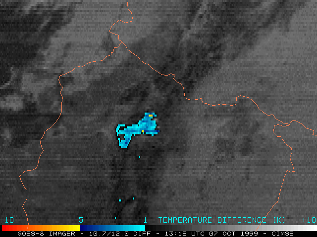
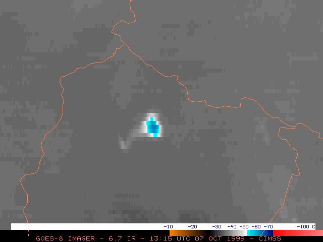
A satellite product that is often utilized to monitor volcanic ash plumes is the GOES 10.7/12.0 micrometer IR difference or "split window" product (below left). Differences in the emissivity of silicate particles within the ash plume at these two wavelengths leads to brightness temperature differences of 1-5 degrees Kelvin. In this case, the IR difference product shows the ash plume very well initally, but as the plume becomes thinner and more diffuse with time it loses its identity on the IR difference product. However, the eastern portion of the ash plume was able to be tracked for a longer period of time on the GOES 6.7 micrometer IR ("water vapor") channel (below right). Due to the generally dry middle and upper troposphere over northern South America on this day, the water vapor content within the ash plume was enough to create a discernible signature that could be followed as it drifted eastward across Ecuador toward Colombia and Peru.
|
|
(* Fade between GOES-8 visible, IR difference, and water vapor at 13:15 UTC *)
(* Fade between GOES-8 visible, IR difference, and water vapor at 16:15 UTC *)
