07 October 1999 | Eruption of the Guagua Pichincha Volcano | GOES-8 Imager Visible
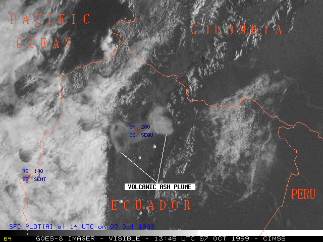
This loop of GOES-8 visible imagery shows the volcanic ash plume following the eruption of the Guagua Pichincha Volcano at 12:07 UTC on 07 October 1999. Due to directional wind shear with height, the plume was being advected in two directions: the highest portion (near 50,000 feet in altitude) was drifting eastward away from the capitol city of Quito (station identifier SEQU), while a lower portion (near 40,000 feet in altitude) was drifting to the west of Quito. It became more difficult to track the motion of the ash cloud as it became more diffuse and moved over regions of low-level cloudiness.
