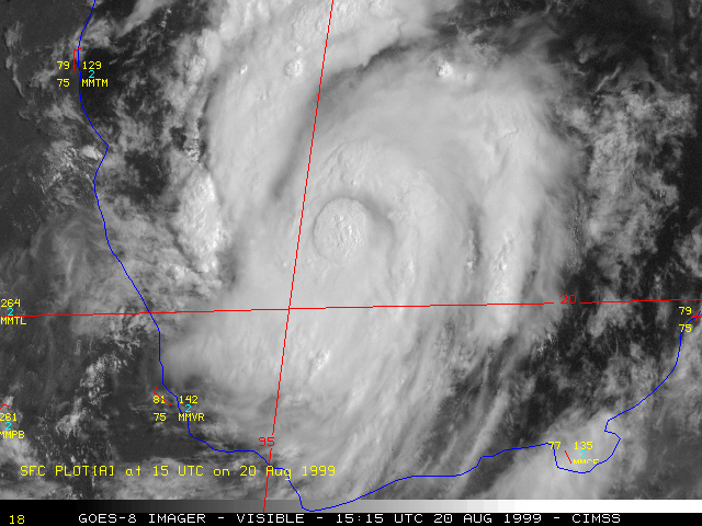
20 August 1999 | Tropical Storm Bret Over the Gulf of Mexico
|

|
|
|
|
NOAA put the GOES-8 satellite into Rapid Scan Operations (RSO - 5 to 10 minute image intervals) and also Super Rapid Scan Operations (SRSO - 1 minute image intervals) on 20 August 1999 to monitor Tropical Storm Bret in the southern Gulf of Mexico. GOES-8 visible and 10.7 micrometer InfraRed (IR) imagery (above) show the dissipation and redevelopment of the Central Dense Overcast (CDO) over the storm center as it developed off the coast of Mexico.
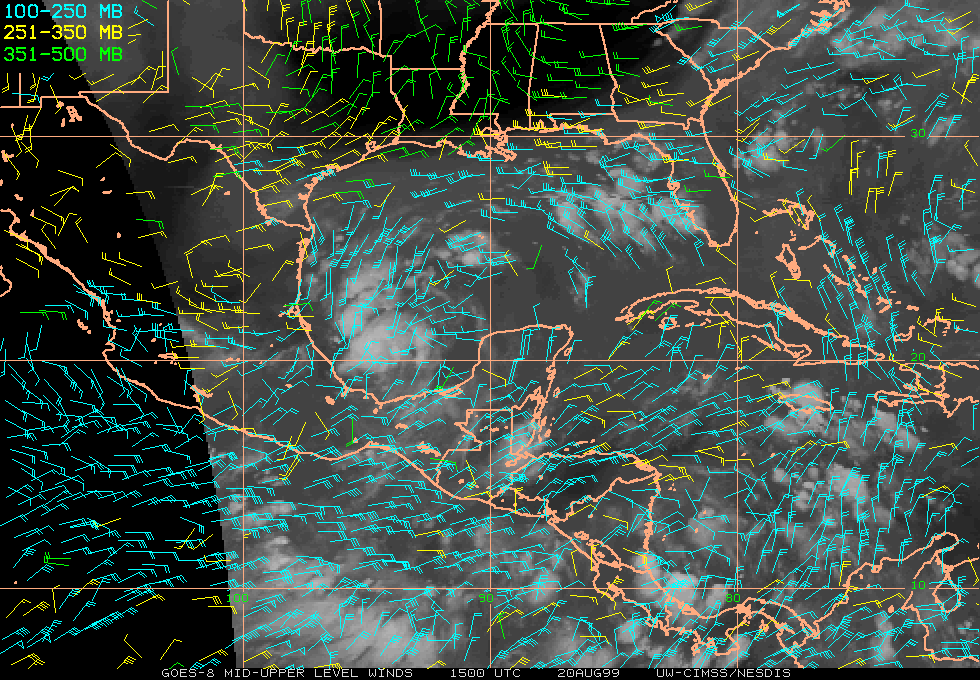
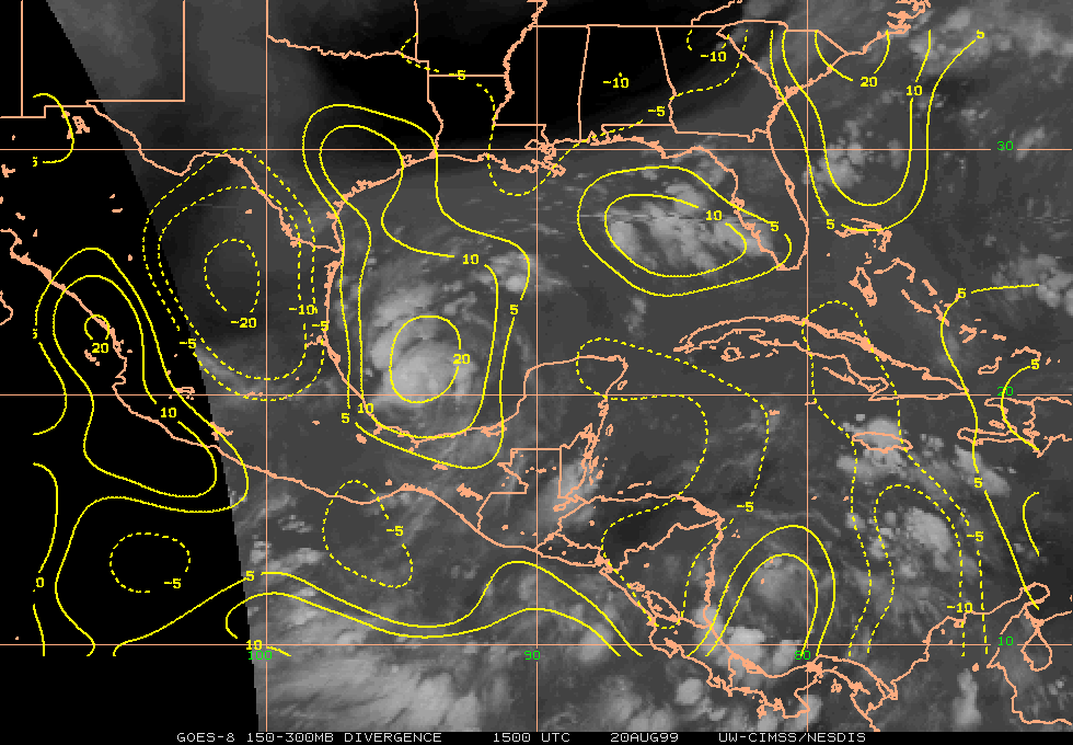
GOES-8 water vapor winds (below) indicated that the tropical cyclone was in an environment of strong divergence and weak shear within the upper troposphere, which was favorable for Bret to continue the trend of intensification. At 15:00 UTC on 20 August, maximum sustained winds were 55 knots, and storm motion was to the north at 6 knots. Bret reached hurricane strength later in the evening on 20 August, becoming the first Atlantic basin hurricane of the 1999 season.
