12 February 1999 -- Convective Roll Snow Squalls Over the Midwest
|
|
|
|
|
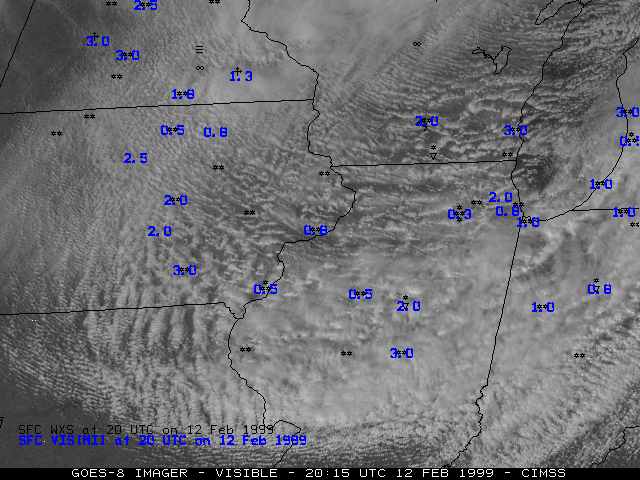
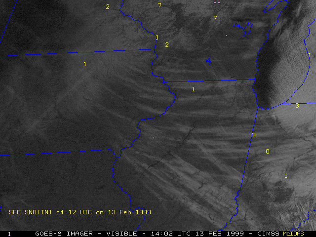
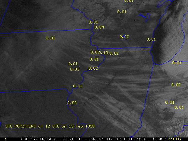
Convective roll snow squalls developed across parts of eastern Iowa, southern Wisconsin, and much of Illinois on 12 February 1999. NOAA GOES-8 visible imagery shows the convective nature of these elongated snow bands (above left), and the resulting snow streaks on the ground the following day (above right). Snowfall accumulations were light (1 to 3 inches, water equivalents of 0.10 inches or less), but the intense snowfall rates and strong winds (gusts to 35 mph) caused near-whiteout conditions (visibilities less than 1/4 mile) which contributed to several traffic accidents (including a 70-vehicle chain reaction accident near Milwaukee WI). Note the variety of orientations of the resulting snow bands on the ground (SW to NE, W to E, and NW to SE), reflecting snowfall accumulations during different flow regimes over the course of a 2-day period.
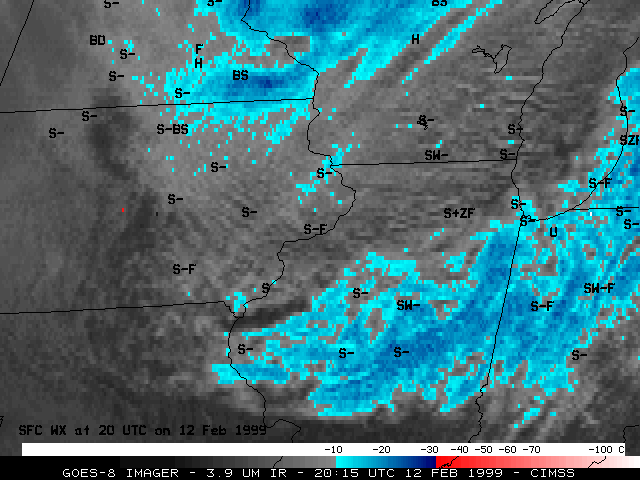
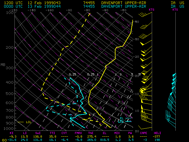
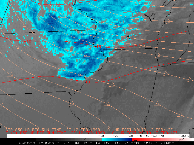
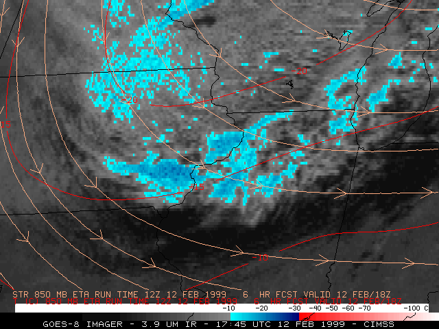
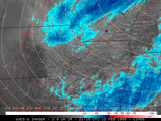
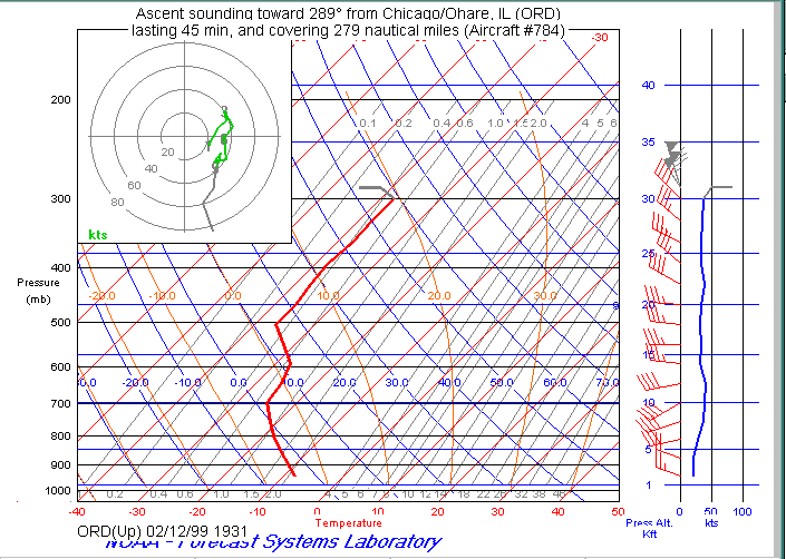
GOES-8 3.9 micron shortwave InfraRed (IR) imagery (below left) shows that the cloud tops over the region on 12 February were a mixture of supercooled water droplets (dark gray enhancement, due to solar reflection) and ice crystals (warmer than -10 C, light gray enhancement; -10 C and colder, blue enhancement). Strong cold air advection in the cyclonic flow regime of a passing shortwave trough (12:00 UTC | 18:00 UTC | 00:00 UTC) helped to destabilize the lower troposphere to the point that horizontal convective rolls (streets of shallow convection aligned with the low-level winds) developed within the lowest 2 kilometers. The Davenport Iowa rawinsonde reports (below right) show that the unstable mixed layer became deeper during the day, but was confined to the 800-900 millibar level (1-2 km altitude) and below and was capped by a well-defined subsidence inversion. A 19:31 UTC ACARS aircraft ascent sounding from Chicago O'Hare airport showed that a nearly adiabatic lapse rate existed below the base of the inversion at 700 millibars (around 3km altitude); a band of moderate to heavy snow showers had just moved through the Chicago region during the hour prior to this aircarft sounding.
Click here to fade between the 20:15 UTC GOES-8 visible and 3.9 micron shortwave IR images. A multispectral NOAA-14 HRPT image is available from the NOAA Operational Significant Event Imagery server.
|
Davenport Iowa Rawinsonde Reports 12 Feb/12 UTC and 13 Feb/00 UTC |
