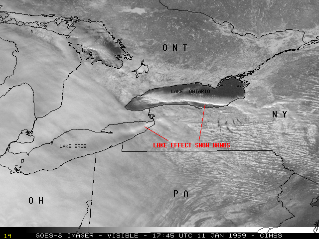
11 January 1999 -- Lake Effect Snow Bands in Western New York
|
|
|
|
|
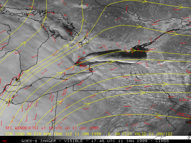
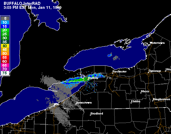
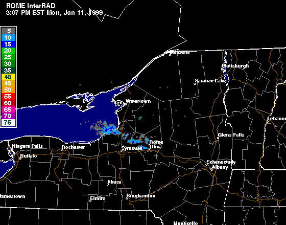
Lake Effect Snow (LES) bands formed over Lake Erie and Lake Ontario on 11 Januray 1999, and affected parts of western New York state with snowfall rates of 1 to 3 inches per hour. Snowfall reports from the Lake Ontario snow band included 12 inches at Fulton (Oswego county), 11 inches at Hannibal (Oswego county), and 9 inches at Fair Haven (Cayuga county). Buffalo NY reported 7.5 inches from the snow band over Lake Erie. This event was one of several during early January 1999, which gave Buffalo more than half of its normal winter season snowfall in a 2-week period.
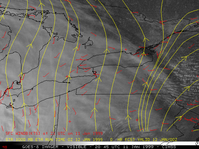
NOAA GOES-8 visible imagery (above) shows that the LES band over Lake Ontario was very evident, while a deck of multi-layered cloudiness overspreading the region was beginning to obscure the LES band over eastern Lake Erie. The synoptic-scale southwesterly flow was oriented along the axis of Lakes Erie and Ontario, allowing a long fetch of cold air (air temperatures near 10 F / -12 C) over the warmer water (non-frozen, water temperatures 32 to 43 F / 0 to +6 C). Mesoscale convergence over the Lakes helped to focus the resulting cloud band into a narrow, elongated feature.
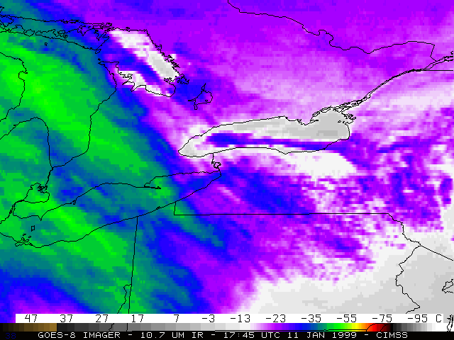
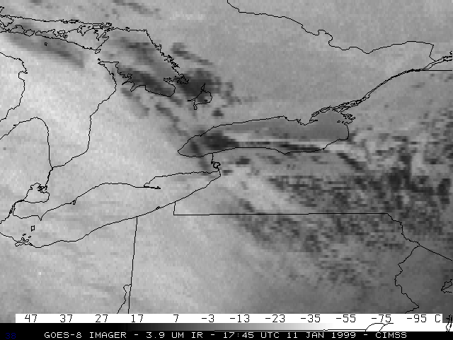
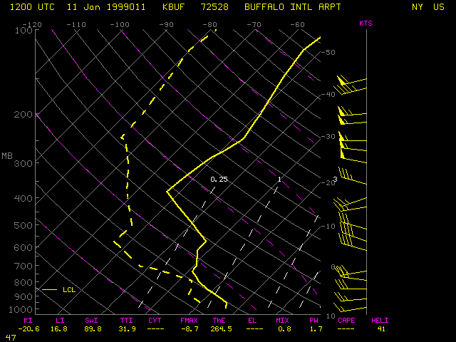
The rawinsonde profile from Buffalo NY revealed a deep, well-mixed Planetary Boundary Layer (PBL), with a temperature inversion near 730 hPa (2400 m). The air temperature near the top of the PBL/base of the inversion was near -30 C. GOES-8 10.7 micron longwave InfraRed (IR) imagery (below left) shows that some of the cloud tops within the Lake Ontario LES band were cooling to near -30 C (dark blue enhancement), indicating that they were near the top of the PBL (or perhaps had penetrated into the inversion layer above). GOES-8 3.9 micron shortwave IR imagery (below right) shows that portions of the Lake Ontario band were becoming glaciated, and exhibited colder cloud top temperatures (lighter gray enhancement); the water droplet composition of the non-glaciated portions of the cloud band appeared warmer (darker gray enhancement) due to the fact that water droplets also reflect incoming solar radiation at the 3.9 micron wavelength.
|
|
|
|
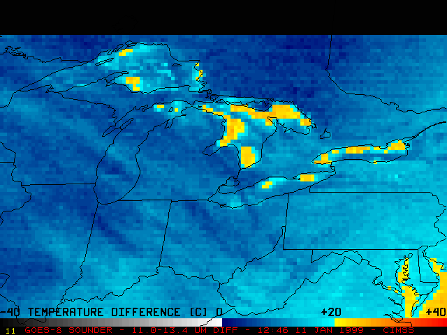
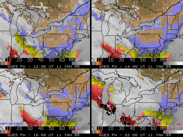
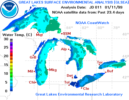
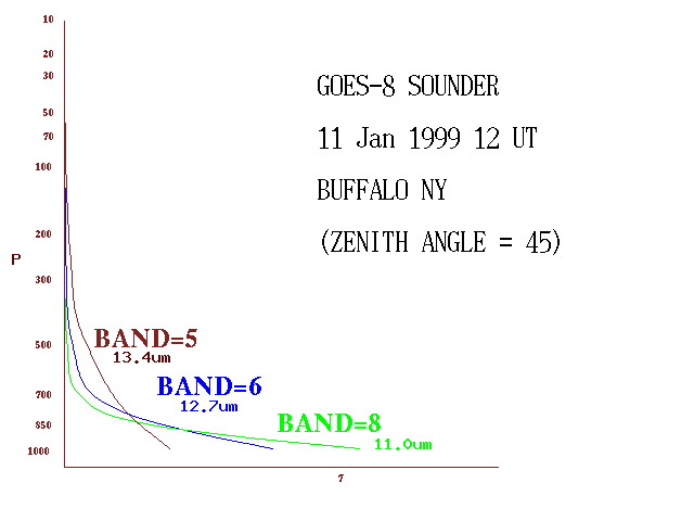
One factor that is important in forecasting the occurrence and severity of LES is the difference in temperature between the relatively warm lake water and the cold air within the lowest 1-2 km of the troposphere. As seen from the Buffalo NY rawinsonde and the Lake water temperatures, the lake water minus 850 hPa "Delta-T" in this case was on the order of 30 degrees C. An example of a GOES-8 Sounder IR temperature difference product (above left) is shown which can help to estimate the magnitude of the Delta-T over portions of the Great Lakes. Calculating the difference between Band 8 and Band 5 brightness temperatures generates an estimate of the Delta-T over cloud-free regions. The GOES Sounder weighting functions calculated for the Buffalo NY region show that Band 8 (longwave IR window channel, 11.0 micron wavelength) senses the greatest amount of upwelling radiation from near the surface, while Band 5 (longwave IR channel, 13.4 micron wavelength) senses less radiation from the surface and more from the lower layers of the troposphere. GOES-8 Sounder Total Precipitable Water (PW) (above right) shows a "plume" of slightly enhanced PW (2 mm, light blue enhancement) over and just downwind of Lakes Erie and Ontario early in the day; higher PW values (2-10 mm, blue to red enhancement) are advected northward into Pennsylvania with the approach of the storm system from the southwest.
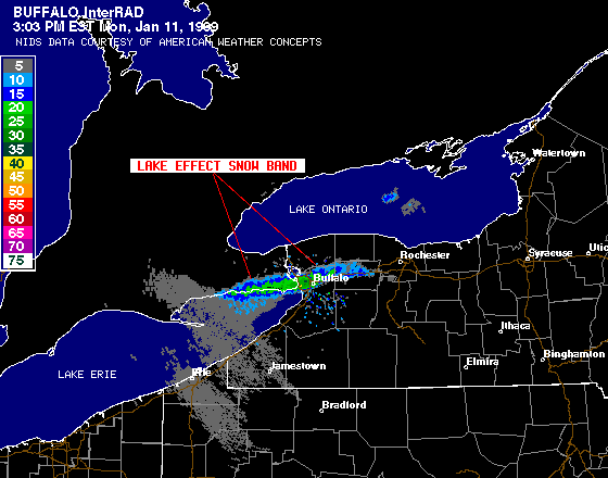
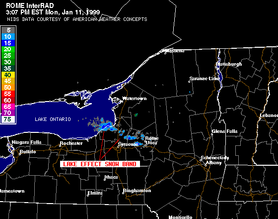
Later in the day, the LES bands became less evident on satellite imagery as the multi-layered cloud shield overspread the eastern Great Lakes region. With the approach of the large system from the southwest, the synopic-scale flow shifted from southwesterly to southerly, causing the LES bands to lift northward; this motion of the snow bands reduced the snowfall accumulations, since they then moved more quickly through a particular county. These snow bands became less organized after about 20:00 UTC (3 PM EST), as is evident on Buffalo NY and Rome NY WSR-88D radar (below).
|
|
