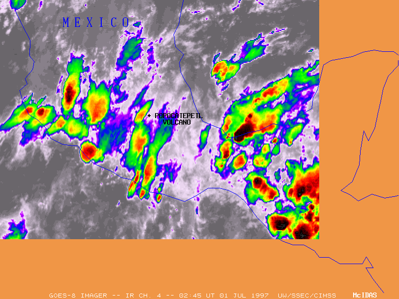
The Popocatepetl volcano (located 72 km southeast of Mexico City) erupted late in the day on 30 June 1997. This eruption produced the first ash fall in Mexico City since 1925. The airport at Mexico City was closed, and the aviation community was immediately alerted to the potential danger of a volcanic ash plume cloud. However, numerous thunderstorms were active across the region at the time (left), making the detection of an ash plume on satellite imagery somewhat difficult.
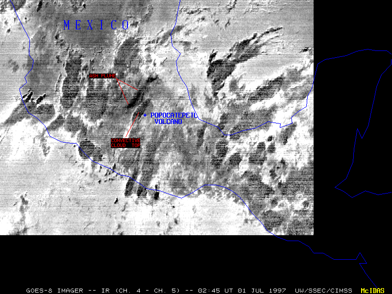
The "split window" differencing technique (right) is often an effective method used to detect volcanic ash plumes. Since the emissivity of silicate particles in the ash cloud varies with wavelength, the brightness temperatures detected using GOES-8 infrared channels 4 (10.7 micron) and 5 (12 micron) differ by as much as 5 degrees K. The ash cloud appears as a dark region (greater temperature difference) fanning outward to the northwest at 02:45 UT on 01 July. This wide pattern of ash plume dispersion resulted from directional wind shear within the middle and upper troposphere. Compare this plume shape to that which occured March 12, 1996, when the winds were westerly at all levels.
Similar emissivity differences are also observed with overshooting tops of convective cirrus canopies, due to strong temperature inversions and moisture gradients within the lower stratosphere. Notice how several of the smaller, rapidly developing convective cloud tops (storms with vigorous updrafts and overshooting tops) appear very dark in the split window product, while the larger, more mature convective anvil tops appear as a lighter gray. The diffuse shape of the volcanic ash plume cloud also helps distinguish it from the convective cloud tops which tend to be more cellular in nature and exhibit well-defined edges.