|
|
 |
 (- Fade between re-mapped MODIS, GOES-08, and GOES-10 water vapor images -)
|
|
|
|
(- Fade between re-mapped MODIS, GOES-08, and GOES-10 water vapor images -)
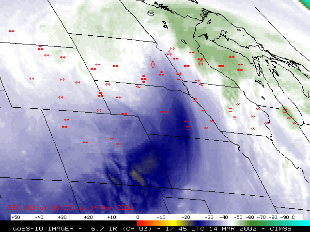
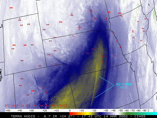
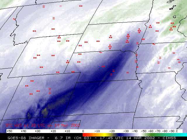
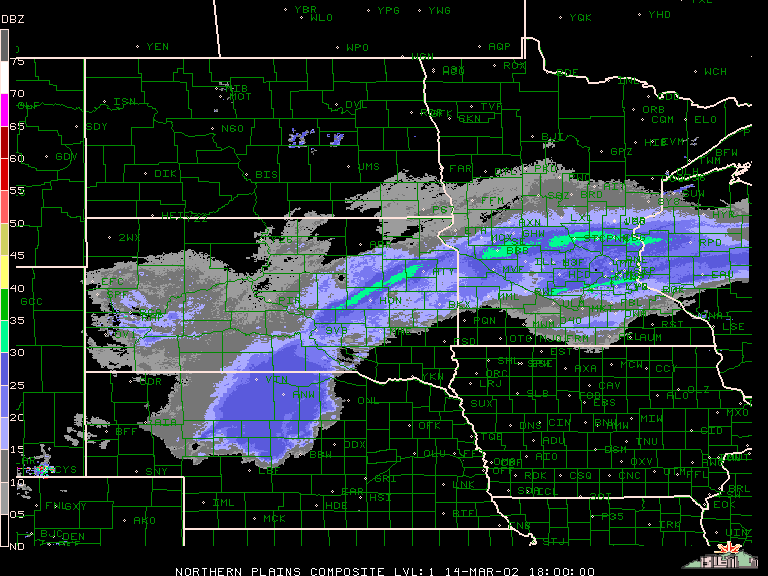
Heavy snow fell across much of the northcentral US on 13-15 March 2002 (the red-enhanced swath across WY, NE, SD, MN, WI and MI on this Terra MODIS composite image). As noted in the mid-day SPC Mesoscale Discussion on 14 March, strong forcing for upward vertical motion in the left exit region of a mid-upper level jet streak moving across Kansas into south-central Nebraska was helping to enhance winter precipitation across parts of northcentral Nebraska (radar composite). Heavy snow (with some convective enhancement) then moved into southeastern South Dakota and southwestern Minnesota as the jet streak continued northeastward towards the Great Lakes region -- storm total accumulations were as high as 19 inches in South Dakota, 21 inches in Minnesota, and 20 inches in Wisconsin.
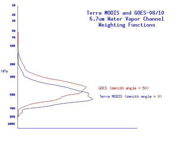
The higher spatial resolution of the MODIS water vapor channel data (1 km, versus 4x8 km for GOES) allowed better detection of the axis of this jet streak feature crossing the Kansas/Nebraska border. Brightness temperatures were generally 2-6 C warmer across this scene on the MODIS data (especially in the region of the dry slot associated with the axis of the jet streak), in part because the weighting function peaks lower in the atmosphere for the MODIS water vapor channel than it does for the GOES-08/GOES-10 water vapor channel. The more extreme viewing angle from GOES (zenith angles near 50 degrees) also contributes to the colder brightness temperatures compared to MODIS.
