|
|
|
|
|
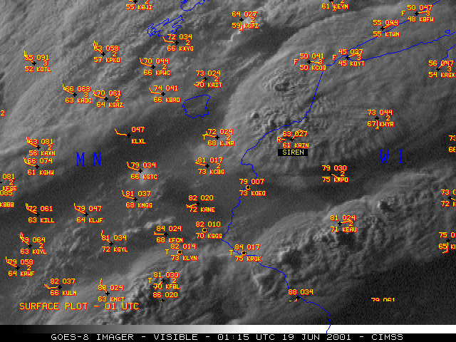
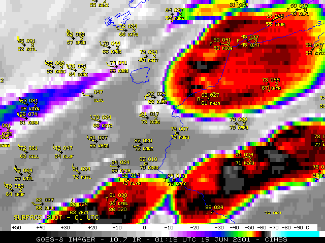
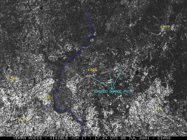
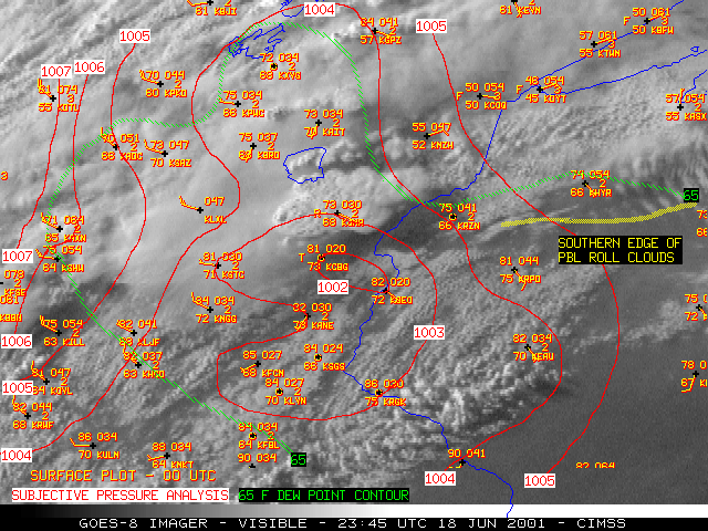
NOAA GOES-8 visible and InfraRed (IR) imagery (above) shows the development of convection which spawned a tornado that struck the town of Siren, Wisconsin (station identifier KRZN) around 01:20 UTC on 19 June (8:20 PM CDT on 18 June) 2001. This tornado was responsible for 3 deaths and 16 injuries, and produced F3 damage along a 1/2 mile wide path in the town of Siren. A Landsat-7 image of the tornado damage path the following morning is available from the Environmental Remote Sensing Center, University of Wisconsin-Madison, and the damage path was still evident 2 weeks later on MODIS imagery. Additional information and damage photos are available from the Duluth, Minnesota National Weather Service office.
As the convection developed, visible imagery indicated several overshooting cloud tops (note the shadowing and texture), where strong sustained updrafts were present. An "Enhanced-V" cloud top signature first became evident on the 00:45 UTC GOES-8 IR image, about 19 minutes before the tornado first touched down west of Siren (near Grantsburg, WI). This IR signature often indicates convection that is producing or is about to produce damaging winds, large hail, or tornadoes. Hail up to 1.75 inches in diameter was also reported with this cell (at 01:18 UTC, about 5 miles north of Siren). The line of strong convection to the south of the Siren storm produced hail of 4.5 inches in diameter around 01:30 UTC (33 miles east of Eau Claire, WI, station identifier KEAU).
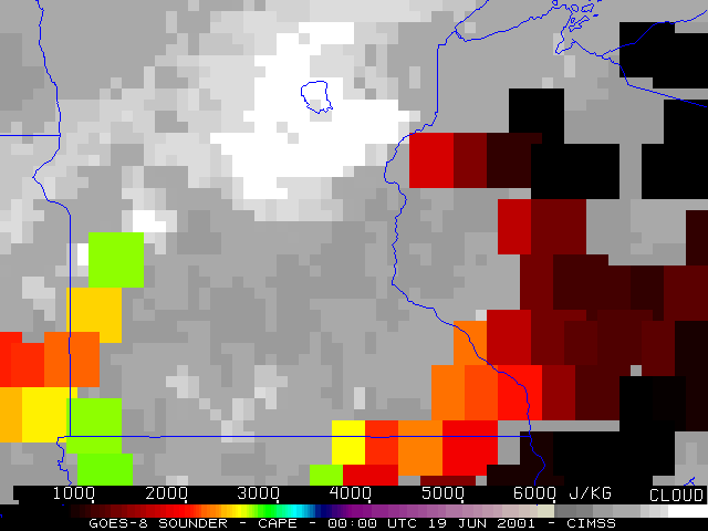
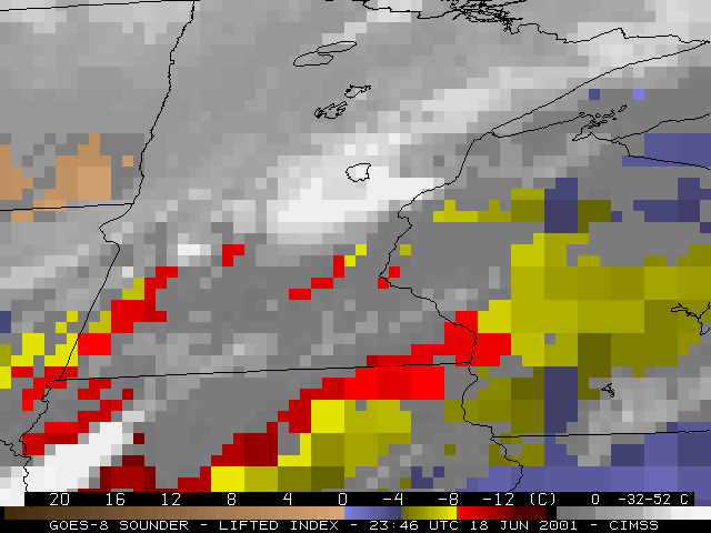
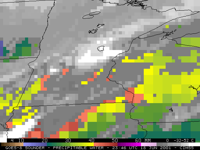
GOES-8 Sounder derived products (CAPE | LI | PW) indicated that both moisture and instability were becoming increasingly favorable in the pre-convective environment across northwestern Wisconsin. The convection initially developed in east-central Minnesota, along a well-defined pre-frontal trough axis that existed ahead of an advancing cold front over western Minnesota.
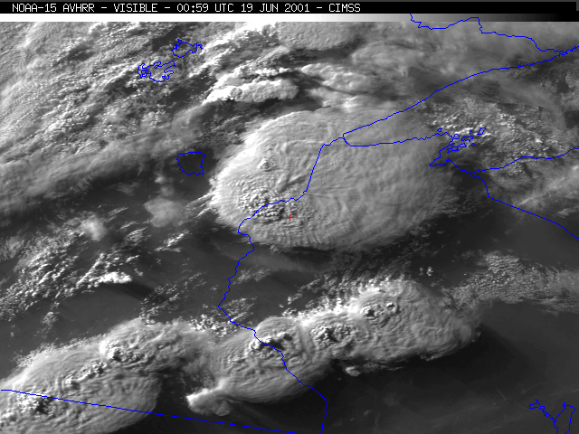
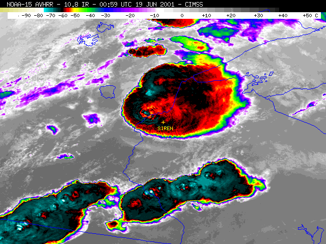
NOAA-15 AVHRR visible and IR imagery from an overpass at 00:59 UTC (below) reveals greater detail in the structure of the overshooting tops and cloud top temperature pattern (about 7 minutes prior to the development of the tornado near Grantsburg, Wisconsin). The coldest IR brightness temperature in the vertex of the "Enhanced-V" region was -73.6 C (cyan enhancement), compared to -60.2 C (black enhancement) on the GOES-8 data.
|
|
 (- Fade between NOAA-15 visible and IR images at 00:59 UTC-)
|
|
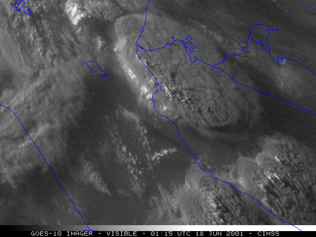
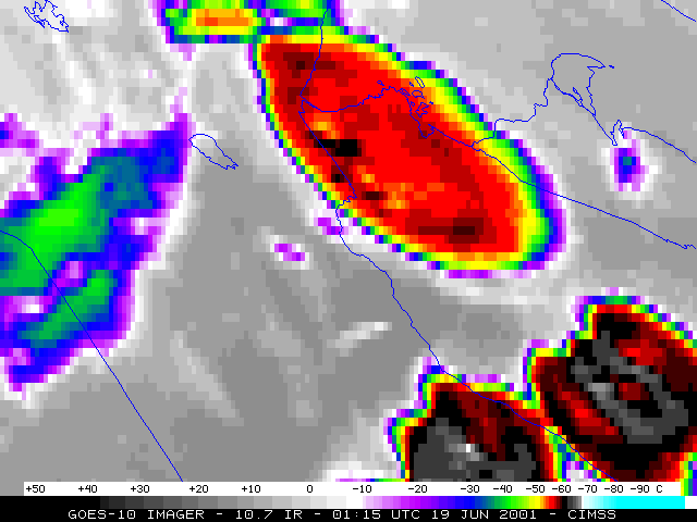
GOES-10 visible and IR imagery are shown above. Using the visible channel, the extreme viewing angle from this satellite allows better illumination of the flanking line convection along the western edge of the storm. An Enhanced-V cloud top signature became apparent on the 00:30 UTC GOES-10 IR image (the storm was producing a tornado around this time near Braham, Minnesota).
|
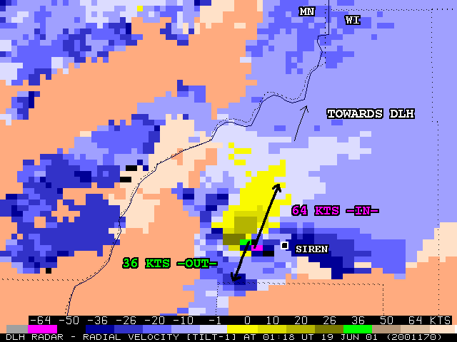
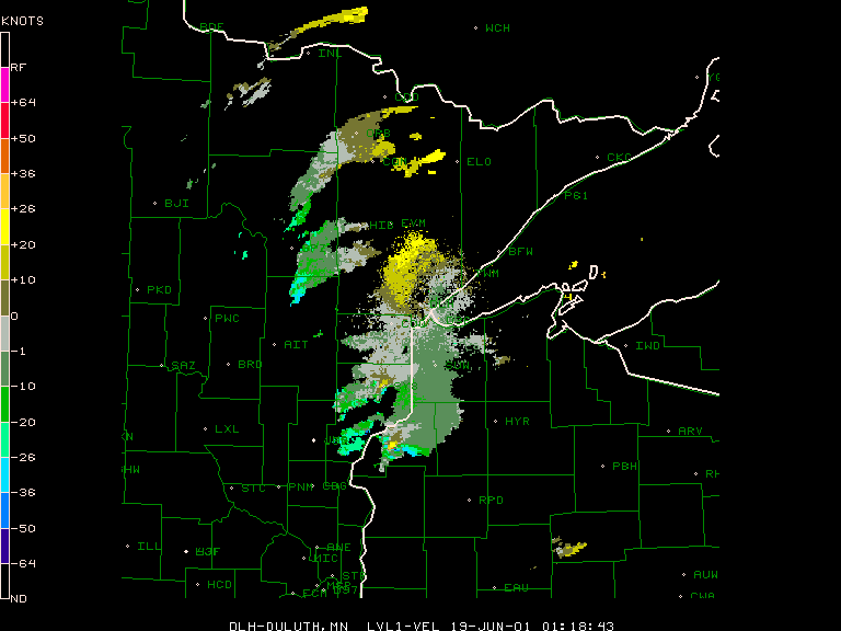
Duluth, Minnesota WSR-88D radar radial velocity data (above) showed a distinct inbound/outbound couplet west of Siren at 01:18 UTC (8:18 PM CDT), which is a radar signature of a mesocyclone circulation aloft. Animations of Duluth base reflectivity and base velocity radar data (below) show the evolution of a well-defined "hook echo" on reflectivity, along with the persistent velocity couplet (images courtesy of NCAR/RAP).

|
|

