April 8, 1998
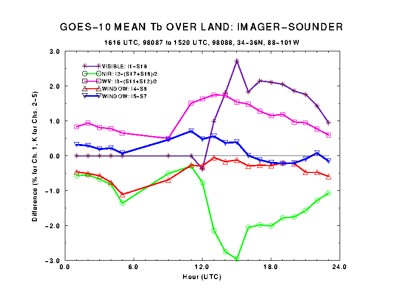
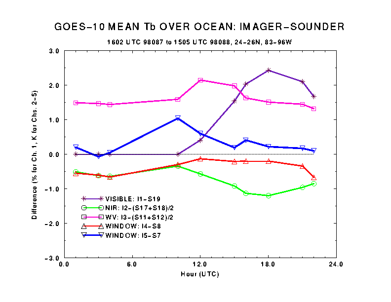
These plots shows the mean differences of GOES-10 imager channels 1-5 and the corresponding GOES-10 sounder channels (imager - sounder). The differences are plotted for each hour during a 24-hour period starting around 1600 UTC, March 28, 1998, over the
land and
ocean
. The area and time were selected such that the imager and sounder view the area within approximately one minute.
For visible channel, the earth appears more reflective to imager than to sounder. The difference has little day to day variation over ocean. The peak difference over land, which normally occurs around local noon, may vary from 2% (March 28) to 6% (not shown but is hinted in March 29 data from 12-15 UTC). March 29 is more cloudy (thus higher average albedo) over the land region than March 28. The difference is about 10-15% of the average albedo over land and 20-30% over ocean.
There is no sounder channel that correspond well to imager Channel 2 (near IR, 3.9 micron). Instead, average of sounder channels 17 (4.0 micron) and 18 (3.8 micron) is compared with imager channel 2. The difference is small at night and becomes larger during day, due to differential response of each channel to solar reflection. Similarly, average of sounder channels 11 (7.0 micron) and 12 (6.5 micron) is compared with imager channel 3 (6.7 micron, the water vapor channel).
Finally, the window channels (Ch. 4 of imager vs Ch. 8 of sounder and Ch. 5 of imager vs Ch. 7 of sounder) compare well with each other. The difference is normally within +/- 0.5 degree.
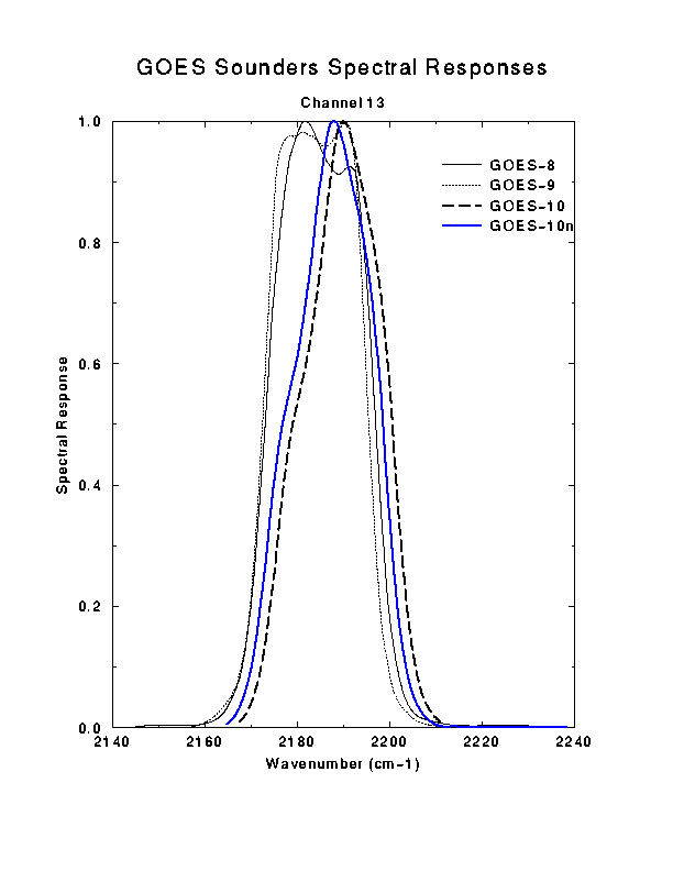
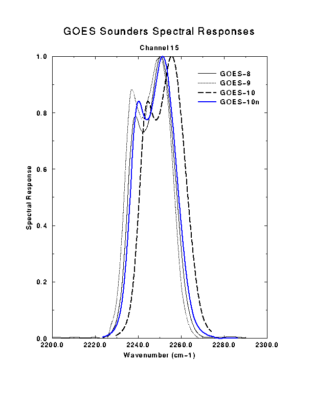
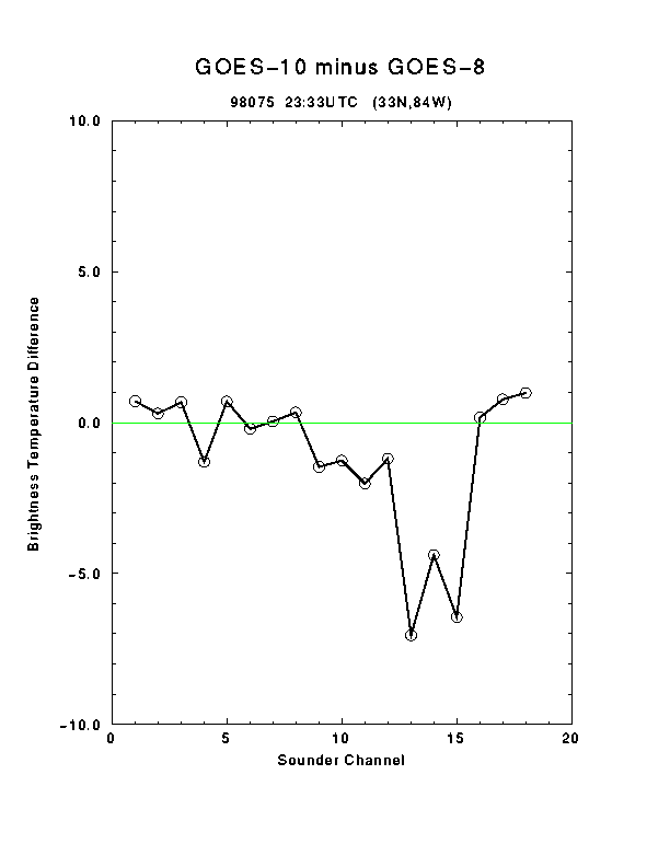
GOES-10 compared to GOES-8 Sounders...
April 4, 1998
The GOES-8 and GOES-10 brightness temperatures were again compared after the
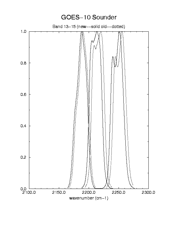
updated spectral response coefficients for the GOES-10 sounder were put in (7 UTC on April 2, 1998). While most of the bands compare very well, some of the differences for shortwave bands (13-15) still seem too large.
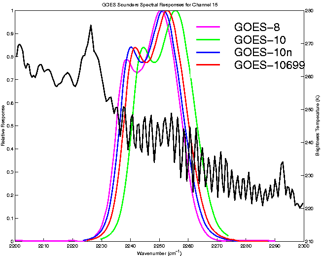
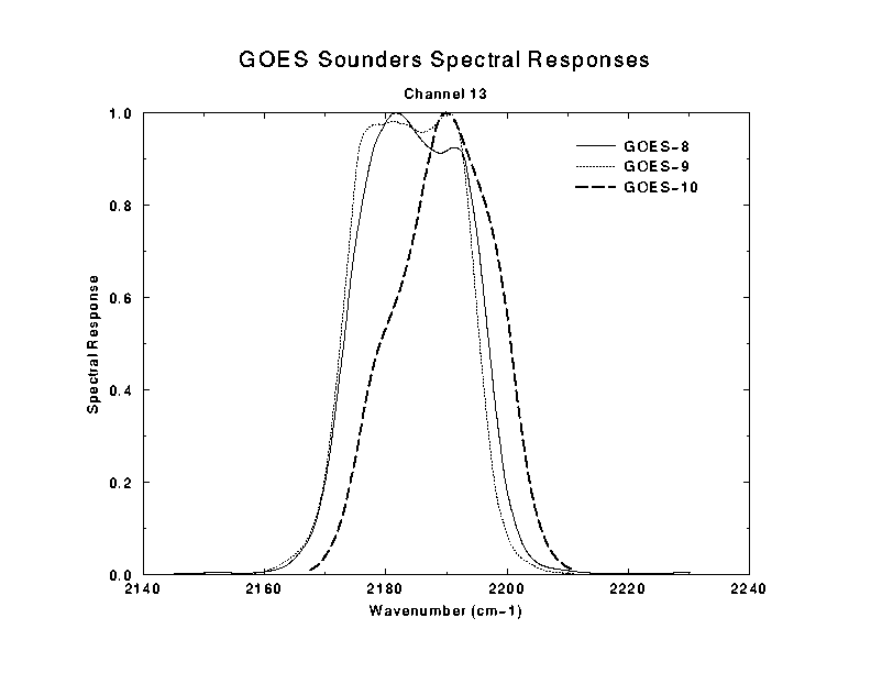
The GOES-8/9 and GOES-10
band 13 spectral responses show that GOES-8 and GOES-9 are more similar than either of the GOES-10's. Yet, the updated GOES-10 is now 'in family' for
band 15 compared to the other satellites.
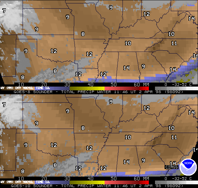
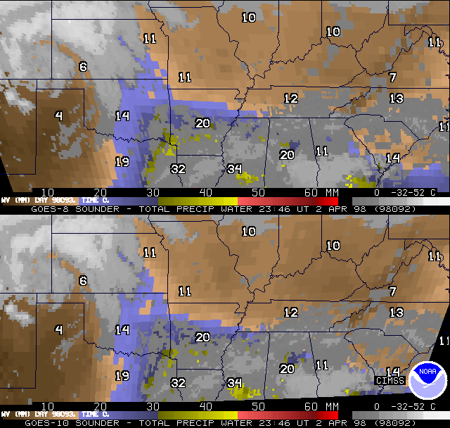
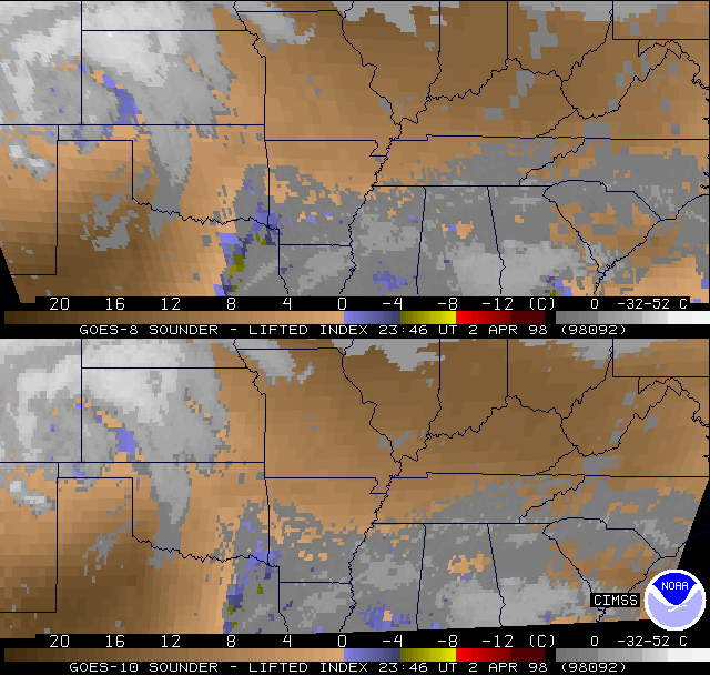
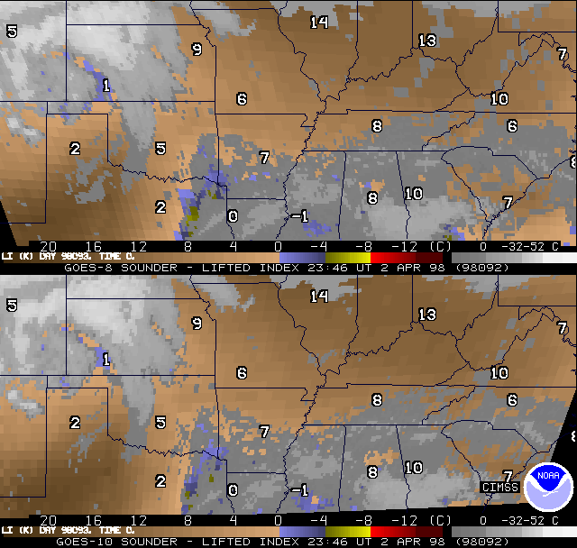
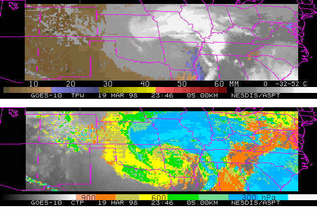
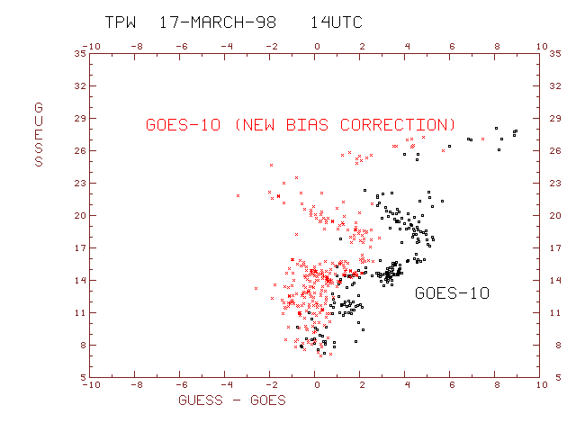
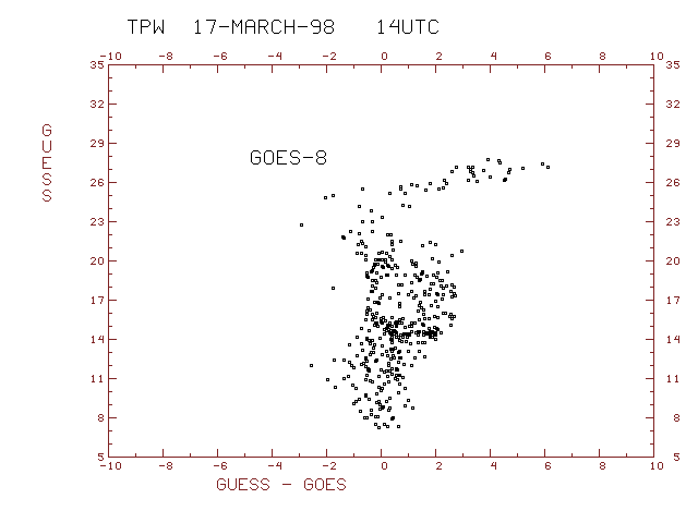
GOES-10 Total Precipitable Water Vapor Product compared to GOES-8...
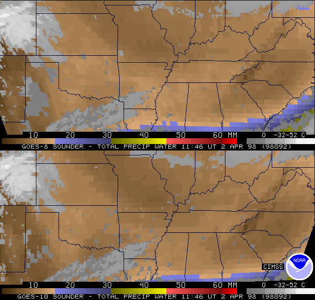
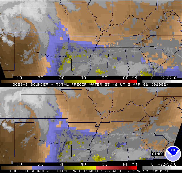
April 3, 1998
Shown are examples
of co-located (meractor re-map) GOES Sounder DPI for both
GOES-8 and GOES-10 over the south central US.
The return flow of moisture during the day on 2 Apr 1998
(98092) from GA across to E TX and northward to E KS is evident,
as the total precipitable water (PW) Derived Product Images
(DPI) between 12z and 00z show [G2P80921.GIF, G2P80922.GIF].
Similar comparisons with raob values overplotted [R2P80921.GIF,
R2P80922.GIF] also show that the GOES-8 and GOES-10 products
are substantially the same in their overlap region. Anticipated
de-stabilization across the south central US was rather small as
of 00z, as noted by the GOES Sounder lifted index (LI) DPI at that
time [G2L80922.GIF, R2L80922.GIF]. The two satellites again
appear much more similar than dissimilar. (Convection that first started just after 00z was near the LA/AR line, close to the only region showing LI values in the
GOES DPI in the 0 to -4C range, despite extensive obscuring clouds. More convection developed later about 03z along the OK/AR line.)
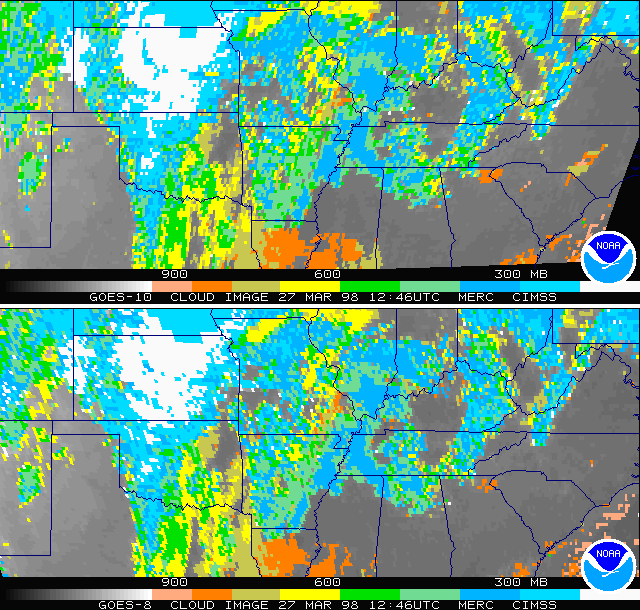
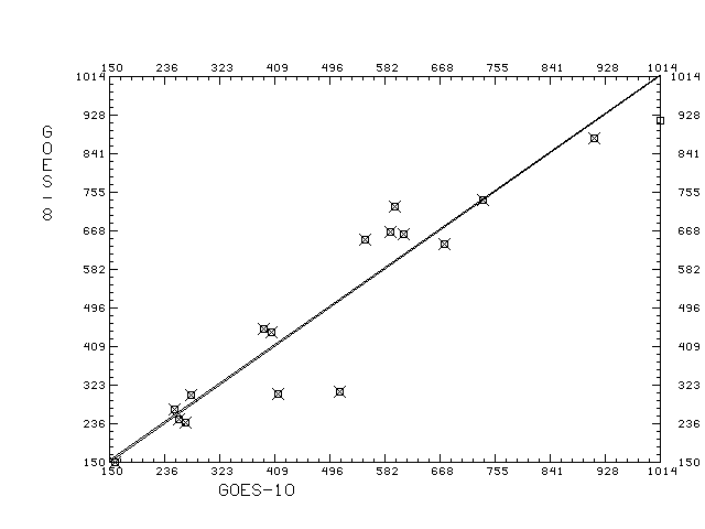
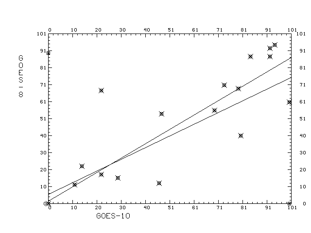
GOES-10 Cloud Product compared to GOES-8...
March 31, 1998
GOES-10 Cloud top pressures from March 27, 1998 near 13 UTC are
compared to GOES-8 are in good agreement.
Scatter plots of co-located observations
cloud top pressure for one time period is within 1 hPa on the average.
Scatter plots of co-located observations
effective cloud amount for one time period is within 2% on the average.
A further explanation of the scatter diagrams is found in the
table.
GOES-10 Space Noise Results...
March 26, 1998
Special GOES-10 sounder sectors which include space views allow for the
noise values to be determined by looking at the scatter of the uniform space. Preliminary indications from March 25 at 18:02 UTC show the GOES-10 noise seems to be the first sounder to
to be within spec for all the channels
(table).
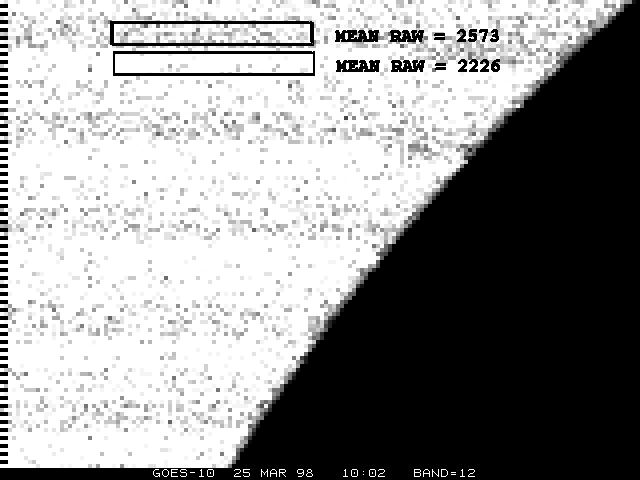
March 25, 1998
Channel 12
at 10:02 UTC on March 20 (and 25), 1998 shows a "banding" which correlates to the space looks. This barely noticeable (in only the most sensitive channels)
effect
is due to the rapidly changing calibration bias between the space looks.
It can be seen that the slope of the bias changes sign near 11 UTC by looking at
the channel 12 at 10:02 and 12:02 UTC.
GOES-10 Sample Products...
March 20, 1998
Derived products
from the GOES-10 sounder are being generated. Channels 13, 14 and 15 were not used for this example.
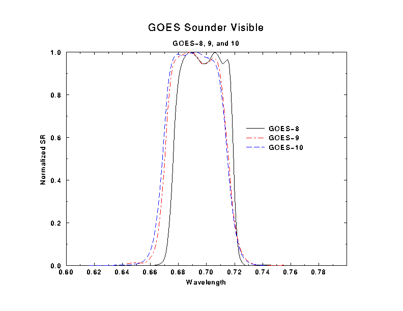
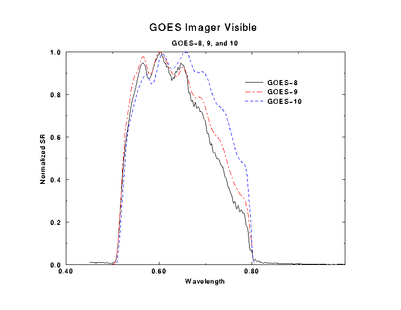
GOES-10 visible data...
March 19, 1998
The GOES visible (band=19)
sounder spectral response
functions are shown for all three satellites. The same plot for the
GOES-/8/9/10 imager spectral response functions for channel 1 (visible).
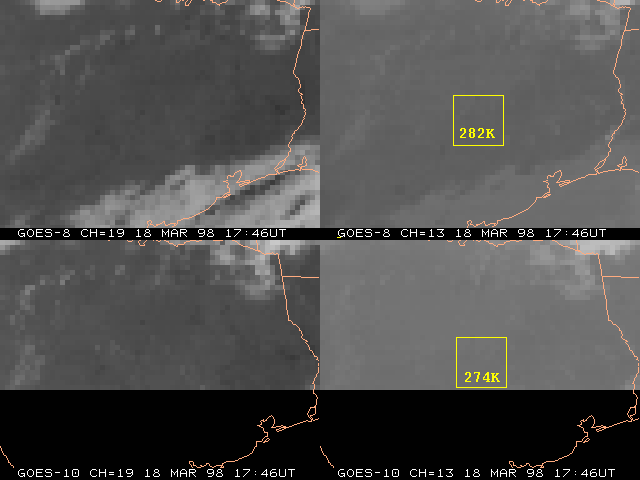
Some GOES-10 channels are too cold....
March 18, 1998
Channels 13 and 15 of the GOES-10 sounder are too cold (by over 6 degrees),
compared to GOES-8 sounder data.
This has the effect of making the
GOES-10 retrievals
too dry (dots). Updating the GOES-10 radiance bias adjustment file helps to midigate this problem (crosses).
Now the differences look more like the
GOES-8 retrievals and the radiosondes (not shown).
The forward model sensitivity to the updated sounder spectral response (SR) functions....
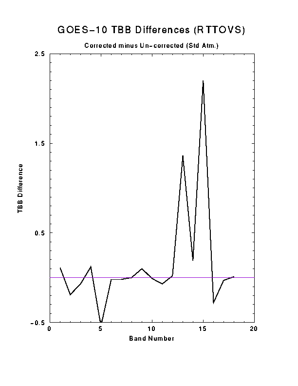
March 15, 1998
The calculated brightness temperatures for the 18 sounder channels before and after the update for the correct filter temperatures with the GOES-10 sounder spectral response functions (RTTOVS forward model):
Un-corrected for the shift due to filter temperatures
WFGIM 1 18 SAT=10
  223.57  223.03  239.18  254.51  265.67  282.68  285.59  286.44  260.57
  257.65  245.87  231.21  271.91  259.42  236.74  280.77  285.95  286.36

Corrected for the shift due to filter temperatures
WFGIM 1 18 SAT=10
  223.68  222.84  239.11  254.63  265.13  282.66  285.57  286.44  260.67
  257.64  245.80  231.23  273.27  259.61  238.94  280.49  285.92  286.37
Brightness Temperature Difference Plot.
Note the large change in channels 13 and 15.
The calculated brightness temperatures for the 18 sounder channels before and after the update for the GOES-10 sounder spectral response functions (for the RTTOVS forward model):
Un-corrected for the shift due to filter temperatures
CH  WAVENO(CM-1) WAVELEN(MICRON)
 1 679.8178711 14.70982265
 2 696.1438599 14.36484718
 3 712.8988037 14.02723598
 4 732.2866211 13.65585518
 5 747.8747559 13.37122250
 6 790.6661987 12.64756203
 7 830.8142090 12.03638554
 8 909.5220947 10.99478531
 9 1029.512085 9.713338852
 10 1340.128662 7.461970329
 11 1423.657837 7.024159908
 12 1535.478027 6.512629986
 13 2189.547852 4.567152977
 14 2215.627197 4.513394833
 15 2252.250000 4.440004349
 16 2420.379395 4.131583691
 17 2512.697510 3.979786634
 18 2665.164551 3.752113581

Corrected for the shift due to filter temperatures
CH  WAVENO(CM-1) WAVELEN(MICRON)
 1 679.1133423 14.72508240
 2 695.3190918 14.38188648
 3 712.7325439 14.03050804
 4 731.4750366 13.67100620
 5 747.4318848 13.37914562
 6 789.8816528 12.66012478
 7 830.2354736 12.04477596
 8 908.8108521 11.00338936
 9 1028.894897 9.719165802
 10 1340.770874 7.458395958
 11 1424.113525 7.021912098
 12 1535.095459 6.514252663
 13 2187.515381 4.571396351
 14 2211.469238 4.521880627
 15 2248.089355 4.448221684
 16 2418.688965 4.134471416
 17 2511.202881 3.982155323
 18 2662.761230 3.755500078
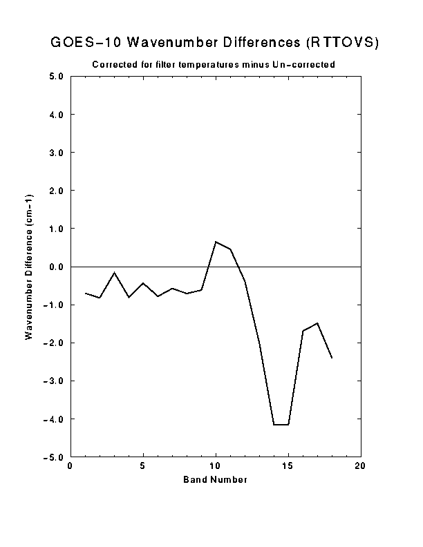
Wavenumber Difference Plot.
Note the largest central wavenumber shift is in channel 15 (over 4 cm-1).
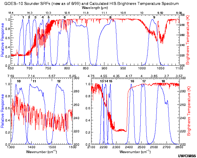
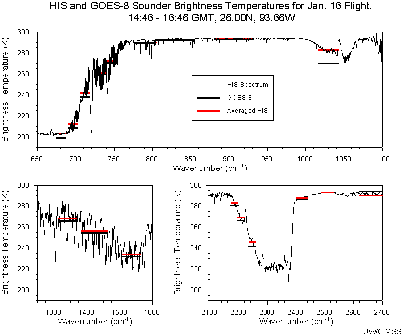
Earlier field experiments with GOES-8 sounder showed an un-explained difference for channels 13 and 15
when comparing to the HIS.
Preliminary indications show the updated calculated brightness temperatures
reduce those differences.
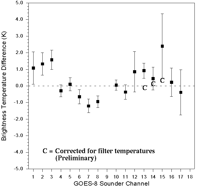
Note the 'C's marked on the difference plot between the GOES measurements and the averaged HIS.
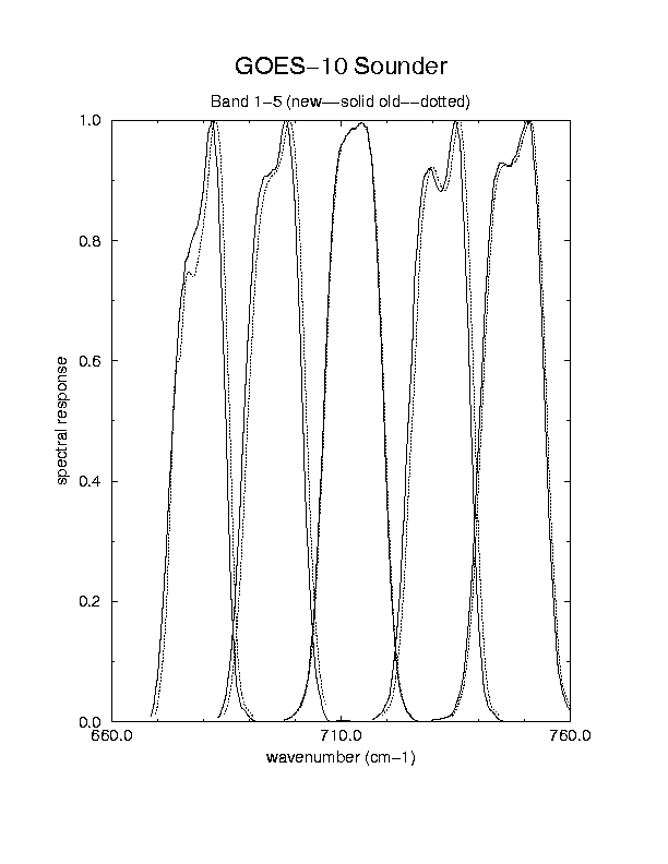
The updated sounder spectral response (SR) functions....
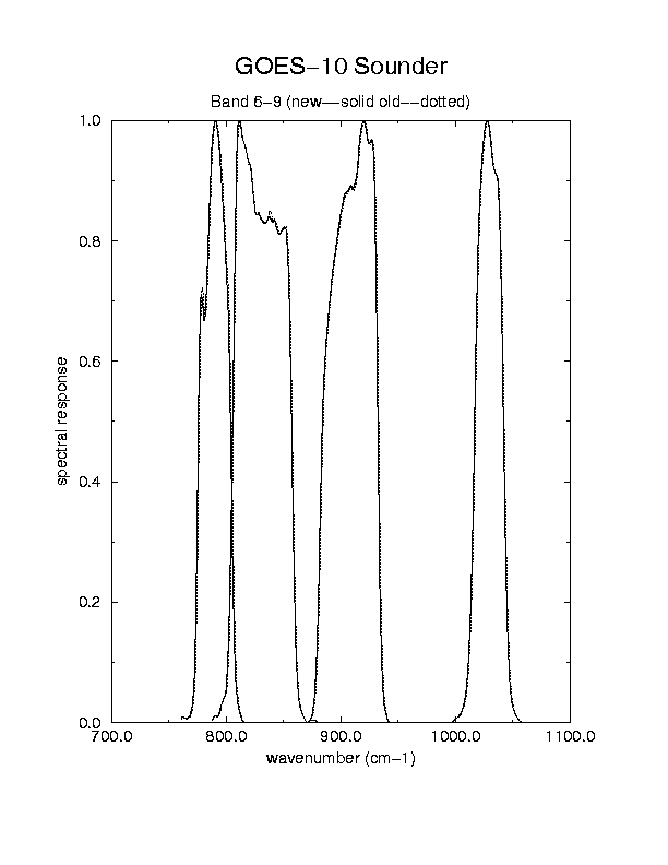
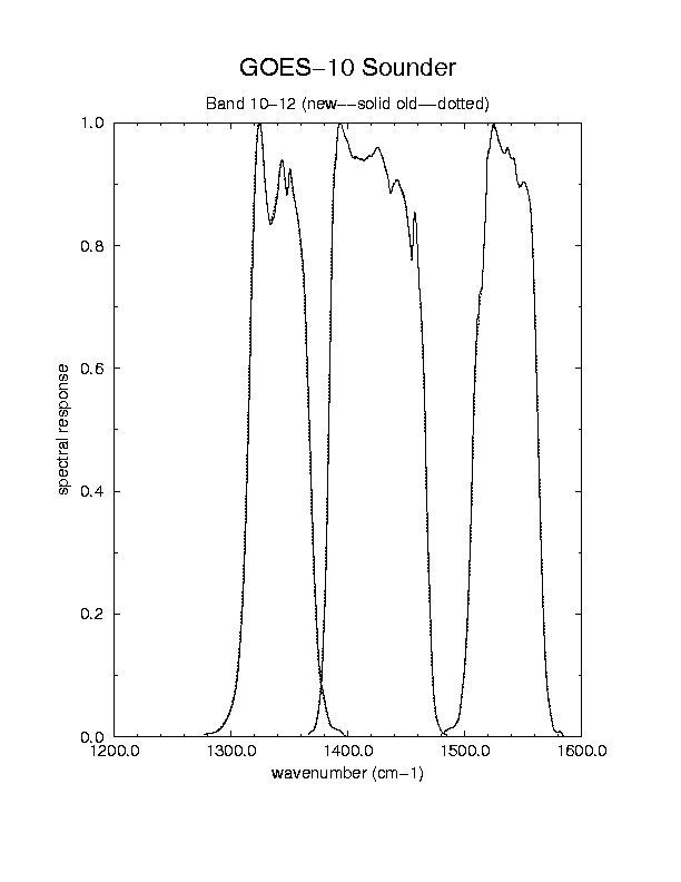
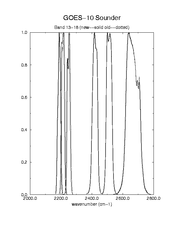
February 27, 1998
New and old SR Bands 1 thru 5
New and old SR Bands 6 thru 9
New and old SR Bands 10 thru 12
New and old SR Bands 13 thru 18
New and old SR Bands 13 thru 15
The first derived product images from the GOES-10 sounder...
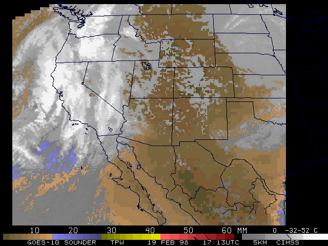
February 19, 1998
First GOES-10 Sounder Total Precipitable Water derived product image 17UTC
FirstGOES-10 Sounder Cloud Top Pressure derived product image 17UTC
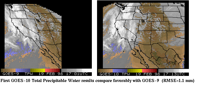
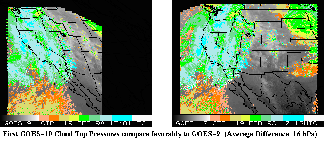
The GOES-10 compares favorably with GOES-9...
GOES-9/10 Sounder Total Precipitable Water derived product images 17UTC
GOES-9/10 Sounder Cloud Top Pressure derived product images 17UTC
Preliminary...
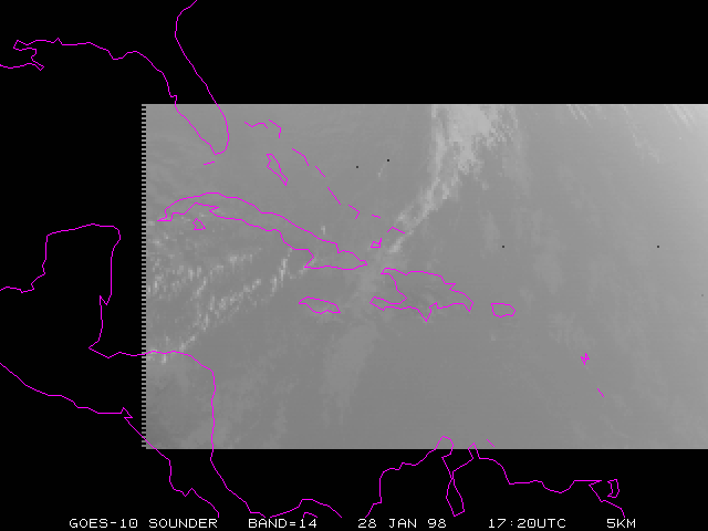
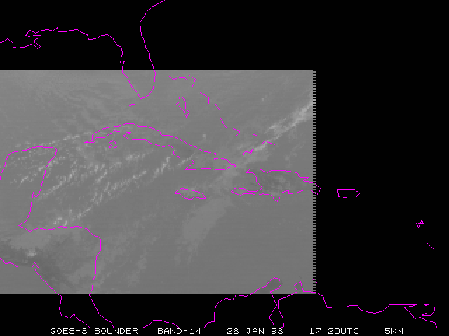
Real data confirms that channels 13-15 are much cooler on GOES-10 than GOES-8.
GOES-10 Band=14 Jan. 28, 1998 17:20UTC
GOES-8 Band=14 Jan. 28, 1998 17:20UTC
LA 7840 7860
  area  ss  yyddd hhmmss  lcor  ecor lr er zr  lsiz  esiz z    bands
  ---- ---- ----- ------ ----- ----- -- -- -- ----- ----- -    -----
  7848  75  98028 172000  5081 10841 10 10 19   156   300 2 123456789ABCDEFG
  7849  71  98028 172000  5401  6341 10 10 19   160   292 2 123456789ABCDEFG
LA: Done

GOES-10....
AREASTATY 7848 7848 20   75   200 1 18  LAT,15 25 LON,70 80
     Min/Max Lat./Long. =      15.00     25.00,     70.00     80.00
 area yyddd hhmmss averageTBB   StndDev.     N    CH  SS
 7848 98028 172000 215.640869   1.719851    7805   1  75
 7848 98028 172000 217.140228   1.180145    7805   2  75
 7848 98028 172000 239.865936   1.789296    7805   3  75
 7848 98028 172000 255.997070   2.252367    7805   4  75
 7848 98028 172000 268.613556   3.509661    7805   5  75
 7848 98028 172000 285.314087   4.918376    7805   6  75
 7848 98028 172000 288.442963   5.672656    7805   7  75
 7848 98028 172000 290.108459   5.775917    7805   8  75
 7848 98028 172000 267.637543   4.296698    7805   9  75
 7848 98028 172000 267.635925   3.606896    7805  10  75
 7848 98028 172000 262.780823   3.905803    7805  11  75
 7848 98028 172000 242.073593   3.246333    7805  12  75
 7848 98028 172000 272.234711   3.759977    7805  13  75
 7848 98028 172000 260.843567   2.548309    7805  14  75
 7848 98028 172000 234.507812   1.609572    7805  15  75
 7848 98028 172000 286.995544   4.115541    7805  16  75
 7848 98028 172000 297.135651   4.605953    7805  17  75
 7848 98028 172000 301.907898   4.805789    7805  18  75

 -- AREASTAT Done --
STOP

GOES-8....
AREASTATY 7849 7849 20   75   200 1 18  LAT,15 25 LON,70 80
     Min/Max Lat./Long. =      15.00     25.00,     70.00     80.00
 area yyddd hhmmss averageTBB   StndDev.     N    CH  SS
 7849 98028 172000 213.595993   1.346970   10288   1  71
 7849 98028 172000 216.229050   1.036191   10288   2  71
 7849 98028 172000 240.803711   1.446372   10288   3  71
 7849 98028 172000 259.261169   2.213167   10288   4  71
 7849 98028 172000 269.354767   2.878719   10288   5  71
 7849 98028 172000 286.827148   4.937650   10288   6  71
 7849 98028 172000 289.975159   5.646367   10288   7  71
 7849 98028 172000 291.411682   5.971783   10288   8  71
 7849 98028 172000 271.901123   4.551138   10288   9  71
 7849 98028 172000 269.397491   3.381033   10288  10  71
 7849 98028 172000 264.993500   4.015846   10288  11  71
 7849 98028 172000 245.290222   2.863240   10288  12  71
 7849 98028 172000 281.580963   4.380967   10288  13  71
 7849 98028 172000 268.324371   2.998654   10288  14  71
 7849 98028 172000 244.256439   1.953310   10288  15  71
 7849 98028 172000 289.403198   4.248234   10288  16  71
 7849 98028 172000 298.493896   4.426011   10288  17  71
 7849 98028 172000 303.628387   5.490553   10288  18  71

 -- AREASTAT Done --

Average Differences.... (G8-G10)
     AVG Diff=    -2.0449        1
     AVG Diff=     -.9112        2
     AVG Diff=      .9378        3
     AVG Diff=     3.2641        4
     AVG Diff=      .7412        5
     AVG Diff=     1.5131        6
     AVG Diff=     1.5322        7
     AVG Diff=     1.3032        8
     AVG Diff=     4.2636        9
     AVG Diff=     1.7616       10
     AVG Diff=     2.2127       11
     AVG Diff=     3.2166       12
     AVG Diff=     9.3463       13
     AVG Diff=     7.4808       14
     AVG Diff=     9.7486       15
     AVG Diff=     2.4077       16
     AVG Diff=     1.3583       17
     AVG Diff=     1.7205       18

At one spot (20N, 75W):
GOES-10...
GIMD IAR,7848 AUTO,1
time, dwell, step, dect, sat:   173048     1     0     2    10
   NRDG   DRDG    MODE   MAXE  MINE   PRIM   SECN   PCWT    PCU
      0      0      3     13      0      7      1     50      0
   LINE   ELEM    LAT    LON   LZEN   SZEN   ELEV   SURF    VIS
   5811  11791   1998   7502   4280   3886     91      7     46
  CHAN1  CHAN2  CHAN3  CHAN4  CHAN5  CHAN6  CHAN7  CHAN8  CHAN9
  21578  21643  24101  25572  26721  28141  28292  28302  26219
  CHA10  CHA11  CHA12  CHA13  CHA14  CHA15  CHA16  CHA17  CHA18
  26887  26514  24495  26875  25927  23386  28195  29335  30359

GOES-8...
GIMD IAR,7849 AUTO,1
time, dwell, step, dect, sat:   172958     1     0     2     8
   NRDG   DRDG    MODE   MAXE  MINE   PRIM   SECN   PCWT    PCU
      0      0      3     13      0      7      1     50      0
   LINE   ELEM    LAT    LON   LZEN   SZEN   ELEV   SURF    VIS
   6097   8602   1998   7502   2309   3884     91      7     13
  CHAN1  CHAN2  CHAN3  CHAN4  CHAN5  CHAN6  CHAN7  CHAN8  CHAN9
  21604  21704  24236  25929  26920  28495  28782  28998  27179
  CHA10  CHA11  CHA12  CHA13  CHA14  CHA15  CHA16  CHA17  CHA18
  26902  26509  24706  28242  26811  24556  29183  30409  31206
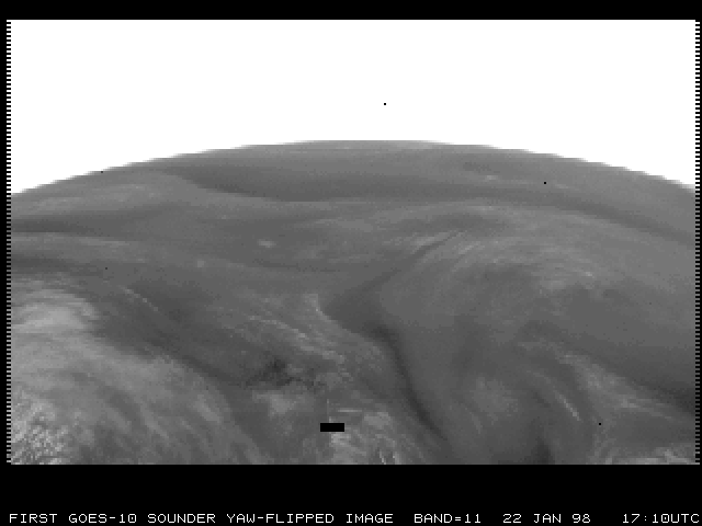
GOES-10 Satellite Projection Band=11 Jan. 22, 1998 17:10UTC
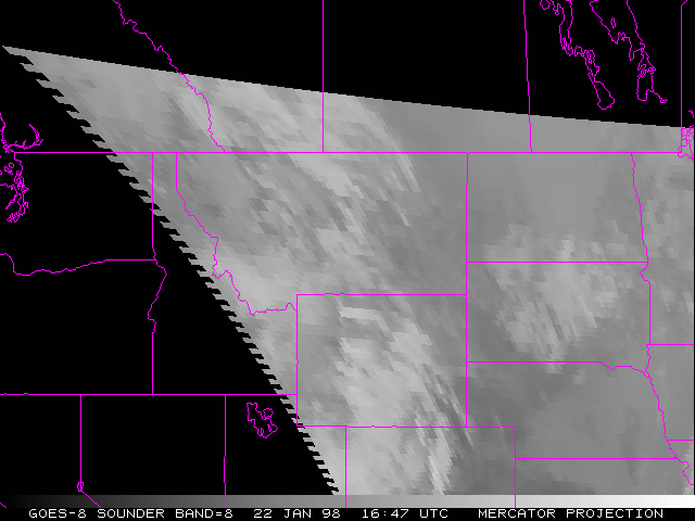
GOES-8 Mercator Band=8 Jan. 22, 1998 16:47UTC
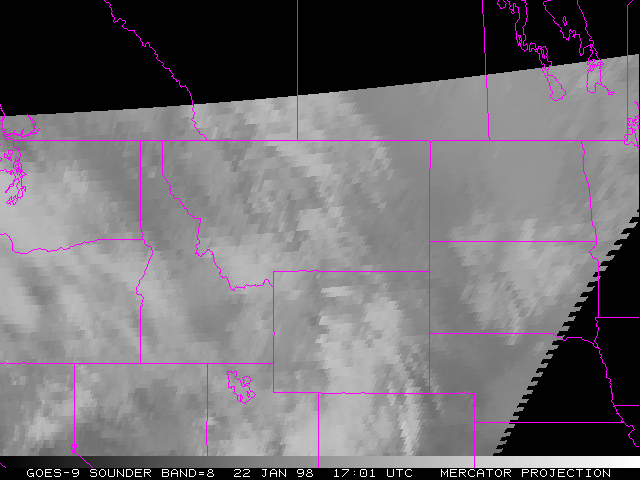
GOES-9 Mercator Band=8 Jan. 22, 1998 17:01UTC
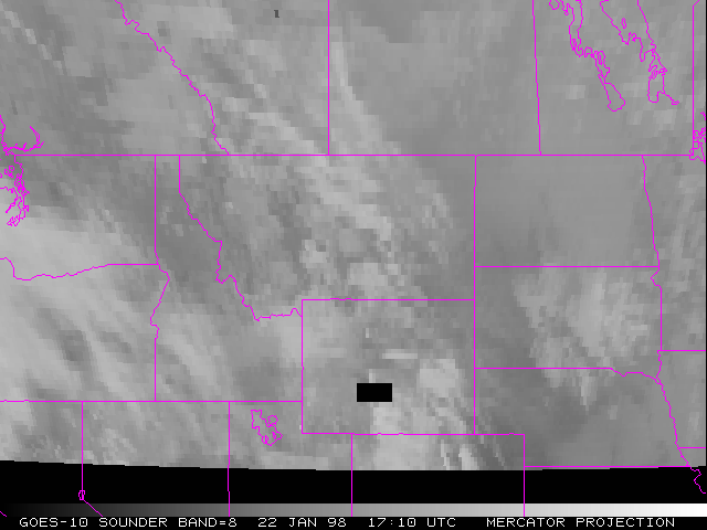
GOES-10 Mercator Band=8 Jan. 22, 1998 17:10UTC
GOES-/8/9/10 sounder spectral response functions for channel 13