


FAQ (Frequently Asked Questions)
Question: What effects does the bias mode 2 have on the calibration of the GOES sounder?
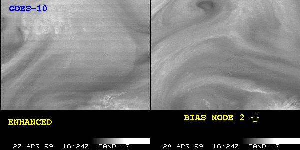
Answer: The bias mode 2 on the GOES-10 Sounder has been implemented as of 1550 UTC 28 April to help minimize drift in the bias factors (intercepts) between space looks. Bias mode 2 will allow the bias to be calculated more frequently and estimated based on its correlation with the variation in optics temperature. During certain parts of the day when optics temperatures are changing rapidly, this mode provides a better correlation between bias variation and optics temperature, and will ultimately provide a higher quality sounding. The following images at 16:24 UTC on 27 and 28 April (channel 12) shows the improved quality using the bias mode 2, as the 'banding' is less prevalant.
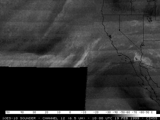
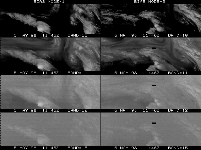
The bias mode 2 will reduce the 'banding' apparent in some images (ie, channel 12, at times around 10 UTC). This mode was tested on 5-6 May 1998. The first day (5 May, left column) was using bias mode 1, while the next day (6 May, right column) used bias mode 2. Note the 'cleaner' band 12 image on 6 May, with no image striping.
Question: What's the resolution of the GOES sounder?
Answer: The detectors themselves have a resolution of approximately 8.7 km (an Instantaneous Geometric Field Of View (IGFOV) of 242 micro-radians) on a side at the sub-satellite point (ie, 0 Latitude and 75 W Longitude for the eastern satellite). However, the IGFOV spacing (sampling) at the sub-satellite point is only every 10 km (280 micro-radians). This is why the sounder is said to have a "nominal resolution" of 10 km.
Now, just as with the imager, the FOV resolution (area that is sensed) becomes more coarse as the sample is taken at higher local zenith angles (the local zenith angle is the same as the absolute value of the latitude for locations at the same longitude as the satellite). So, if the eastern sounder is taking samples over Wisconsin, the resolution is basically 11 km (East/West) by 16 km (North-South).
To reduce the signal-to-noise, several sounder products are processed for a 3 x 3 (research) or 5 x 5 (operations) field of view box. While the 3 x 3 equates to a 30 x 30 km box at the sub-satellite point, it equates to a 33 km x 49 km box over Wisconsin. It also equates to a 36 km x 45 km box over the CART site.
For more information, see the sounder chapter of the GOES I-M DataBook:
http://rsd.gsfc.nasa.gov/goes/text/geos.databook.html
Question: How often will LI and TPW sounder-derived products be updated during convective season, and how long is the delay between availability and display due to processing time?
Answer: The sounder Derived Product Images (DPI) are available every hour (except during satellite eclipse). There is a lag of approximately one hour between the start time of the sounder scanning (e.g. 11:46 UT) and completion of the DPI processing (e.g.12:44 UT).
Of course given that there is hourly sounder coverage, one can look at the previous hour if the current hour is not yet processed.
Question: What is the estimated accuracy of the GOES sounder-derived Lifted Index (LI) and Total Precipitable Water (TPW) products?
Answer: One way to estimate the accuracy of the GOES sounder products is by comparing them to co-located radiosondes. Of course the GOES sounder does not measure the exact same space (point measurement versus a volumetric one) or time (co-locations are required to be within one hour) as the radiosonde, but the comparisons can still be informative. In general, due to the limited number of channels, the retrieved profile will be much smoother in the vertical than a radiosonde.
TPW: An improvement in moisture detection is evident when comparing
both sounder retrievals and the first guess to radiosondes. For example,
for the period from April 1996 through February 1997 the improvement
for the Root-Mean-Square Error (RMSE) of the total water vapor (TPW)
is roughly 20% (3.3 to 2.6 mm).
The RMSE = SquareRoot ((Bias*Bias) + (StandardDeviation *StandardDeviation))
LI: For the lifted index (LI), the RMSE between the retrievals and the radiosondes is approximately 1.5 degrees Kelvin. The changes in space or time may be more accurate than this value.
For more information: http://cimss.ssec.wisc.edu/goes/sndprf/sndprf.htm
Question: How often will LI and TPW sounder-derived products be updated during convective season, and how long is the delay between availability and display due to processing time?
Answer: The sounder Derived Product Images (DPI) are available every hour (except during satellite eclipse). There is a lag of approximately one hour between the start time of the sounder scaning (e.g. 11:46 UT) and completion of the DPI processing (e.g.12:44 UT).
Of course given that there is hourly sounder coverage, one can look at the previous hour if the current hour is not yet processed.