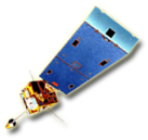


The Geostationary Operational Environmental Satellites (GOES) provide crucial information to help meteorologists observe and predict local weather events, including thunderstorms, tornadoes, fog, flash floods, and other severe weather. In addition, GOES observations have proven helpful in monitoring dust storms, volcanic eruptions, and forest fires.
CIMSS scientists develop and test algorithms that use data from GOES instruments to understand atmospheric properties and conditions. GOES sounder and imager product development includes:
- Generating atmospheric profiles of temperature and moisture
- Tracking atmospheric motions to create winds information
- Determining characteristics of clouds
- Detecting the development of convective clouds, detecting and characterizing wildfires
- Depicting the behavior tropical storms
CIMSS supports NOAA’s GOES mission through 4 major programs:
- GOES Improved Measurements and Product Assurance Program (GIMPAP)
- Geostationary-Product Systems Development and Implementation (PSDI)
- GOES-R Preparation
- Virtual Institute for Satellite Integration Training (VISIT)
While continuing to explore and refine the use of current GOES observations, CIMSS scientists also participate in preparations for the next generation of U.S. geostationary satellites. CIMSS has helped define the expectations and specifications for the Advanced Baseline Imager (ABI) as well as algorithms to handle ABI data for the GOES R series of environmental satellites.
More »