University
of Wisconsin-Madison
|
|
|
|
CoRP Symposium 2012 postponedWe will host next summer's symposium from 23-24 July 2013 at the Pyle Center, University of Wisconsin—Madison. Please include this symposium in your travel plans for next year! The purpose of this workshop is to highlight research and application development within NESDIS, its Cooperative Institutes and its Cooperative Science Center, CREST. Next year's CoRP Symposium will be hosted by the Cooperative institute for Meteorological Satellite Studies at the University of Wisconsin—Madison. Events include Workforce Development panel of recent graduates and a poster reception. Guest room blocks will be available at the Federal rate 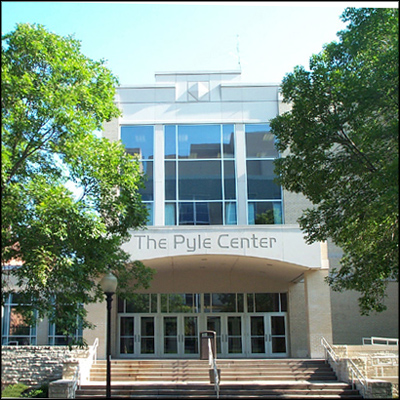
The Pyle Center This the premier conference facility is operated by the University of
Wisconsin Extension Service. This venue includes a 58-seat auditorium, dining rooms, and breakout rooms. Free wireless
Internet access is provided. During the CoRP Symposium, morning and afternoon breaks, one buffet lunch with a guest speaker and the poster reception will be offered at The Pyle Center to allow the maximum opportunity to network with other students and scientists. Address Cooperative Research Program (CoRP)NESDIS' Center for Satellite Applications and Research (STAR) manages the coast-to-coast research coalition of the federal government and universities known as the Cooperative Research Program. CoRP's branches, Institutes and its Center (CREST) work together on remote sensing of the environment in these focus areas: 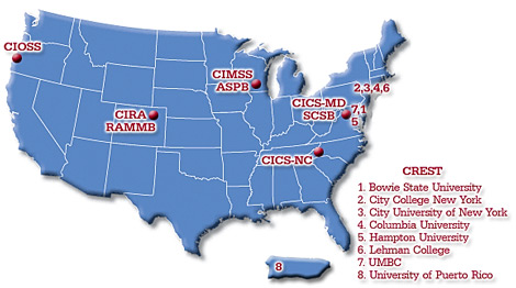
 |