
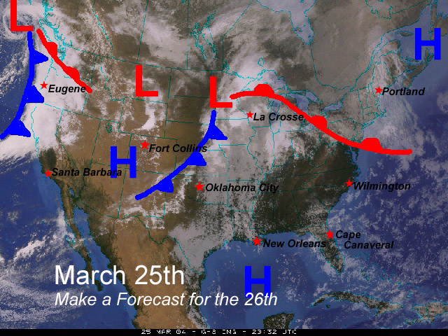
Forecasting Exercise continued
Your job is to forecast the High temperature, the amount of cloud cover, the wind direction and whether it will be raining or snowing at select locations in the afternoon of March 26th. The locations you should forecast for are: Santa Barbara California, Eugene Oregon, Ft Collins Colorado, Oklahoma City Oklahoma, La Crosse Wisconsin, Wilmington North Carolina, New Orleans Louisiana, Portland Maine and Cape Canaveral Florida. Here is a the satellite image and weather map you just analized with these locations plotted on it:
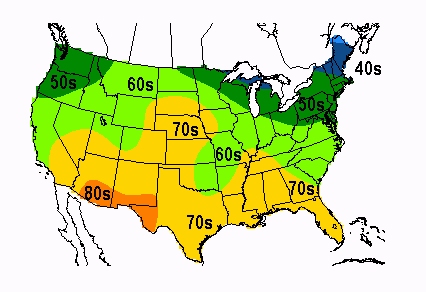
Below is a map that shows the high temperatures from the afternoon of March 25th. Your forecast is for for the next day, the afternoon of March 26th. Don't forget that as the fronts move east across the country cooler air will follow the cold fronts and milder air will follow the warm fronts.

Use as many maps and images that you need to fill out the following forecast table. For example, you might want to check the satellite loop again to forecast cloud cover.
High Temperature
5 degree increments (example 40-45, 45-50)Cloud Cover
Cloudy, Mostly Cloudy, Partly Cloudy, or ClearWind Direction
and intensity