
Whether or Not
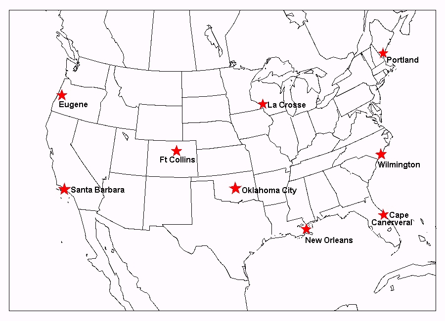
Now it's your turn to be a weather forecaster for a field trip of your choice at some future date. You will need to do some research to decide when and where you might want to go. Your choices are: Eugene Oregon, Santa Barbara California, La Crosse Wisconsin, Portland Maine, Ft Collins Colorado, Oklahoma City Oklahoma, Wilmington North Carolina, New Orleans Louisiana, and Cape Canaveral Florida.
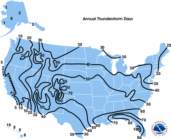
Below is a database of climate data to help you research your location.
Climate is the accumulation of daily and seasonal weather events over a long period of time, typically 30-year averages.
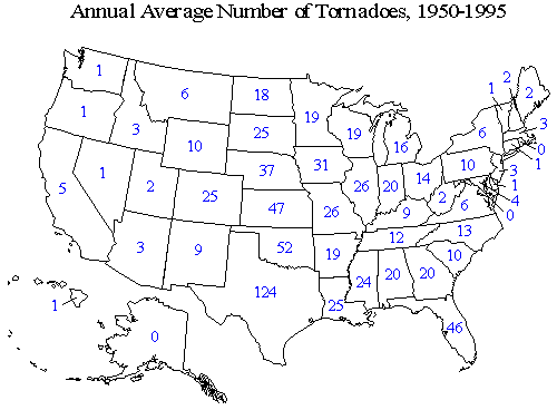
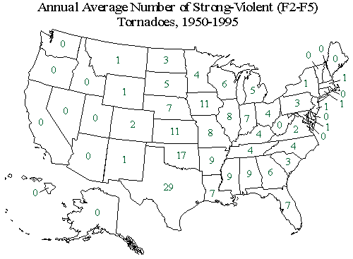
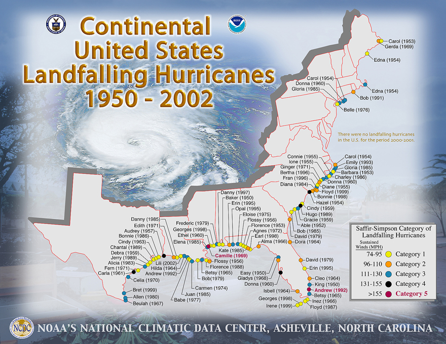
Average Daily Temperatures Average Minimum Temperatures Average Maximum Temperatures Average Daily Dew Point Temperatures Average Number of Tornadoes Average Number of Strong Tornadoes United States Hurricane History Average Snowfall Average Cloud Cover Fog occurence in the United States Average Thunderstorms occurences Common Wind speeds and direction What are your chances for severe weather where you're going? Be sure to explain why you think you'll have the type of weather you forecast and why you won't have some other types of weather.
When you're finished with your research and have picked your fieldtrip date(s) and location, make a forecast for the same location using satellite data from the Internet or the TV weather forecast for the upcoming weekend. Compare your forecasts. Why are they different? How does satellite data help?