Forecasting Exercise
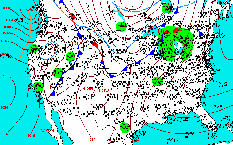
Meteorologists use several different maps to make a forecast. In this exercise you will need to consider satellite images, pressure patterns, and surface temperatures to forecast the weather for selected locations across the United States the day following the satellite image you just analized. Here is a map of the isobars:
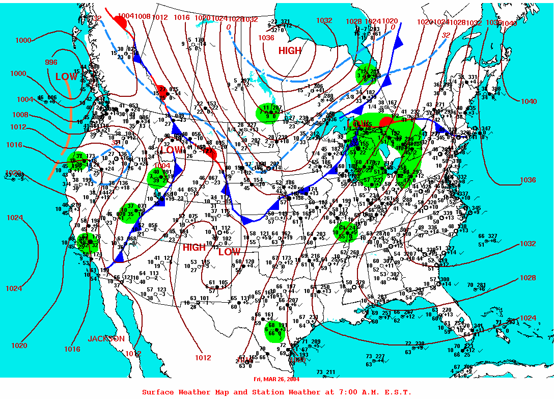
If you click on the surface weather map above you'll see another map from the morning of the 26th with the station weather plots on it. Click on it to make the map bigger. Or just look below for surface observations on the morning of March 26th. Your forecast is for the afternoon of the 26th.