WEATHER INGREDIENTS and WEATHER SYMBOLS
Looking at satellite images is a great start for every forecast, but more information is always helpful. Let's review some symbols commonly seen on weather maps, starting with fronts. Fronts are boundaries between two different air masses.
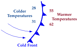
A blue line with triangles on one side is a cold front. When you see a cold front on a weather map, it means a colder air mass is trying to replace warmer air.The front marks the leading edge of the cold air. The blue triangles always point in the direction that the front (and the cold air) is going.
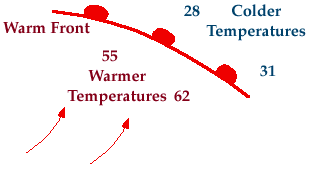
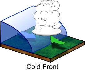
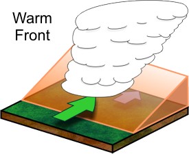
A red line with half-circles signifies a warm front. A warm front shows the leading edge of warmer air trying to replace a colder air mass. The half circles always point in the direction that the front (and the warmer air) is moving. Fronts don't just exist at the surface of the earth; they have a vertical structure extending up into the atmosphere as well. When air masses behind fronts collide, warmer air is always forced up and over the colder air. When the warm, moist air rises, it cools, and water condenses out into clouds and precipitation. By showing where the clouds are, satellite images outline the approximate location of fronts.
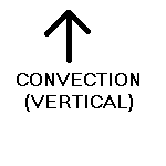
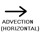
Why do air masses move? The fact that the Earth is round causes the sun to warm areas near the equator more than areas near the poles. Differences in heating are also due to the orientation of the Earth in its orbit around the sun (it's tilted) and the irregular shape of the orbit. All the while, the Earth is also rotating on it's axis. The differences in heating combined with constant motion causes air to move along the surface (advection) and rise in the sky (convection).