
Winter Storms
Winter Storms require three main ingredients for their formation:
* Cold air
* Moisture, and a
* Lifting mechanism (this could be a feature in the atmosphere such as a front or low pressure system, or a geographical feature such as hill or a mountain)There are two main types of winter storms, named for the track they take as they develop. Aberta clippers form in Alberta Canada and move quickly across the middle part of the United States. They are called "clippers" because they move so fast. This means that they can't accumulate much moisture and don't result in heavy snowfall.
The type of of winter storm that could result in a foot of snow is called a panhandle hook. These storms travel further south than clippers and usually curve over the Oklahoma panhandle before heading north again. This path allows panhandle hooks to grab a lot of moisture from the Gulf of Mexico and produce a lot of snow!
The biggest winter storms are called blizzards. Bllizzards pack winds over 35 mph, blinding wind-driven snow, snow drifts, and dangerous wind chill. Blizzards are frequently called Deceptive Killers because most deaths that result are indirectly related to the storm, people die in traffic accidents on icy roads or from hypothermia when caught outside.
Satellites are excellent for tracking winter storms as well as providing the best evidence of where the heaviest snow fell after a storm passes. Satellites are even being used to estimate snow depth and water content.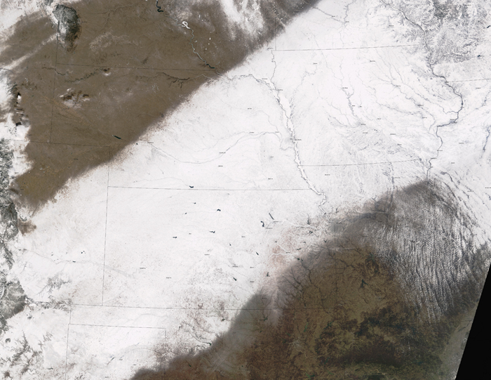
This POES image shows a freshly fallen band of snow.As satellite images became increasingly available to meteorologists in the 1980s, one of the most helpful interpretation skills was using animated satellite loops to tell the difference between freshly fallen snow and cloud cover. The clouds moved, but the snow didnt!