
Visible Satellite Images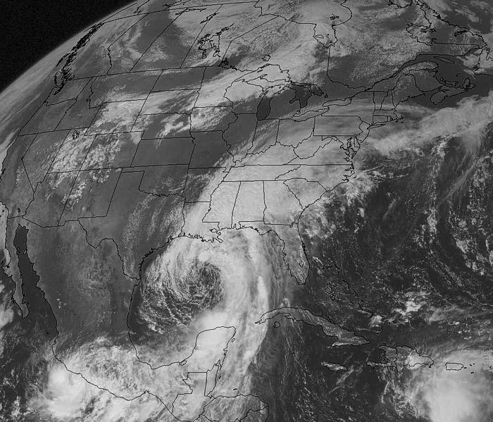
This visible image of North America was taken on September 25, 2002 at 12:45 p.m. CDT. Since it is the middle of the day and the sun is high in the sky, there is a lot of reflected light and the clouds are easy to see. However, there isn't much difference in the brightness which makes it harder for meteorologist to distinguish cloud height or cloud type. To do this they like to look at the infrared (IR) image and the water vapor image to make comparisons. 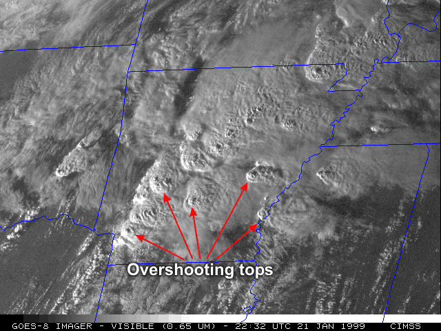 This is a late afternoon visible image of the tops of strong thunderstorms over Arkansas on January 21, 1999. The bumpy spots are the tops of thunderstorms, probably severe thunderstorms. These bumps are called overshooting tops which occur when strong updrafts of air punch through the cloud tops of the thunderstorms. Since this is a visible image where satellite instruments measure reflected sunkight, you can see the shadows on the eastern edge of the overshooting tops. |
Back to the Satellite Imagery Page