
WEATHER FORECASTING
Imagine an experiment with dozens of dependent variables and no controlled variables. Thats a good way to think about a weather forecast. The sun, the source of all energy on Earth, would be the independent variable, well, sort of. Even though the sun rises and sets on a steady schedule, and sends out fairly steady amounts of energy, the Earth keeps turning below it! And because our Earth is round, energy from the Sun heats the planet unevenly. This means temperature and pressure change with space and time. Clouds drift in and out of the scene, and different concentrations of gases affect the weather experiment.
Forecasting weather is one of the hardest and most complicated things scientists do on a daily basis. These scientists, called meteorologists, use many tools to tackle the job of weather forecasting. They start by looking at images provided by weather satellites. Here's a satellite image of the United States. Can you tell where it's cloudy?
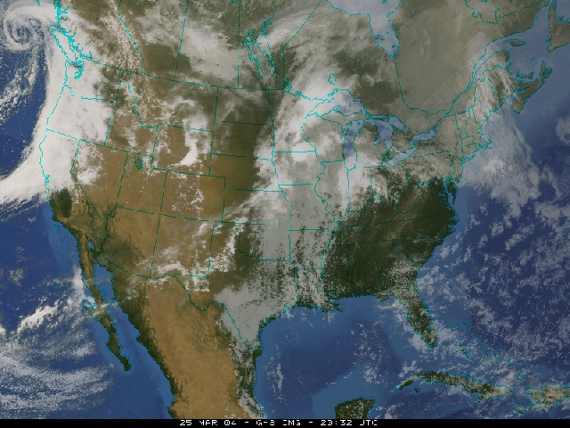
Along with showing us where the clouds are (the white and grey areas) this satellite image suggests that precipitation is occurring in the Pacific Northwest and much of the Midwest. You could forecast rain for central California from this satellite image alone. And you'd probably be right. A single satellite image holds tons of information. A meteorologist looking at this image could tell where the mild air is, where the cold fronts and warm fronts are, and even identify stormy weather. Click on this image to see the cold fronts, warm fronts, and areas of High and Low pressure. You can click back and forth between the images to see the pattern, try it!