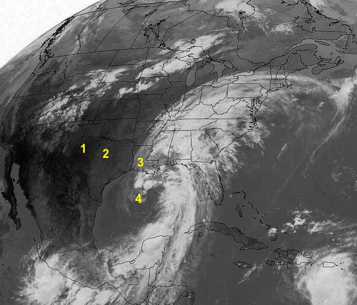
This infrared (IR) image of North America was taken on September
25, 2002. IR images show the temperatures
of objects, usually clouds. Satellite instruments can meaure IR data 24-hours
a day whether the sun is up or not because eveything is always sending out
IR energy.
In IR images, warmer objects appear the darkest. As the temperature
of object decreases,
the appearence
is
lighter
and lighter
until the coldest objects appear white.
- This area is cloud free. The satellite IR sensor therefore measures the ground temperature which is very warm.
- This is a region of cumulus clouds with cloud top height below 10,000 ft.
(3000 m)
- Mid level clouds.
- The white features just to the north of the number four are tops of thunderstorms just north of the center of Tropical Storm Isidore.


