
GOES East Visible Image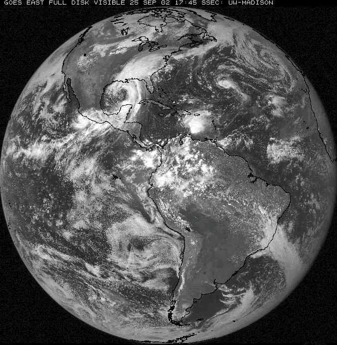 This is a full disk GOES East visible image taken at 12:45 p.m. CDT from September 25, 2002. Computers were used to outline the land features. North America is located in the upper left and South America in the central and lower right of the image. Africa can be seen on the far right side of the image. |
Back to the Satellite Imagery Page