 January 1, 1990
Before discussing the ozone hole, let's review global distributions of ozone. The figures below depict global measurements of ozone in Dobson Units. These measurements were made from the Total Ozone Mapping Spectrometer (TOMS) flown on satellites by NASA. The TOMS instrument determines ozone amounts through measurement of UV sunlight reflected back to space by clouds and the surface. Measurements of ozone by the TOMS can therefore only be made during the daylight hours.
The following 12 maps depict TOMS observervations for the first day of each month in the year 1990. White regions on the maps represent missing observations. You can enlarge each figure independently to answer the following questions. There are three maps for each figure. The top figure is a Mollweide map projection. The bottom left map is a view over the South Pole and the bottom right map is a view looking down on the North Pole. These figures where obtained from the NASA's TOMS home page.
 February 1, 1990
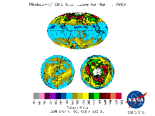 March 1, 1990
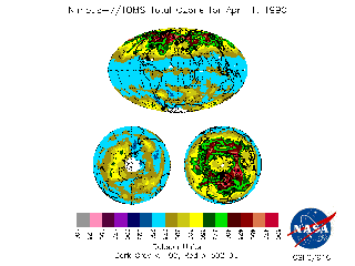 April 1, 1990
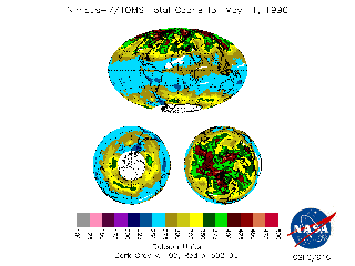 May 1, 1990
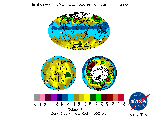
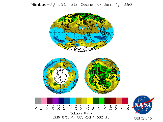 June 1, 1990
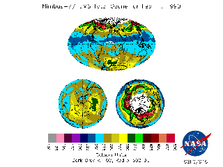
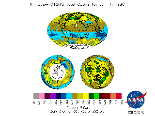 July 1, 1990
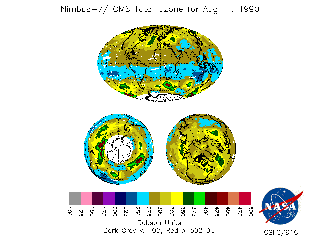 August 1, 1990
 September 1, 1990
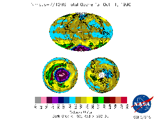 October 1, 1990
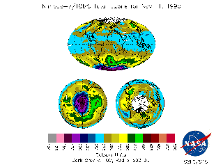 November 1, 1990
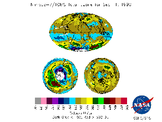
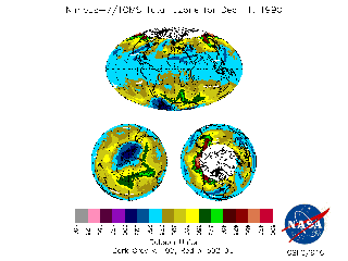 December 1, 1990