

Highlights for the week ending September 4, 2026
Data and Information
CIMSS summer intern shows benefits of GXI 5.15 um band for retrieving water vapor using machine learning
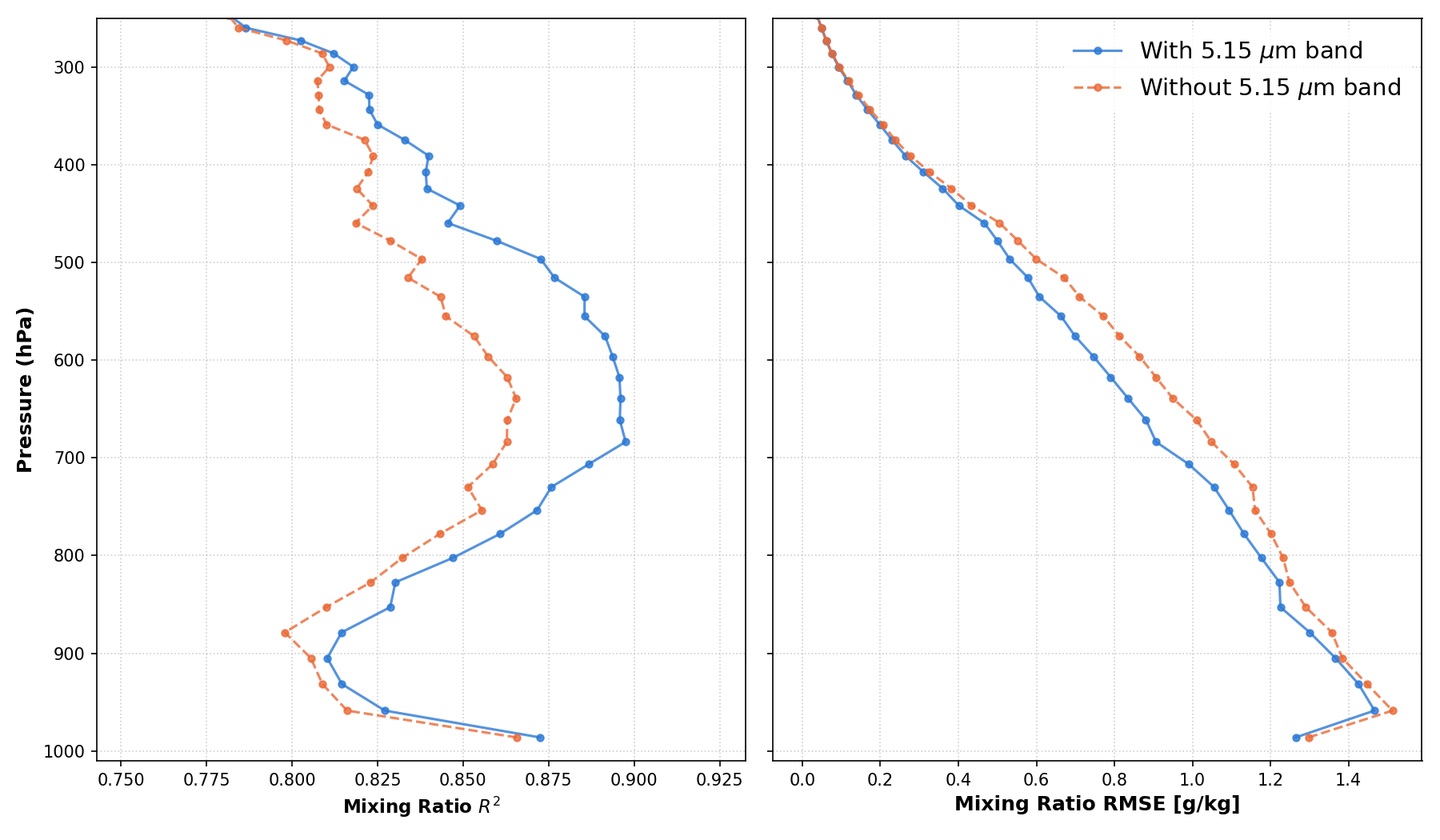
Researchers at the Cooperative Institute for Meteorological Satellite Studies utilized a neural network retrieval to evaluate the benefit of using the GXI 5.15 um band, compared to using strictly heritage GOES bands. In dry conditions there is a 3% improvement in the Root Mean Square Error (RMSE) of the near-surface water vapor retrieval. The fractional RMSE improvement across a variety of moisture conditions is between 3-10% for determining low-level moisture content. La Ditra Mason, a participant in the 2026 Space Science and Engineering Center Summer Student Internship program, also utilized machine learning techniques to confirm the high permutation importance of the 5.15 um band in detecting low-level water vapor. As expected, she found reduced RMSE and enhanced correlation between retrieved and simulated/reference moisture content values when using the 5.15 um band, including in the lower atmosphere where the correlation values are relatively smaller.
- Nathaniel Miller, CIMSS; nbmiller@wisc.edu
-
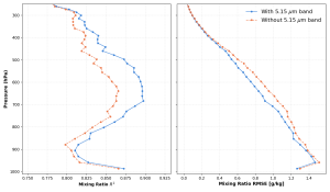 Figure: The correlation between a Random Forest machine learning water vapor retrieval and the simulated reference data is higher when including the GXI 5.15 um band. The enhanced coefficient of determination (R squared) values are evident throughout the troposphere (left panel), including in the lower atmospheric levels where retrieval accuracy is diminished. The improvement in Root Mean Square Error (RMSE) when including the 5.15 um band is depicted in the right panel.
CIMSS provides new enhanced AMSR3 imagery for forecasters
With support from the Joint Polar Satellite System (JPSS) Program, new spatially enhanced (3.125 km) Advanced Microwave Scanning Radiometer-3 (AMSR3) 36/89 GHz imagery is now being provided in near real-time by the Cooperative Institute for Meteorological Satellite Studies. The imagery is used by Alaska Sea Ice Program (ASIP) and US National Ice Center (USNIC) scientists for forecasting, analyzing, and tracking sea ice. The enhanced AMSR3 imagery files are available online for download.
- Tom Greenwald, CIMSS; tomg@ssec.wisc.edu
-
 Figure: Spatially enhanced (3.125 km) AMSR3 36H GHz imagery for the morning passes, 3 September 2026.

Training and Education
NOAA Lapenta Intern at CIMSS: Tracking decades of deep convection using GOES-East
Patrick Newman – a rising fourth year undergraduate student at the University of Massachusetts Lowell – recently completed his summer William Lapenta Internship with NOAA at the Cooperative Institute for Meteorological Satellite Studies. Andrew Heidinger (NOAA/NESDIS) and Mike Foster (CIMSS) served as Patrick’s mentors on his research project titled “The Eye from Above: Tracking Three Decades of Eastern U.S. Deep Convection Using GOES-East.” Patrick created a climatology of Mesoscale Convective Systems (MCS’s) using a GOES-East satellite record dating back to 1995 recently generated at CIMSS. He used Python-based cloud tracking software to identify individual MCS’s and performed a statistical analysis tracking frequency, duration, location, distance travelled, areal extent, and intensity over three decades. These research efforts will stimulate further applied research to increase National Weather Service forecasters’ situational awareness for MCS events.
- Mike Foster, CIMSS; mike.foster@ssec.wisc.edu
- Andrew Heidinger, NOAA/NESDIS
Social Media and Blog Posts
CIMSS Satellite Blog Updates
The Cooperative Institute for Meteorological Satellite Studies (CIMSS) Satellite Blog was updated with the following posts: ”Satellite signatures of the NASA Roman Space Telescope launch” (Aug. 30), “Tropical Storm Edouard makes landfall in far southwest Louisiana, and produces flash flooding across southeast Texas” (Sep. 1) and “Hurricane Lowell reaches Category 5 intensity over the Central Pacific” (Sep. 2).
- Scott Bachmeier, CIMSS; scott.bachmeier@ssec.wisc.edu
-
 Figure: GOES-19 Rocket Plume RGB image at 1129 UTC on August 30, 2026 -- showing the signature of hot water vapor (brighter shades of yellow-green) within the exhaust plume of the SpaceX Falcon Heavy rocket booster following the NASA Roman Space Telescope launch from Kennedy Space Center in Florida.
 -
 Figure: GOES-18 Infrared Window image with plots of GLM Flash Points at 1933 UTC on September 2, 2026 -- showing Hurricane Lowell as it was reaching Category 5 intensity over the Central Pacific.

