
Cloud Identification

Low Level Clouds - I
Low clouds float between 100 feet high and 6500 feet above the earth. Two common types, stratus and cumulus, undergo very different processes to become clouds.
Cumulus (Heap Clouds)
A cumulus cloud results when air is heated up by the sun and rises a bit faster than
the surrounding air. This process is called convection. At a certain
level in the atmosphere the air cools and the water vapor condenses out to form a cloud.
Convective cumulus clouds develop puffy cotton shaped profiles. These
clouds are easy to pick out on visible satellite images, as long as there aren't any
clouds above them!
Fair weather cumulus clouds have a height that is similar to its width.
These clouds are common in summer when air rises due to convection resulting from solar
heating of the surface. During autumn and winter cumulus form over large open lakes.
Fair weather cumulus are not deep enough to cause rain.
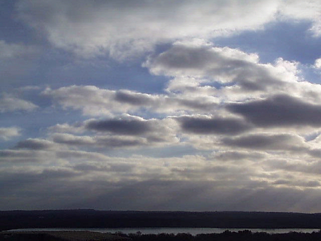
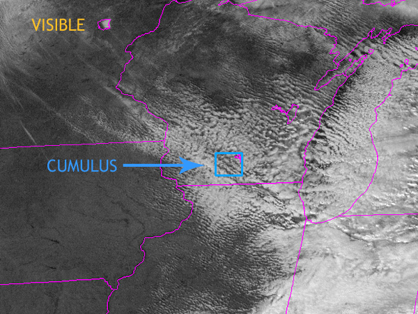
The images below provide a view of cumulus clouds from the ground, and from visible and infrared satellite images.
 |
 |
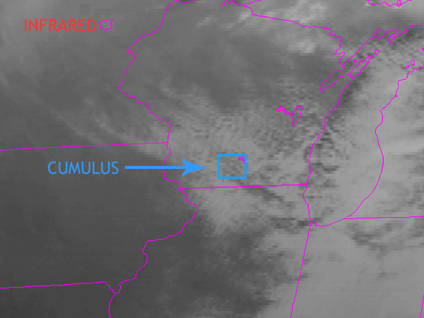 |
| Cumulus clouds from below | Visible satellite image | IR satellite image |
Identify Cumulus Clouds in Satellite Images
The first satellite image is a visible image using reflected light, the second satellite image is an IR image that measures thermal energy.
 Use your mouse or finger and slide across the image to fade between the different images.
| 3 / 12 |