|
Satellite technology is one of the biggest scientific breakthroughs of the 20th century. Satellite meteorology has become ubiquitous in the modern world, especially in the United States where cloud patterns and pictures of weather systems accompany the weather forecast every day on every television station.
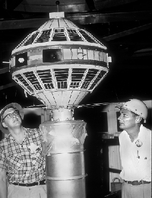
This is largely due to the work of Dr. Verner Suomi, the founder of CIMSS, who had the idea for weather satellites by seeing instant replay on a televised football game.
By combining information from imagers and sounders from multiple Geostationary and Polar orbiting satellites, meteorologists and educators can observe short-term phenomena around the globe 24 hours a day, every day of the year. This helps us understand and explain how the whole Earth functions. In the short term, weather satellites help meteorologists save lives. Informed citizens can easily forecast near-term weather conditions by interpreting satellite images readily available on the Internet or the evening news. Satellite images monitored over decades show patterns of global flow in the hydrosphere and atmosphere, creating a capacity for wise stewardship of our planet by increasing our understanding of global climate change.
|