Earth image  HomeAbout the CourseModulesGlossaryReal-time DataGallery
Clouds that produce precipitation

Clouds

Beginning of Module


Created by UW-Madison, 2002
When the atmosphere becomes unstable the convection intensifies and cumulus clouds can develop into rain clouds or thunderstorms. A mature thunderstorm is called a cumulonimbus and is also very easy to pick out on satellite images. Powerful cumulonimbus clouds with bright white overshooting tops that punch through the tropopause are especially easy to track on visible satellite images. And even though the base of a cumulonimbus cloud may be as low as 3 or 4000 feet, the anvil tops spread out because they are as high as the tropopause, frequently 50 or 60,000 feet high in the summer. These are big storms!

Cumulonimbus clouds form in moist atmospheres and are common in spring and summer. They often occur in the advance of a cold front. In summer they can form over mountains due to orographic lifting in combination with solar heating. Precipitation falls from these clouds and severe weather (lightning, hail, tornado, flash flood) is common. Cumulonimbus can be isolated storms or organized in groups. When cumulonimbus clouds form together in an organized system, the chance of severe weather increases.


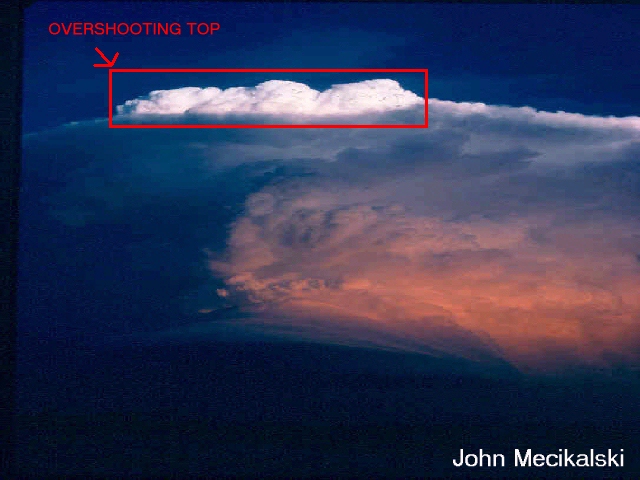
Cumulonimbus cloud from below

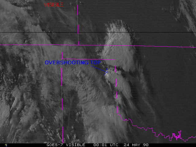
Visible satellite image
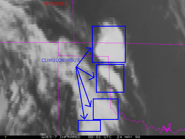
IR satellite image
The first satellite image is a visible image using reflected light, the second satellite image is an IR image that measures thermal energy.


Nimbostratus are layered clouds with low bases that produce precipitation and are usually formed by advection. Nimbostratus are often associated with the passage of warm fronts. Nimbostratus may quickly develop into a thunderstorm.

Continue to the next page

Go back to the previous page