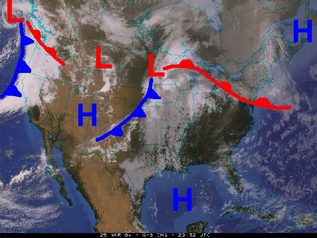
Click on the map to see the satellite image without the fronts.
Along with showing us where the clouds are (the white
and grey areas) this satellite image suggests that precipitation
is occuring in the Pacific Northwest
and much of the Midwest.
A single satellite
image holds
tons of
information.
A meteorologist looking at this image could tell where the mild
air is, where the cold fronts and warm fronts
are, and even identify stormy weather.
Click on this image
to see the cold fronts, warm fronts, and areas of High and
Low pressure. You can click back and forth
between the images to see the pattern, try it!
Back to theWeather Forecasting page