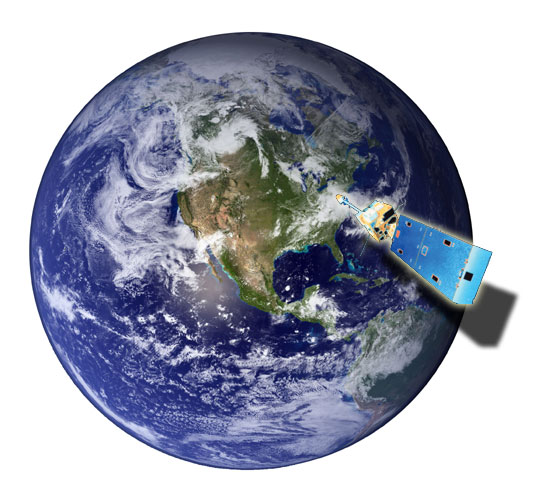
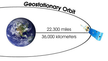
The images below show a geostationary satellite orbiting the earth. A satellite in geostationary orbit hovers over the same spot of the Earth, collecting data over that particular region. You'll find out more about geostationary orbit, as well as polar orbit, in "Weather Satellites and Orbits."
Select Modules to start your adventure in Satellite Meteorology.