Index of /satellite-blog/images/2023/01
Name
Last modified
Size
Description
Parent Directory
-
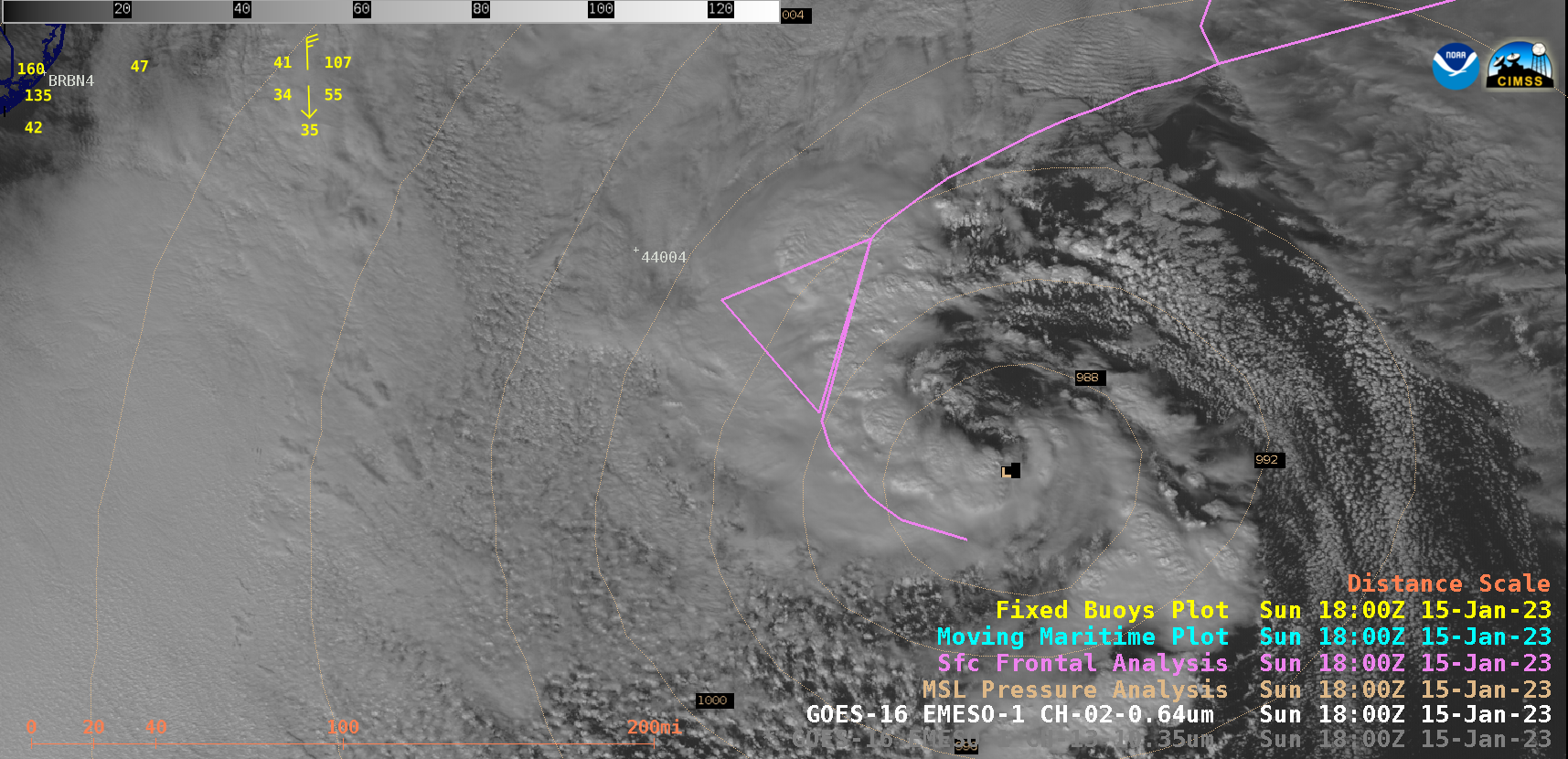
ws_vis-20230115_180028.png
2023-01-16 03:47
1.1M
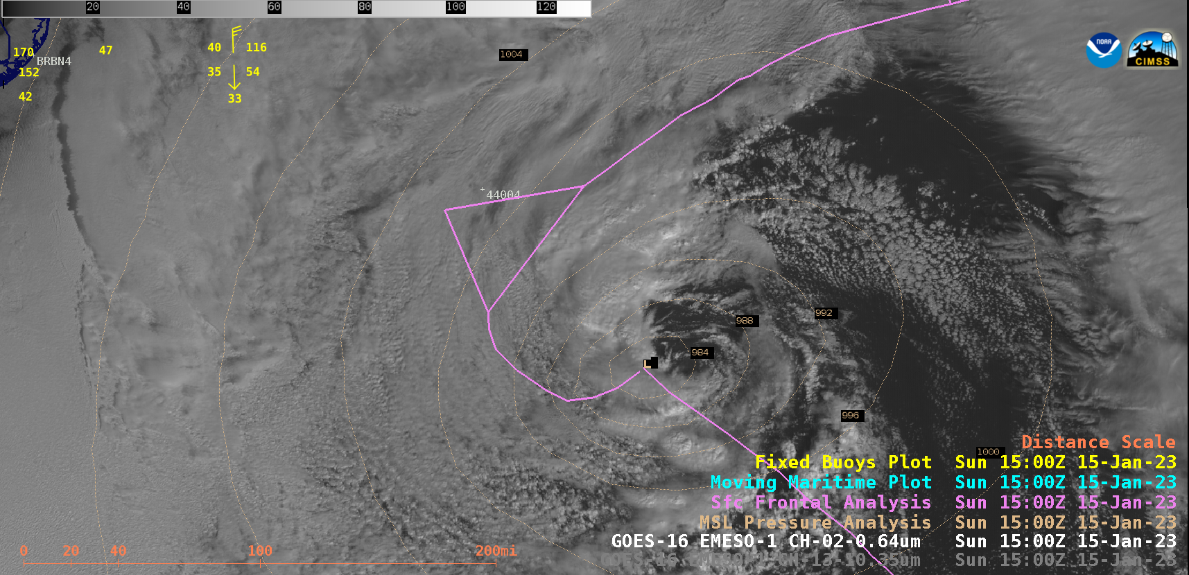
ws_vis-20230115_150028.png
2023-01-17 19:50
1.1M
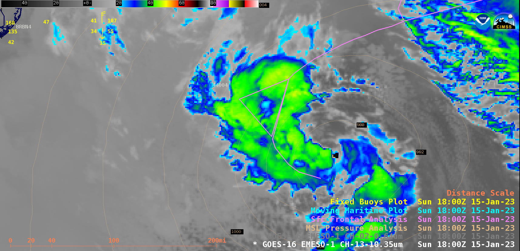
ws_ir-20230115_180028.png
2023-01-16 03:47
222K
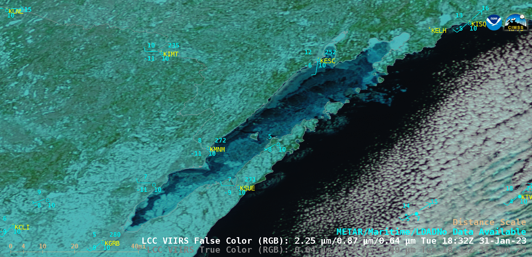
wi_rgb_obs-20230122_163117.png
2023-01-23 02:44
189K
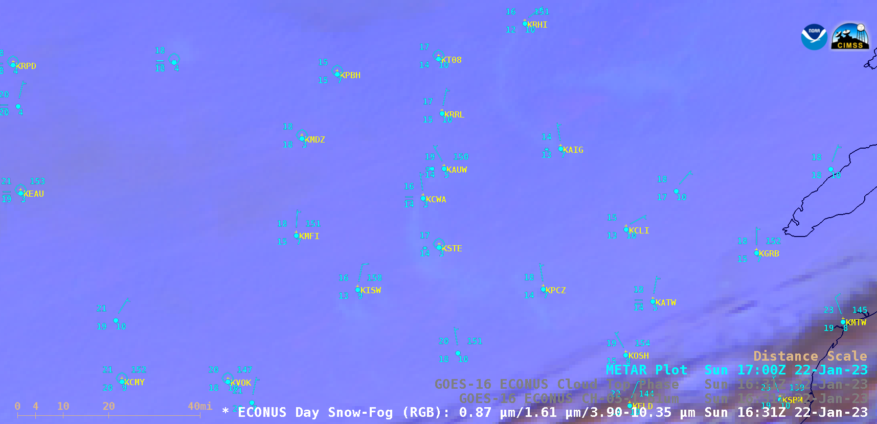
wi_rgb-20230122_163117.png
2023-01-23 02:44
122K
wi_phase-20230122_163117.png
2023-01-23 02:44
90K
wi_nir_obs-20230122_163117.png
2023-01-23 02:44
150K
wi_nir-20230122_163117.png
2023-01-23 02:44
82K
va_wv_raob_sites-20230120_120028.png
2023-01-23 18:01
168K
va_wv-20230120_170028.png
2023-01-23 03:26
186K
va_vis-20230120_170028.png
2023-01-23 03:26
1.0M
va_topo_20230120.png
2023-01-23 16:49
152K
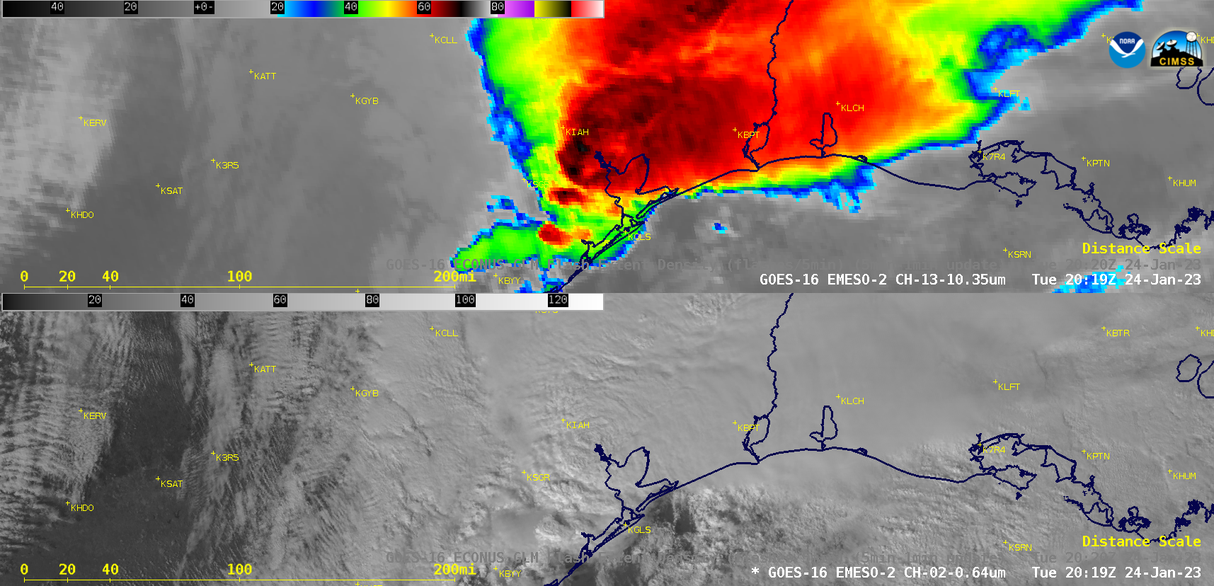
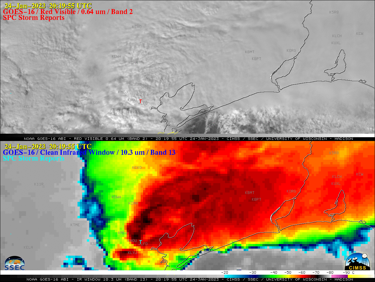
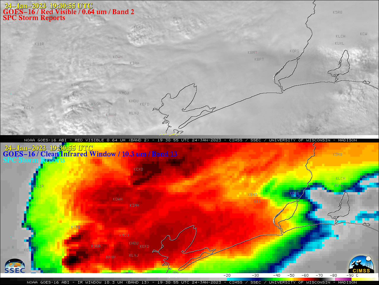
tx_2p_fed-20230124_201955.png
2023-01-26 00:19
727K
tx_2p-20230124_201955.png
2023-01-26 00:19
764K
test.jpg
2023-01-05 16:46
940K
sfo_rgb-20230104_120117.png
2023-01-05 04:36
2.0M
sfo_rgb-20230103_220117.png
2023-01-05 21:58
1.8M
sfo2_rgb-20230104_200117.png
2023-01-06 02:45
1.7M
sfo2_rgb-20230104_120117.png
2023-01-05 21:59
2.0M
sfo2_rgb-20230104_110117.png
2023-01-06 01:16
2.0M
sfo2_rgb-20230104_100117.png
2023-01-06 02:49
2.0M
redo_Clipped_Filled_GOES-18_ABI_RadF_cimss_true_color_2022205_210019Z_1500x2500.gif
2023-01-18 20:22
5.9M
redo_Clipped_Filled_GOES-18_ABI_RadF_cimss_true_color_2022205_210019Z_1200x1500.gif
2023-01-18 20:38
2.2M
redo_Clipped_Filled_GOES-18_ABI_RadF_cimss_true_color_2022205_210019Z.gif
2023-01-18 20:18
5.9M
pl_vis-20230106_190117.png
2023-01-07 04:06
1.1M
pl_vis-20230106_180117.png
2023-01-07 04:06
1.1M
pl_rgb2_operCTH_compare-20230106_190117.png
2023-01-09 22:41
1.0M
pl_rgb2_obs_compare-20230106_190117.png
2023-01-09 22:41
1.6M
pl_rgb2_obs-20230106_190117.png
2023-01-07 04:06
1.6M
pl_rgb2_obs-20230106_180117.png
2023-01-07 04:06
1.6M
pl_rgb2_flsCLDTHK_compare-20230106_190117.png
2023-01-09 22:41
1.5M
pl_rgb2_compare-20230106_190117.png
2023-01-09 22:41
1.6M
pl_rgb2_clavrxCTH_compare-20230106_190117.png
2023-01-09 22:41
1.3M
pl_rgb2-20230106_190117.png
2023-01-07 04:06
1.6M
pl_rgb2-20230106_180117.png
2023-01-07 04:06
1.5M
pl_rgb1-20230106_190117.png
2023-01-07 04:06
1.8M
pl_rgb1-20230106_180117.png
2023-01-07 04:06
1.8M
pl_operCTH_compare-20230106_190117.png
2023-01-09 22:41
1.0M
pl_flsCLDTHK_compare-20230106_190117.png
2023-01-09 22:41
1.6M
pl_clavrxCTH_compare_-20230106_190117.png
2023-01-09 22:41
1.4M
pl_clavrxCTH_compare-20230106_190117.png
2023-01-09 22:41
1.4M
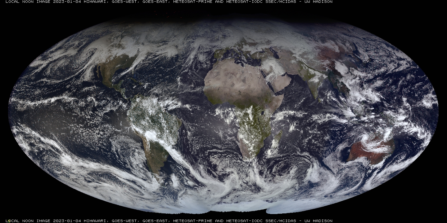
local_noon_latest_04Jan2023.jpg
2023-01-05 16:46
940K
hi_wv_ir-20230110_120117.png
2023-01-10 20:25
114K
hi_vis_tpw-20230128_235956.png
2023-01-30 04:12
599K
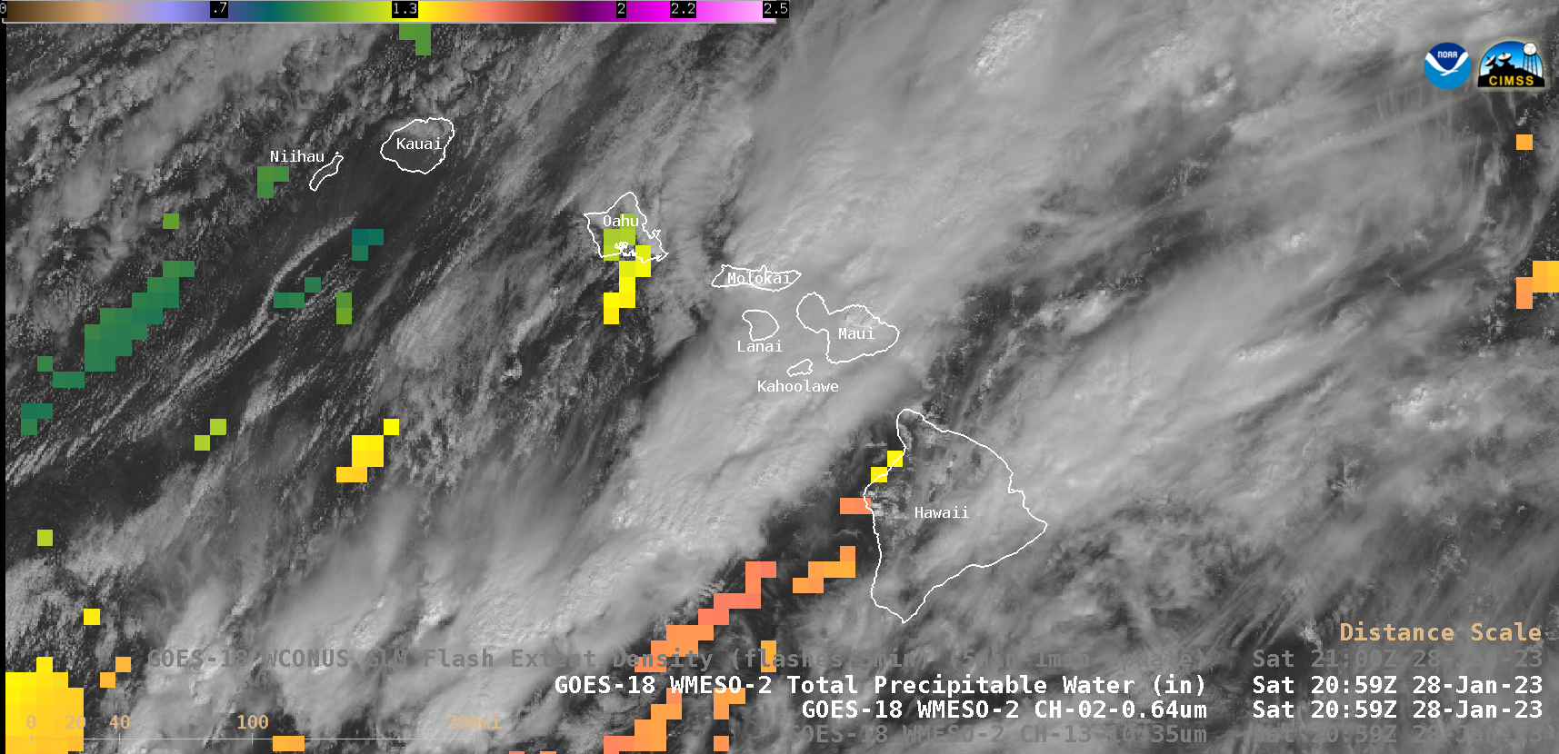
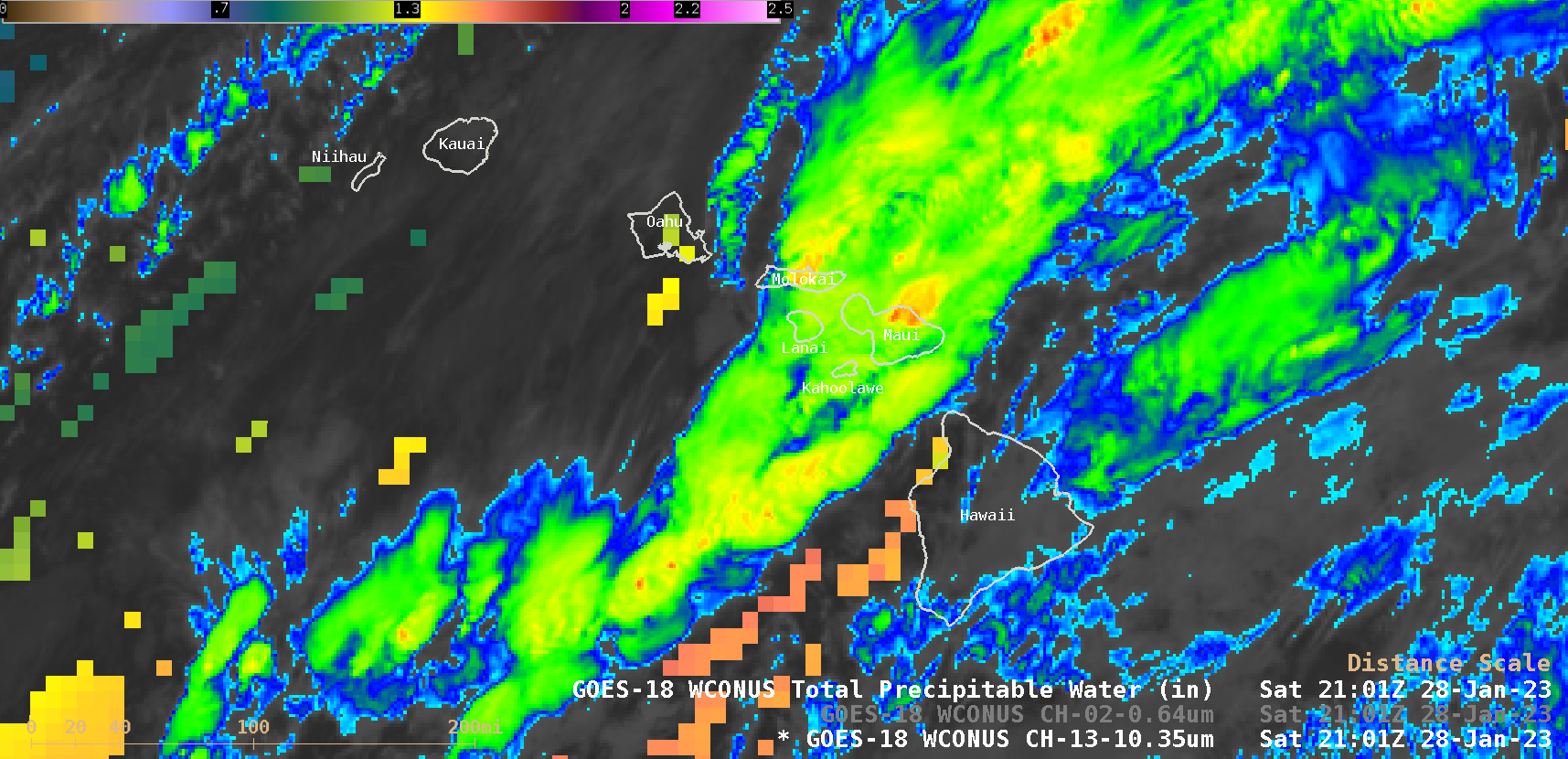
hi_vis_tpw-20230128_205956.png
2023-01-30 04:53
613K
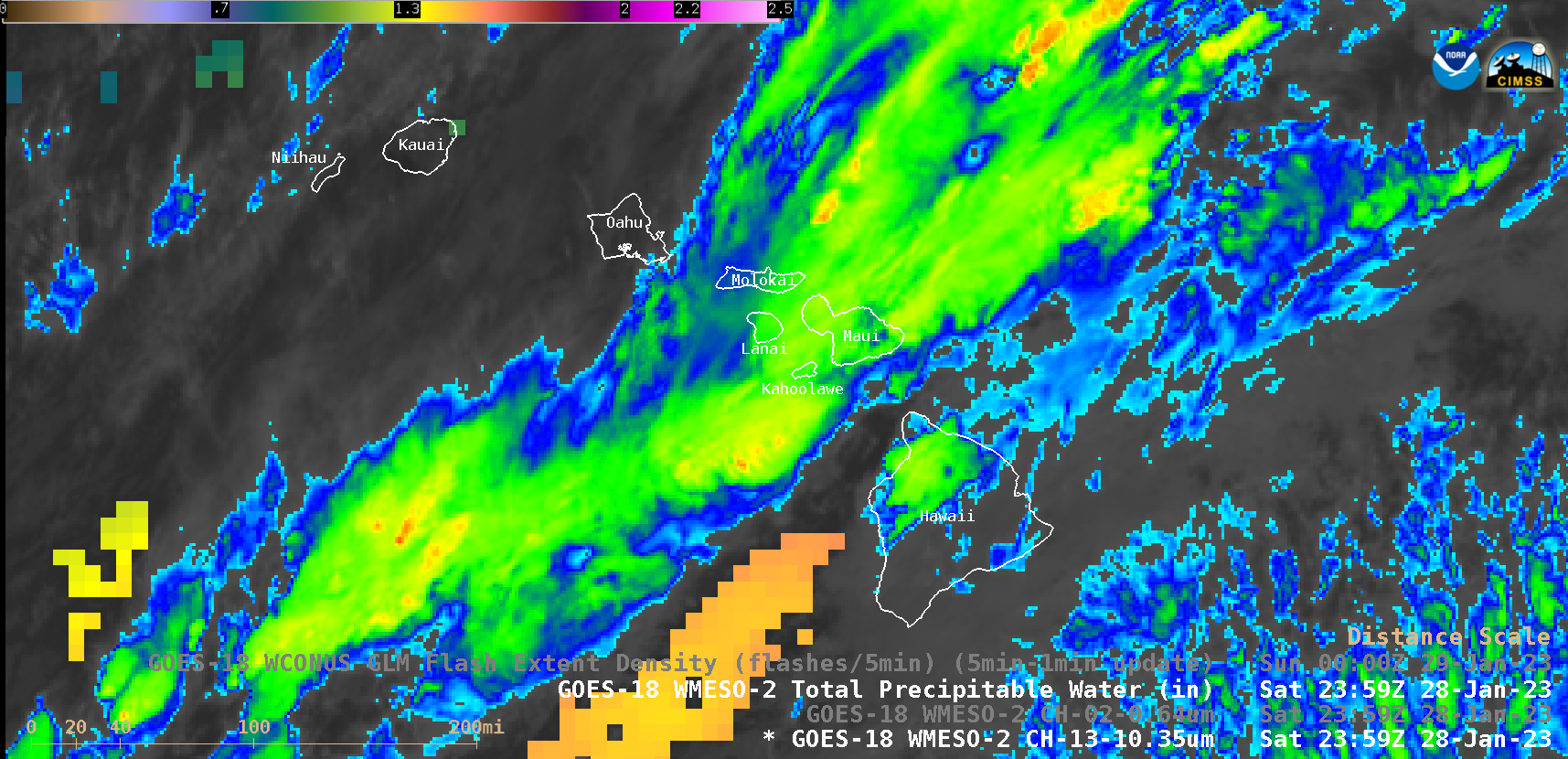
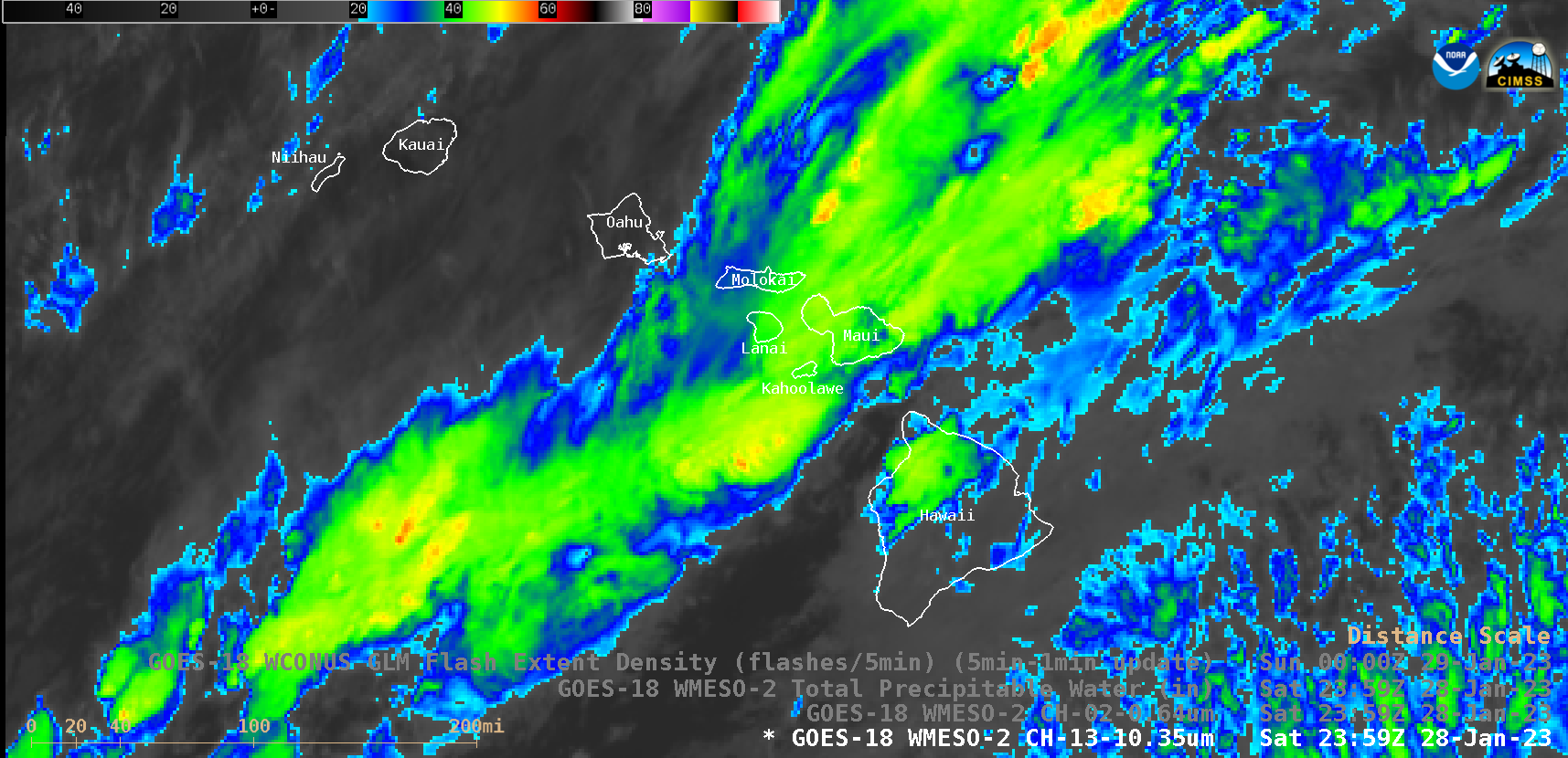
hi_ir_tpw-20230128_235956.png
2023-01-30 04:12
271K
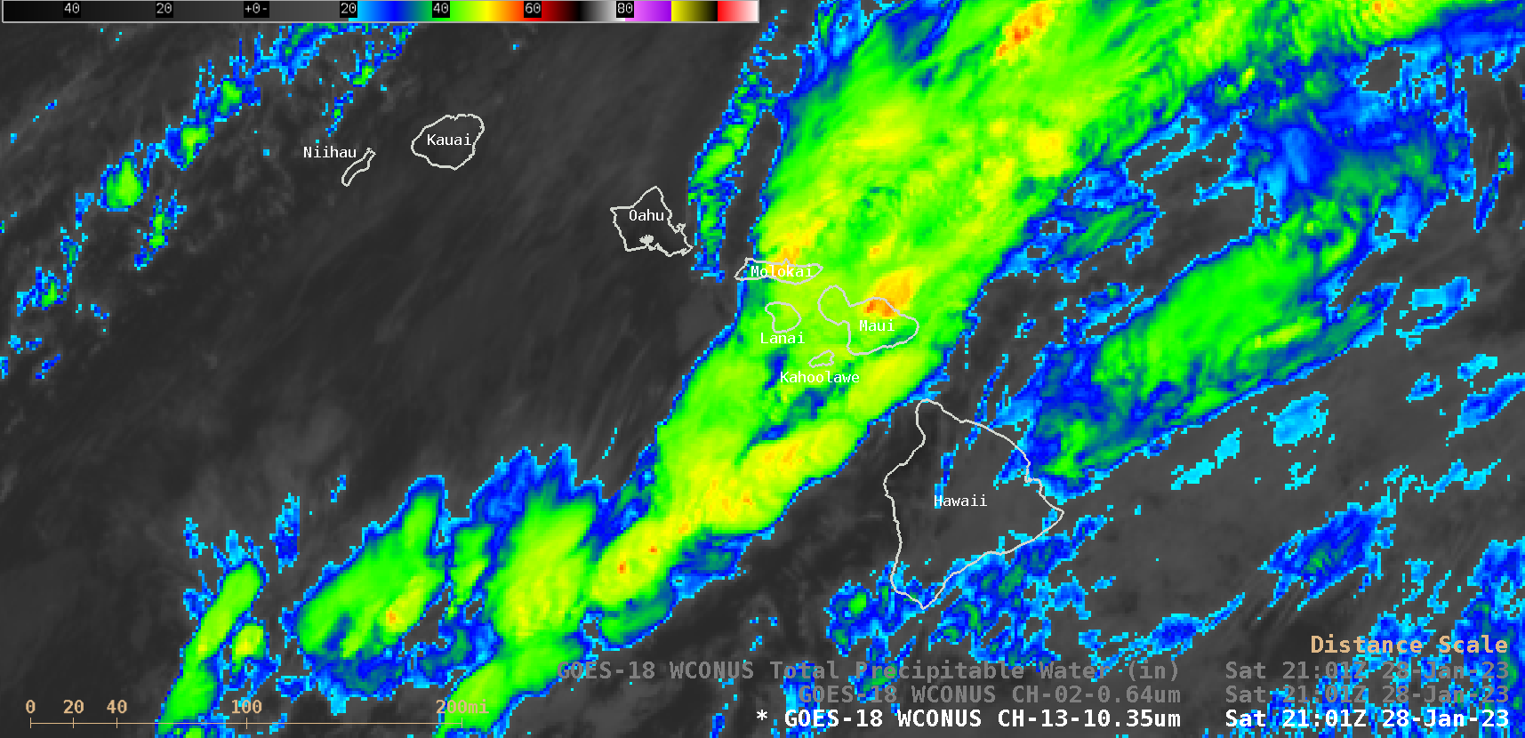
hi_ir_tpw-20230128_210118.png
2023-01-29 18:42
312K
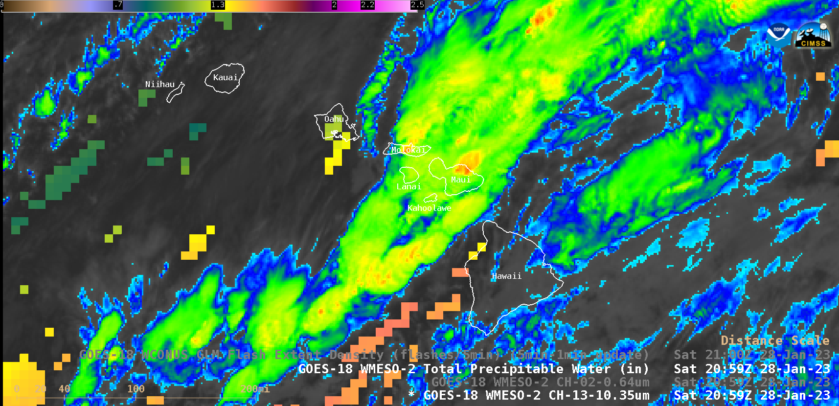
hi_ir_tpw-20230128_205956.png
2023-01-30 04:53
273K
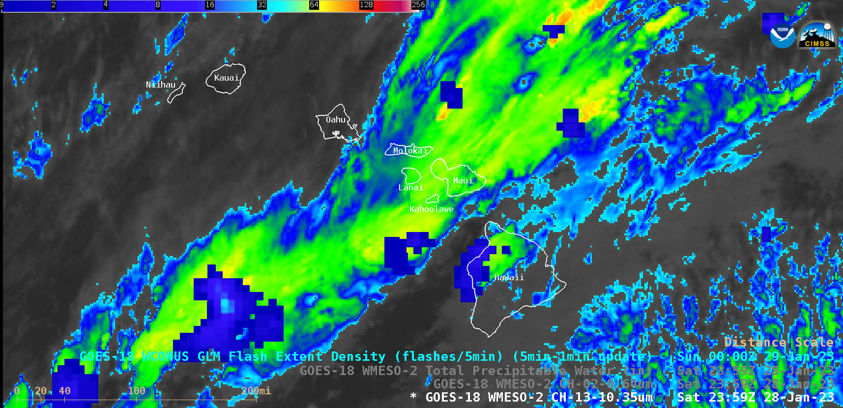
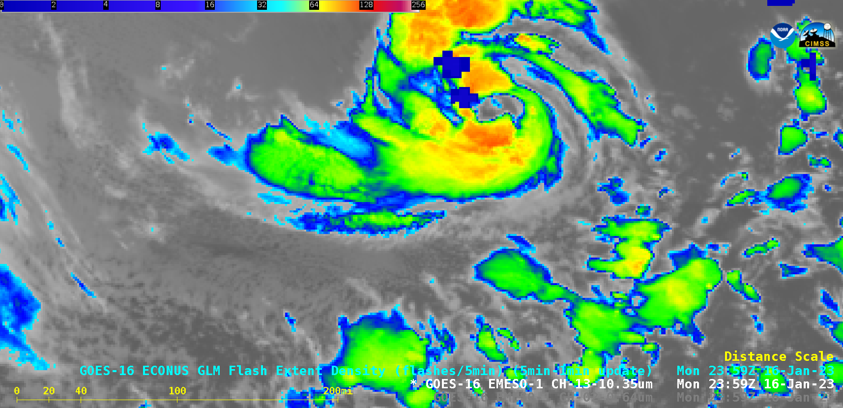
hi_ir_fed-20230128_235956.png
2023-01-30 04:12
266K
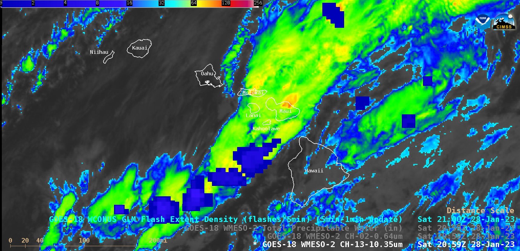
hi_ir_fed-20230128_205956.png
2023-01-30 04:53
268K
hi_ir-20230128_235956.png
2023-01-30 04:12
273K
hi_ir-20230128_210118.png
2023-01-29 18:42
312K
hi_ir-20230128_205956.png
2023-01-30 04:53
275K
grb_vis-20230130_200117.png
2023-01-31 17:04
304K
goeswest_abi_radc_true_color_night_s20230123203117_e20230124003117_f49.mp4_combined_horizontally_with_goeseast_abi_radc_true_color_night_s20230123203117_e20230124003117_f49.mp4
2023-01-24 18:15
1.4M
goeswest_abi_radc_true_color_night_s20230104170117_e20230105012117_f100.mp4
2023-01-06 01:32
2.8M
goeswest_abi_radc_true_color_night_20230104210117.png
2023-01-06 01:32
845K
goeseast_abi_radc_true_color_night_s20230131140117_e20230131210117_f85.mp4
2023-01-31 23:37
1.2M
goeseast_abi_radc_true_color_night_20230131210117.png
2023-01-31 23:37
900K
fsd_wv-20230103_145117.png
2023-01-04 03:49
615K
fsd2_wv-20230103_145117.png
2023-01-04 03:49
824K
epac_viirs_dnb-20230104_104440.png
2023-01-04 19:12
1.3M
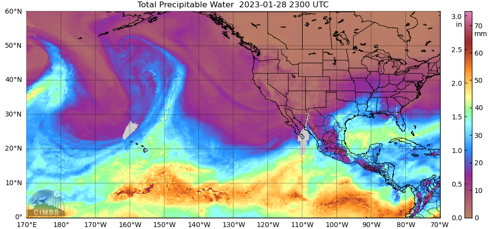
comp20230129.230000_tpw.png
2023-01-30 16:27
370K
comp20230128.230000_tpw.png
2023-01-30 16:27
367K
al90_ltg-20230116_235925.png
2023-01-22 00:00
197K
al90_ir-20230117_091525.png
2023-01-20 18:02
239K
al90_ir-20230117_091028.png
2023-01-20 18:02
240K
al90_ir-20230117_090925.png
2023-01-20 18:06
240K
al90_ir-20230117_090825.png
2023-01-20 18:06
240K
al90_ir-20230117_090725.png
2023-01-20 18:06
240K
al90_ir-20230117_090625.png
2023-01-20 18:06
240K
al90_ir-20230117_090525.png
2023-01-20 18:06
240K
al90_ir-20230117_090425.png
2023-01-20 18:06
240K
al90_ir-20230117_090325.png
2023-01-20 18:06
240K
al90_ir-20230117_090225.png
2023-01-20 18:06
240K
al90_ir-20230117_090125.png
2023-01-20 18:06
240K
al90_ir-20230117_090028.png
2023-01-20 18:06
240K
al90_ir-20230116_235925.png
2023-01-22 00:00
197K
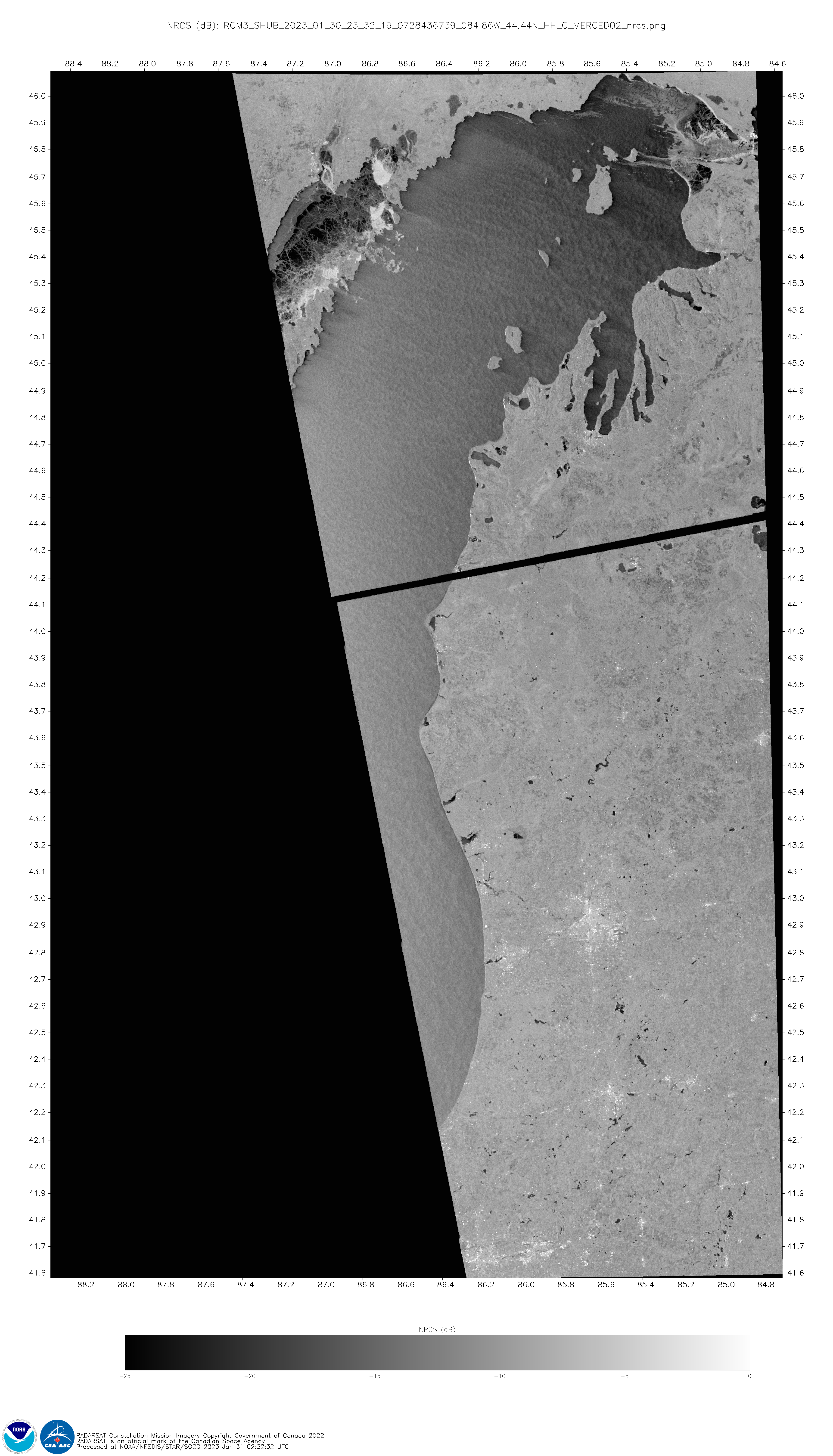
RCM3_SHUB_2023_01_30_23_32_19_0728436739_084.86W_44.44N_HH_C_MERGED02_nrcs.png
2023-01-31 19:04
6.2M
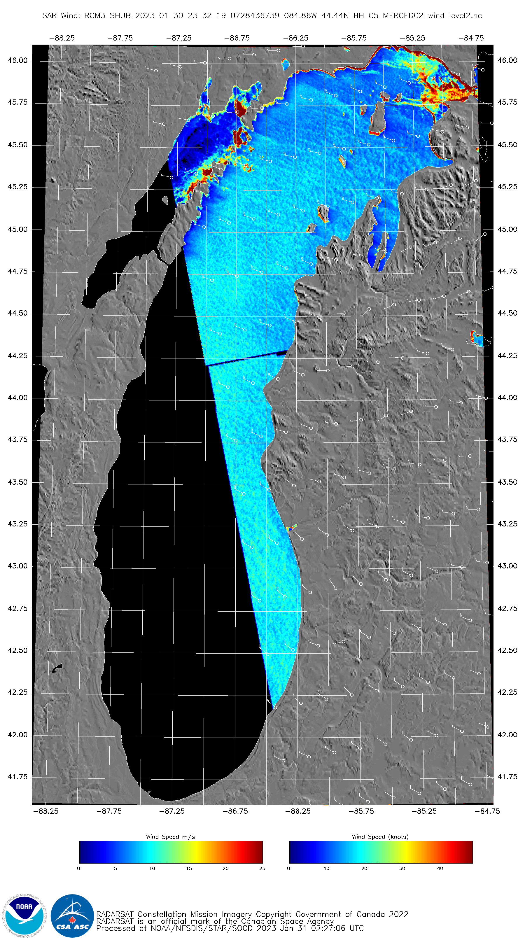
RCM3_SHUB_2023_01_30_23_32_19_0728436739_084.86W_44.44N_HH_C5_MERGED02_wind.png
2023-01-31 19:04
1.0M
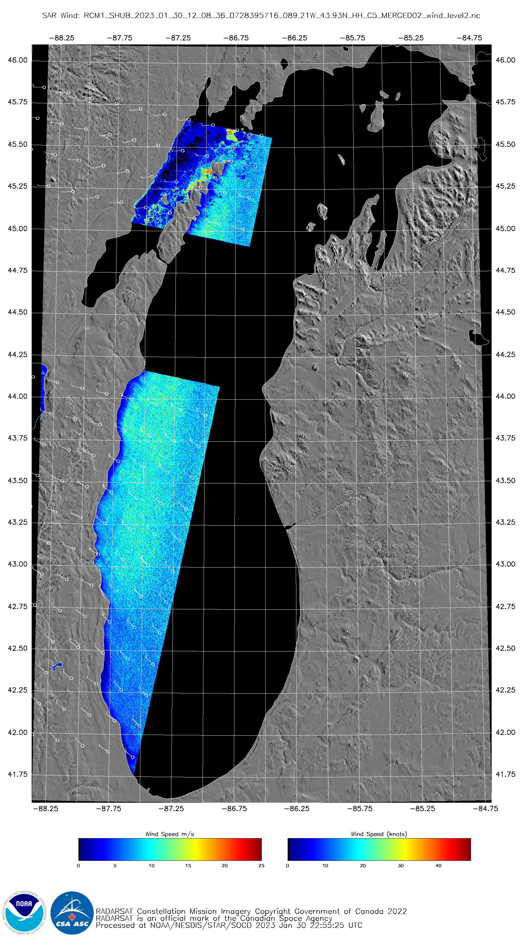
RCM1_SHUB_2023_01_30_12_08_36_0728395716_089.21W_43.93N_HH_C5_MERGED02_wind.png
2023-01-31 19:04
1.2M
GOES-16_ABI_RadF_true_color_2023004_170020Z_1800x1800.jpg
2023-01-04 19:30
1.2M
GOES-16_ABI_RadF_cimss_true_color_2023004_170020Z_1800x1800.jpg
2023-01-04 19:30
1.0M
GOES-15_NAV_loop_GOES-15_2017254_180000_2017254_214500_5s.mp4
2023-01-20 18:58
1.0M
G16_VIS_LA_MS_AL_SVR_12JAN2023_B2_2023012_184325_GOES-16_0001PANEL_FRAME00333.GIF
2023-01-13 17:36
603K
G16_VIS_LA_MS_AL_SVR_12JAN2023_B2_2023012_181825_GOES-16_0001PANEL_FRAME00308.GIF
2023-01-13 17:27
627K
G16_VIS_LA_MS_AL_SVR_12JAN2023_B2_2023012_131325_GOES-16_0001PANEL_FRAME00003.GIF
2023-01-12 21:07
462K
G16_VIS_LA_MS_AL_SVR_03JAN2023_B2_2023003_192955_GOES-16_0001PANEL_FRAME00720.GIF
2023-01-04 03:39
468K
G16_VIS_LA_MS_AL_SVR_03JAN2023_B2_2023003_192925_GOES-16_0001PANEL_FRAME00719.GIF
2023-01-04 03:39
464K
G16_VIS_IR_TX_LA_SPC_24JAN2022_B213_2023024_201955_0002PANELS_FRAME00050.GIF
2023-01-25 03:09
246K
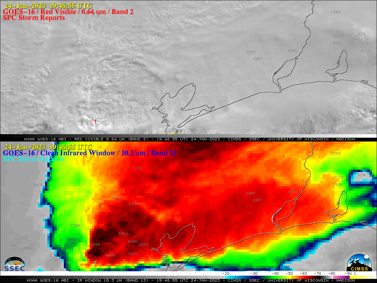
G16_VIS_IR_TX_LA_SPC_24JAN2022_B213_2023024_194855_0002PANELS_FRAME00019.GIF
2023-01-25 02:42
230K
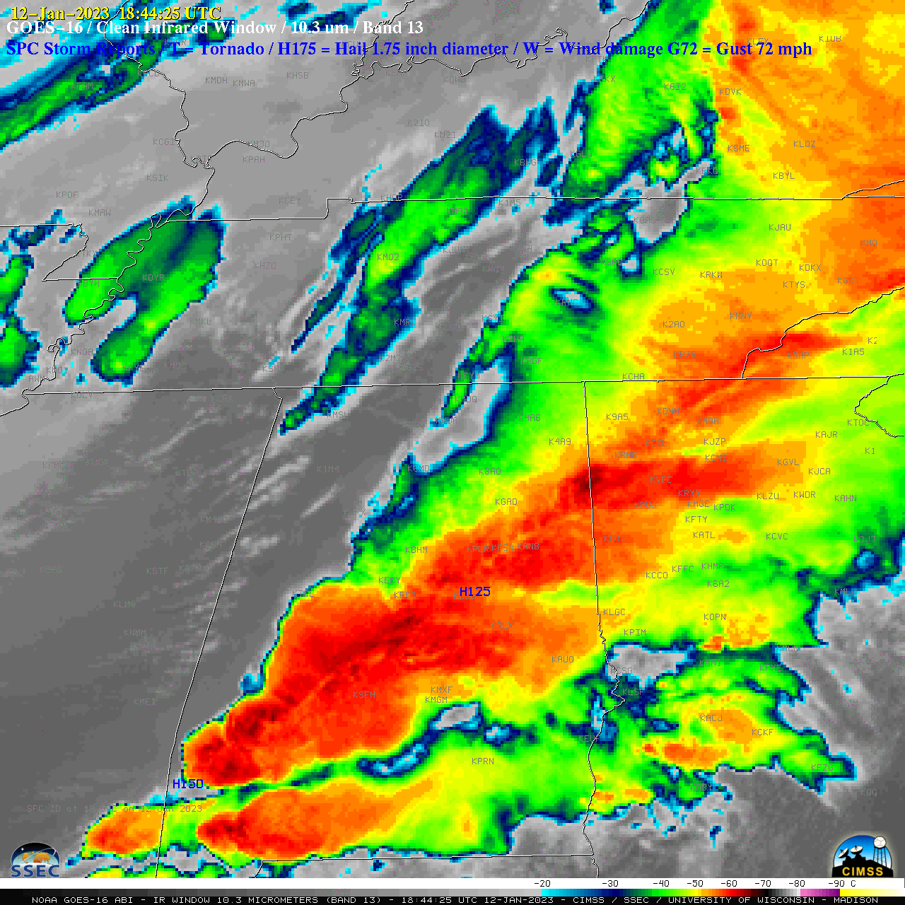
G16_IR_LA_MS_AL_SVR_12JAN2023_B13_2023012_184425_GOES-16_0001PANEL_FRAME00334.GIF
2023-01-12 23:15
373K
G16_IR_LA_MS_AL_SVR_12JAN2023_B13_2023012_184325_GOES-16_0001PANEL_FRAME00389.GIF
2023-01-13 17:39
374K
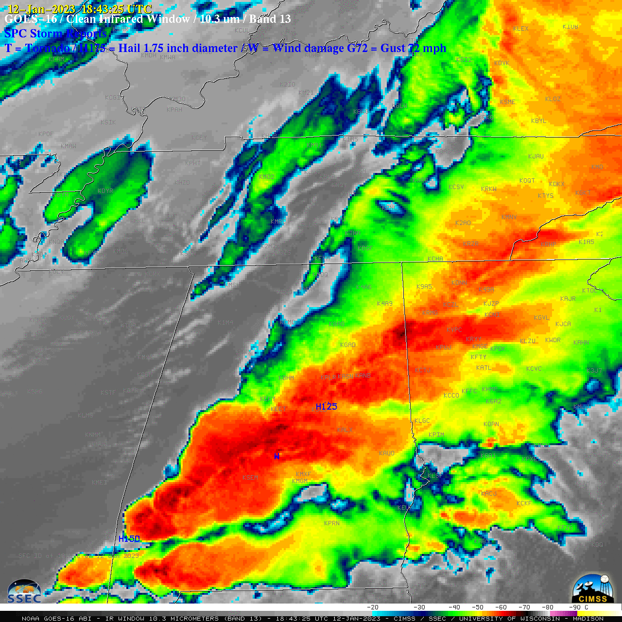
G16_IR_LA_MS_AL_SVR_12JAN2023_B13_2023012_181825_GOES-16_0001PANEL_FRAME00364.GIF
2023-01-14 22:09
375K
G16_IR_LA_MS_AL_SVR_12JAN2023_B13_2023012_181825_GOES-16_0001PANEL_FRAME00308.GIF
2023-01-12 21:02
376K
G16_IR_LA_MS_AL_SVR_12JAN2023_B13_2023012_131325_GOES-16_0001PANEL_FRAME00003.GIF
2023-01-12 20:06
389K
G16_IR_LA_MS_AL_SVR_03JAN2022_B13_2023003_192955_GOES-16_0001PANEL_FRAME00930.GIF
2023-01-04 03:40
279K
G16_IR_LA_MS_AL_SVR_03JAN2022_B13_2023003_192925_GOES-16_0001PANEL_FRAME00929.GIF
2023-01-04 03:40
281K
G16B13_LI_0to12_Obs-20230119_1706_to_0120_0001anim.mp4
2023-01-20 20:11
13M
FD_GOES-13_VIS_ONLY_MED_BIG_NOMAP_20-May-2011_1745_UTC.JPG
2023-01-06 16:21
1.8M
FD_GOES-13_SANDWICH_MED_BIG_NOMAP_20-May-2011_1745_UTC.JPG
2023-01-06 16:19
4.9M
FD_GOES-8_SANDWICH_MED_SML_NOMAP_05-Apr-1995_1745_UTC_1024x1024.JPG
2023-02-12 21:03
721K
FD_GOES-8_SANDWICH_MED_BIG_NOMAP_05-Apr-1995_1745_UTC.JPG
2023-02-12 21:03
4.9M
FD_GOES-7_SANDWICH_MED_SML_NOMAP_25-Sep-1989_1801_UTC_1024x1024.JPG
2023-02-12 21:02
708K
FD_GOES-7_SANDWICH_MED_BIG_NOMAP_25-Sep-1989_1801_UTC.JPG
2023-02-12 21:02
4.7M
Bachmeier_timesheet_Mar_Apr_2024.pdf
2024-04-24 22:43
34K
Bachmeier_timesheet_Jan_Feb_2024.pdf
2024-02-28 16:00
34K
Bachmeier_timesheet_Jan2024.pdf
2024-02-07 17:14
28K
Bachmeier_timesheet_Feb_Mar_2024.pdf
2024-04-01 15:12
35K
Bachmeier_timesheet_Apr_May_2024.pdf
2024-05-27 01:19
32K
240116_MMVR_SFCMG.GIF
2024-01-19 02:59
16K
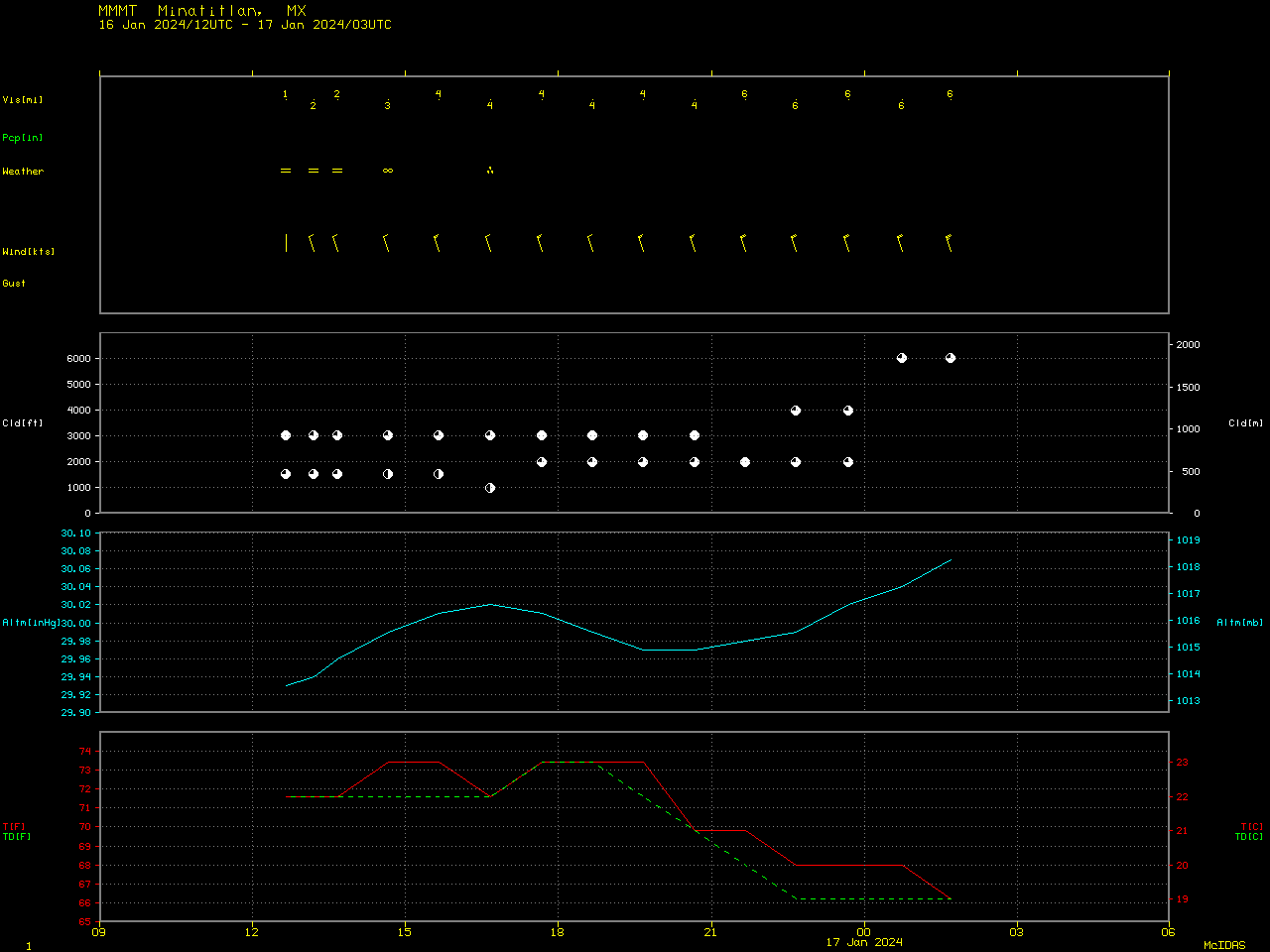
240116_MMMT_SFCMG.GIF
2024-01-19 02:59
16K
230131_noaa20_suomiNPP_viirs_falseColorRGB_Green_Bay_ice_anim.gif
2023-02-02 03:09
2.1M
230131_goes16_visible_Green_Bay_ice_floes_anim.mp4
2023-02-02 03:09
3.6M
230131_goes16_visible_Green_Bay_ice_floes_anim.gif
2023-02-02 03:09
36M
230131_goes16_visible_Green_Bay_ice_anim.mp4
2023-02-02 03:09
968K
230131_goes16_visible_Green_Bay_ice_anim.gif
2023-02-02 03:09
2.1M
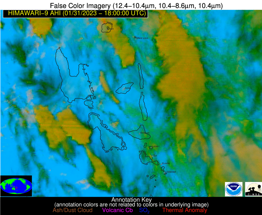
230131_230201_himawari8_falseColorRGB_Epi_so2_plume_anim.mp4
2023-02-02 03:20
2.8M
230131_230201_himawari8_falseColorRGB_Epi_so2_plume_anim.gif
2023-02-02 03:20
24M
230131_1910z_rgb.png
2023-02-02 03:40
1.1M
230130_noaa20_suomiNPP_viirs_trueColorRGB_falseColorRGB_Green_Bay_ice_floes_anim.gif
2023-01-31 16:52
4.0M
230130_goes16_visible_Green_Bay_ice_floes_anim.mp4
2023-01-31 16:52
3.4M
230130_goes16_visible_Green_Bay_ice_floes_anim.gif
2023-01-31 16:52
35M
230130_0836utc_2332utc_rcm_sar_Lake_Michigan_anim.gif
2023-01-31 19:12
2.2M
230129_goes18_visible_totalPrecipitableWater_HI_anim.mp4
2023-02-01 20:59
15M
230129_goes18_infrared_glmFlashExtentDensity_HI_anim.mp4
2023-02-01 02:46
130M
230129_goes18_infrared_glmFlashExtentDensity_HI_anim.gif
2023-01-31 03:45
859M
230129_goes18_infrared_HI_anim.mp4
2023-02-01 21:35
133M
230129_00z_sfc_epac.gif
2023-01-30 03:31
90K
230128_goes18_visible_totalPrecipitableWater_HI_anim.mp4
2023-01-30 04:52
25M
230128_goes18_infrared_glmFlashExtentDensity_HI_anim.mp4
2023-01-30 04:52
85M
230128_goes18_infrared__HI_anim.mp4
2023-01-30 04:52
86M
230128_East_Pacific_surface_analyses_anim.gif
2023-01-30 03:35
610K
230128_18z_sfc_epac.gif
2023-01-30 03:31
88K
230128_12z_sfc_epac.gif
2023-01-30 03:31
87K
230128_06z_sfc_epac.gif
2023-01-30 03:31
88K
230128_00z_sfc_epac.gif
2023-01-30 03:31
91K
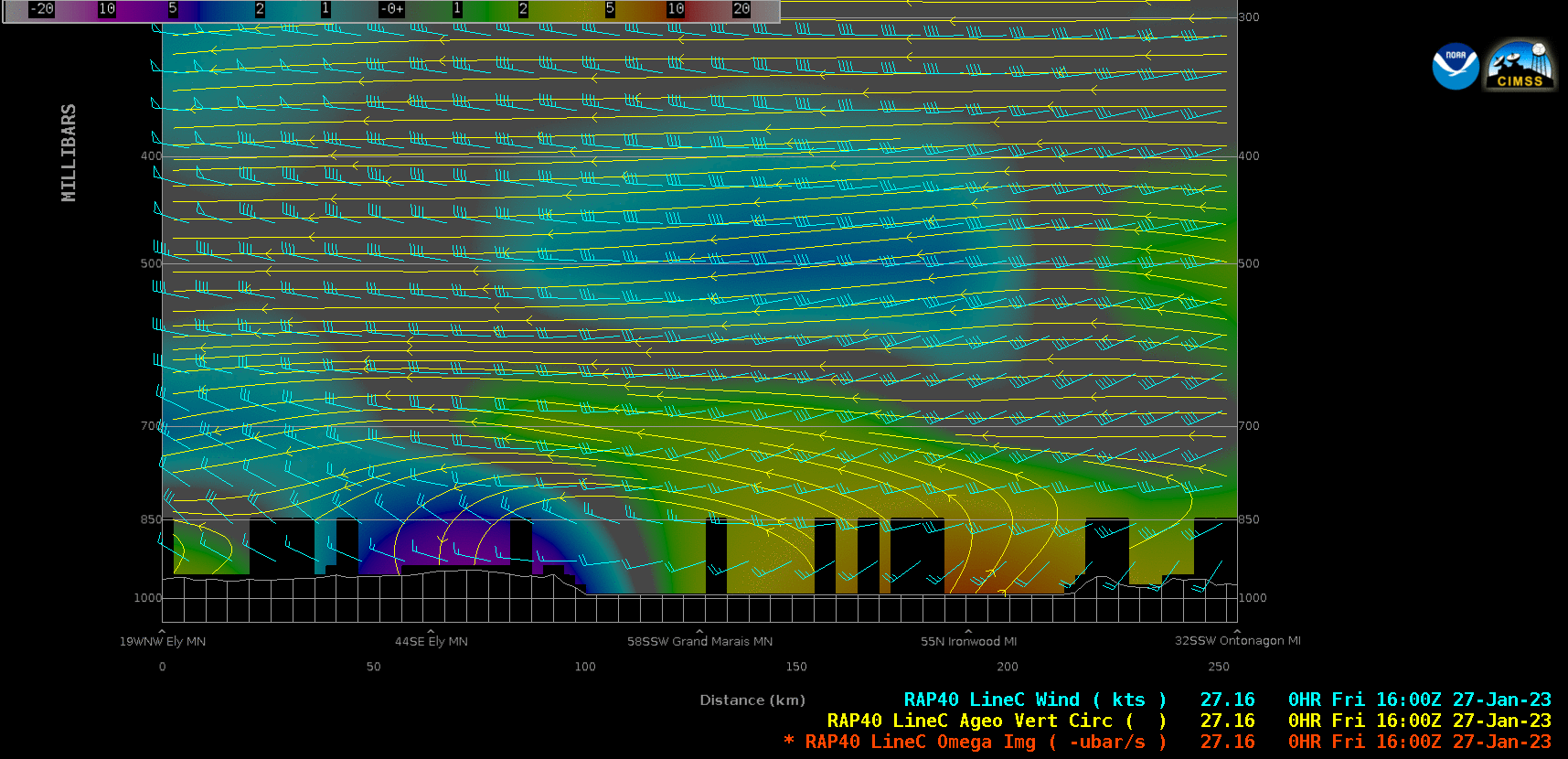
230127_rap40_LinceC_cross_sections_Lake_Superior_anim.mp4
2023-01-28 19:41
1.2M
230127_rap40_LinceC_cross_sections_Lake_Superior_anim.gif
2023-01-28 19:41
1.5M
230127_goes16_visible_waterVapor_Lake_Superior_orographic_waves_anim.mp4
2023-01-28 19:41
9.6M
230127_goes16_visible_waterVapor_Lake_Superior_orographic_waves_anim.gif
2023-01-28 19:41
98M
230127_230129_mimicTPW_East_Pacific_anim.gif
2023-01-31 03:16
18M
230127_230128_mimicTPW_East_Pacific_anim.mp4
2023-01-30 16:25
1.7M
230127_230128_mimicTPW_East_Pacific_anim.gif
2023-01-30 16:25
13M
230126_khgx_pns.text
2023-01-26 17:54
2.8K
230126_goes18_goes16_trueColorRGB_Gulf_of_Tehuantepec_anim.mp4
2023-01-27 00:24
898K
230125_khgx_rainfall_pns.text
2023-01-25 18:05
23K
230125_230126_goes18_goes16_trueColorRGB_Gulf_of_Tehuantepec_anim.mp4
2023-01-27 00:24
3.6M
230125_1200utc_24hour_precipitation_TX_LA.png
2023-01-25 17:59
595K
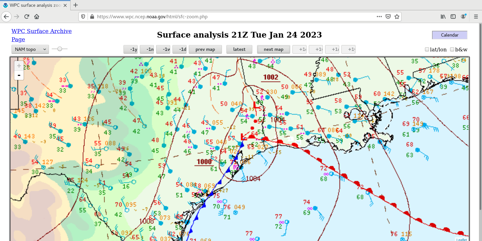
230125_00z_sfc.png
2023-01-25 04:23
610K
230124_surface_analyses_anim.gif
2023-01-25 04:26
1.2M
230124_goes16_visible_infrared_spcStormReports_TX_LA_anim.mp4
2023-01-25 03:20
19M
230124_goes16_visible_infrared_spcStormReports_TX_LA_anim.gif
2023-01-25 03:20
60M
230124_goes16_visible_infrared_glmFlashExtentDensity_TX_LA_small_anim.mp4
2023-01-26 02:09
13M
230124_goes16_visible_infrared_glmFlashExtentDensity_TX_LA_anim.mp4
2023-01-26 00:17
44M
230124_goes16_visible_infrared_glmFlashExtentDensity_TX_LA_anim.gif
2023-01-26 00:17
262M
230124_2124utc_goes16_infrared_cloudTopTemperature_cloudTopHeight_TX_anim.gif
2023-01-27 03:47
1.3M
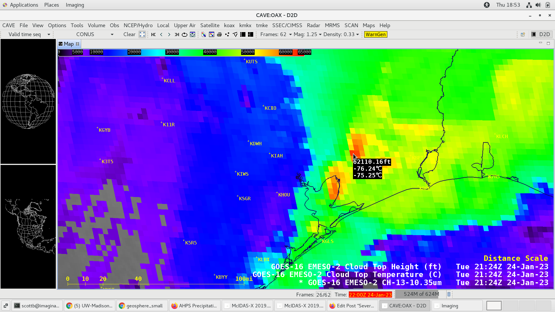
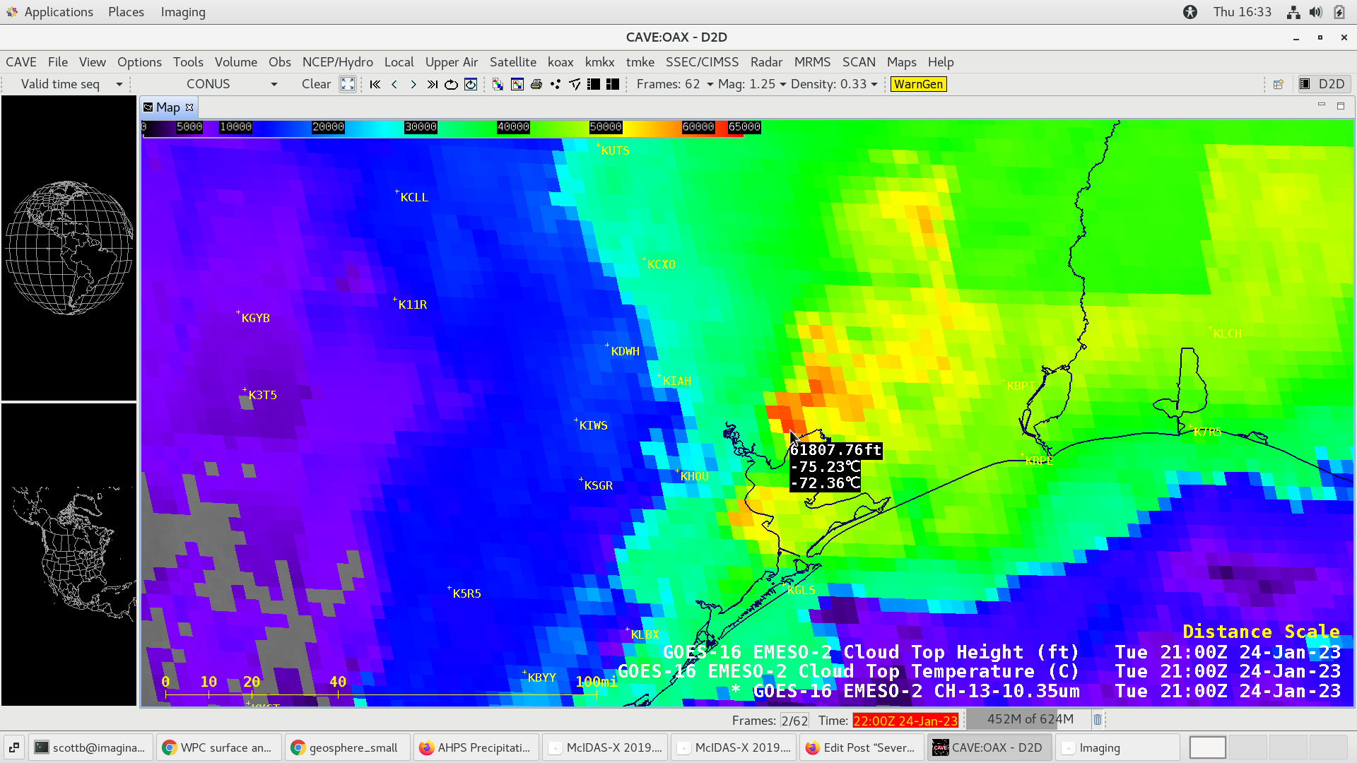
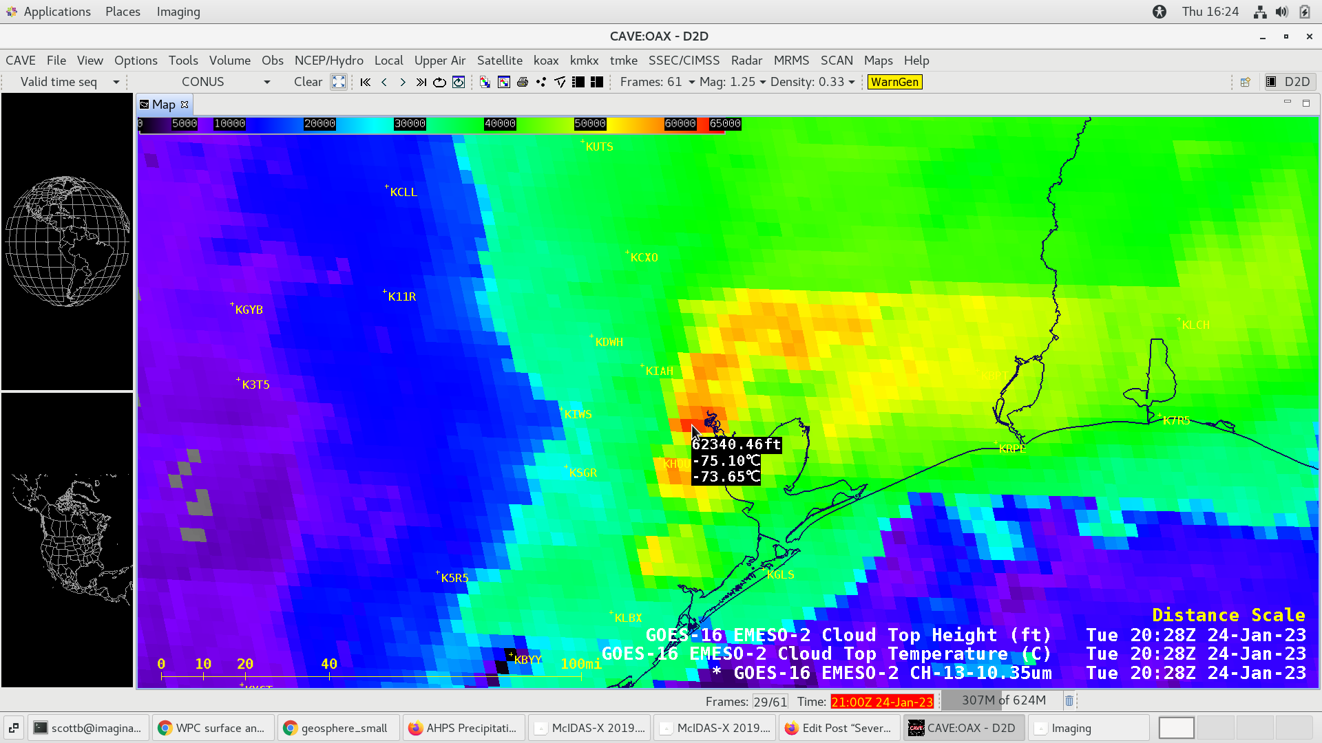
230124_2124utc_goes16_infrared_cloudTopTemperature_cloudTopHeight_TX.png
2023-01-27 03:47
222K
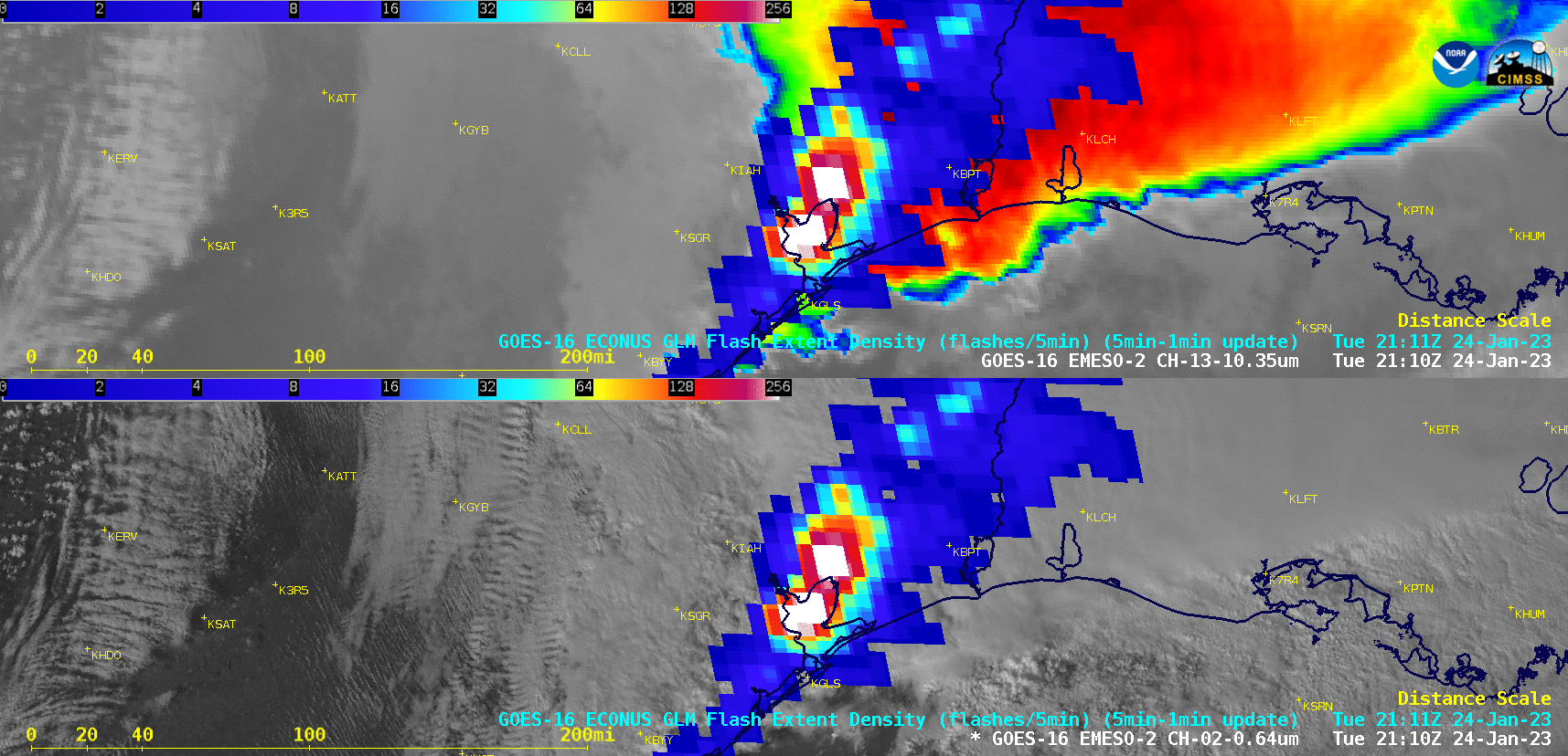
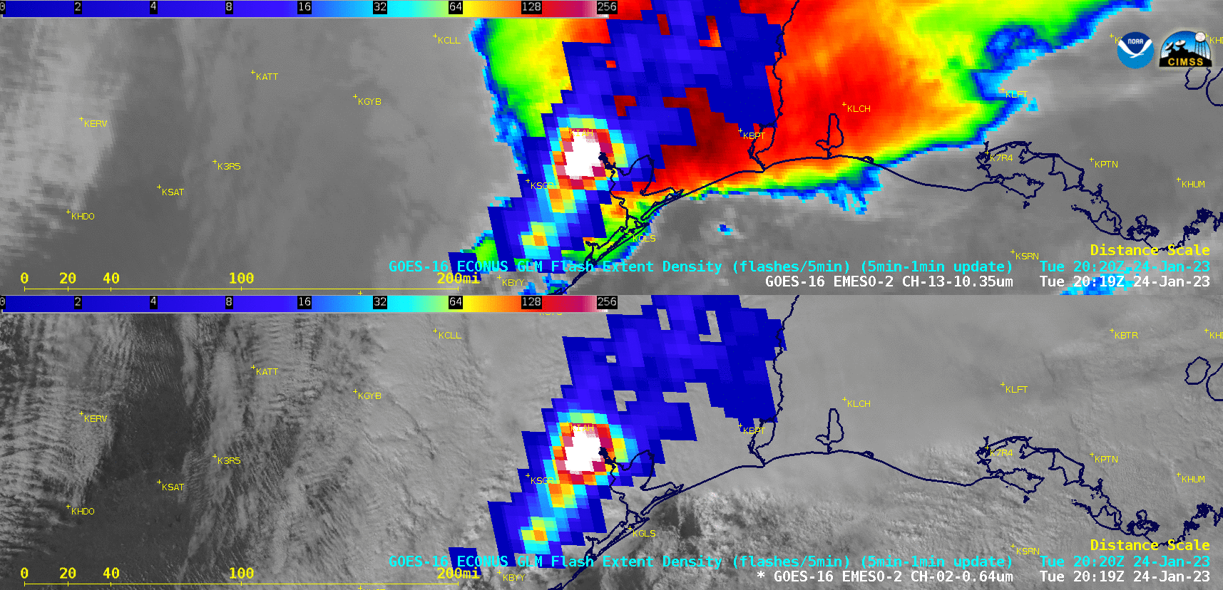
230124_2110utc_goes16_visible_infrared_glmFlashExtentDensity_445_TX_LA_anim.gif
2023-01-26 00:16
1.0M
230124_2100utc_goes16_infrared_cloudTopTemperature_cloudTopHeight_TX.png
2023-01-27 03:47
221K
230124_2028utc_goes16_infrared_cloudTopTemperature_cloudTopHeight_TX.png
2023-01-27 03:47
217K
230124_2019utc_goes16_visible_infrared_glmFlashExtentDensity_414_TX_LA_anim.gif
2023-01-26 00:16
969K
230124_21z_sfc.png
2023-01-25 04:23
623K
230124_18z_sfc.png
2023-01-25 04:23
630K
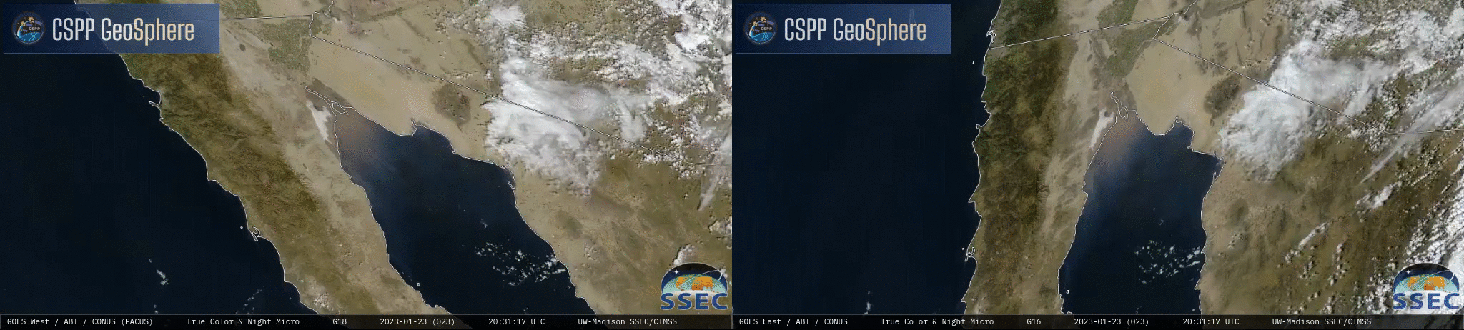
230123_goes18_goes16_trueColorRGB_Gulf_of_California_v2_anim.mp4
2023-01-24 19:54
628K
230123_goes18_goes16_trueColorRGB_Gulf_of_California_anim.mp4
2023-01-24 18:30
3.5M
230123_goes18_goes16_trueColorRGB_Gulf_of_California_anim.GIF
2023-01-24 18:30
34M
230122_goes16_nearInfraredSnowIce_WI_anim.mp4
2023-01-23 02:45
5.4M
230122_goes16_nearInfraredSnowIce_WI_anim.gif
2023-01-23 02:45
40M
230122_goes16_daySnowFogRGB_WI_anim.mp4
2023-01-23 02:45
5.8M
230122_goes16_daySnowFogRGB_WI_anim.gif
2023-01-23 02:45
105M
230122_KPCZ_SFCMG.GIF
2023-01-23 22:19
17K
230122_1631utc_nearInfraredSnowIce_cloudTopPhase_WI_anim.gif
2023-01-23 22:25
366K
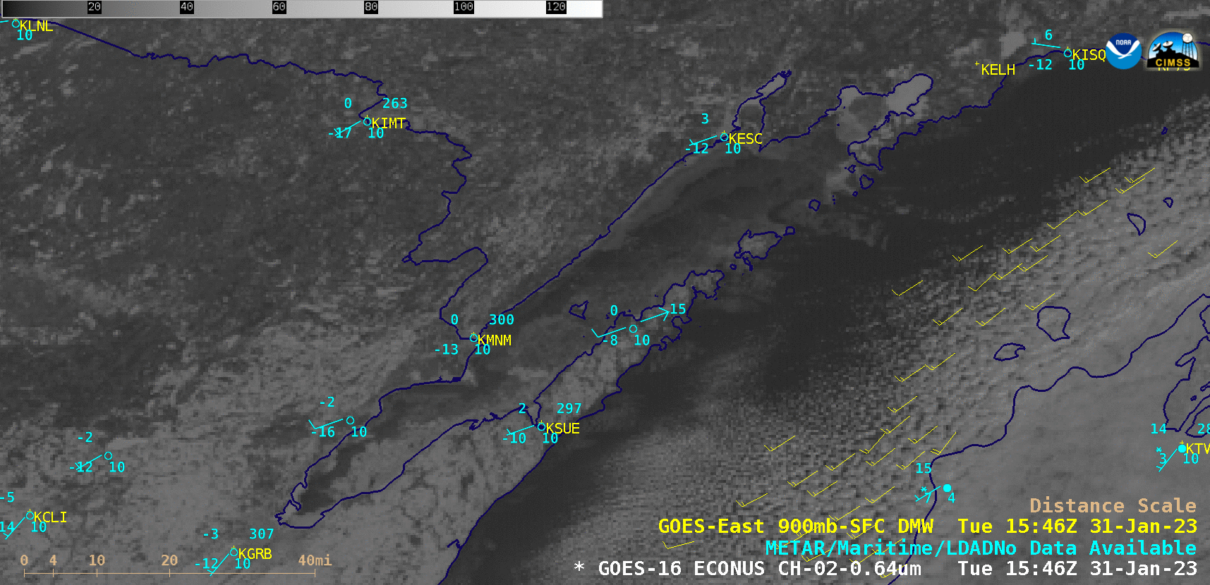
230120_goes16_waterVapor_pilotReports_MidAtlantic_mountain_waves_anim.mp4
2023-01-21 04:36
13M
230120_goes16_waterVapor_pilotReports_MidAtlantic_mountain_waves_anim.gif
2023-01-21 04:36
507M
230120_goes16_visible_pilotReports_MidAtlantic_mountain_waves_anim.mp4
2023-01-21 04:36
28M
230120_goes16_visible_pilotReports_MidAtlantic_mountain_waves_anim.gif
2023-01-21 04:36
483M
230120_1200utc_kiad_wv_wf.png
2023-01-23 16:58
610K
230120_1200Z_KIAD_RAOB.GIF
2023-01-23 17:19
42K
230117_goes16_infrared_Invest90L_anim.mp4
2023-01-19 03:36
28M
230117_goes16_infrared_Invest90L_anim.gif
2023-01-19 03:36
260M
230116_goes16_visible_infrared_glmFlashExtentDensity_Invest90L_v2_anim.mp4
2023-01-20 16:33
29M
230116_goes16_visible_infrared_glmFlashExtentDensity_Invest90L_v2_anim.gif
2023-01-20 16:33
237M
230116_goes16_visible_infrared_glmFlashExtentDensity_Invest90L_anim.mp4
2023-01-22 00:24
44M
230116_goes16_visible_infrared_glmFlashExtentDensity_Invest90L_anim.gif
2023-01-22 00:24
354M
230115_goes16_visible_infrared_US_East_Coast_warm_seclusion_small_anim.mp4
2023-01-16 03:32
16M
230115_goes16_visible_infrared_US_East_Coast_warm_seclusion_anim.mp4
2023-01-16 02:56
49M
230115_goes16_visible_infrared_US_East_Coast_warm_seclusion_anim.gif
2023-01-16 03:32
586M
230115_0717utc_suomiNPP_viirs_infrared_dayNightBand_seaSurfaceTemperature_East_Coast_warm_seclusion_anim.gif
2023-01-16 18:40
1.5M
230113_kbmx_pns.text
2023-01-17 21:29
24K
230112_goes16_visible_spcStormReports_MS_AL_GA_TN_KY_small_anim.mp4
2023-01-13 17:26
13M
230112_goes16_visible_spcStormReports_MS_AL_GA_TN_KY_anim.mp4
2023-01-13 17:26
84M
230112_goes16_visible_spcStormReports_MS_AL_GA_TN_KY_anim.gif
2023-01-13 17:26
331M
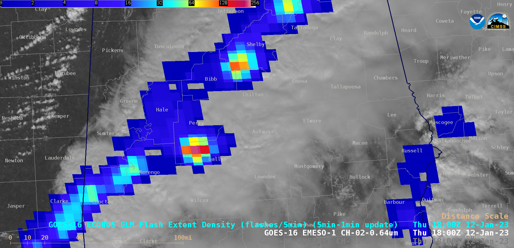
230112_goes16_visible_glmFlashExtentDensity_Autauga_to_Chambers_County_AL_long_track_tornado_anim.mp4
2023-01-19 20:08
8.1M
230112_goes16_visible_glmFlashExtentDensity_Autauga_to_Chambers_County_AL_long_track_tornado_anim.gif
2023-01-19 20:08
54M
230112_goes16_visible_glmFlashExtentDensity_AL_long_track_tornado_anim.mp4
2023-01-19 19:36
7.5M
230112_goes16_visible_glmFlashExtentDensity_AL_long_track_tornado_anim.gif
2023-01-19 19:36
48M
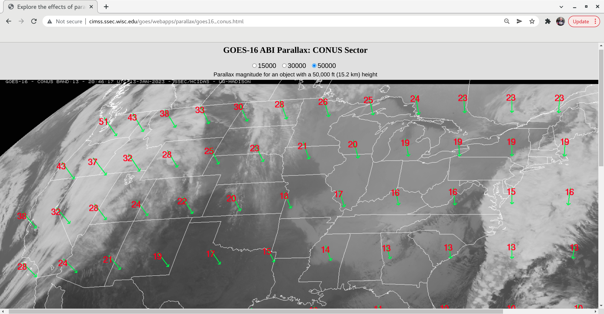
230112_goes16_parallax_50ft.png
2023-01-13 22:08
1.1M
230112_goes16_infrared_spcStormReports_MS_AL_GA_TN_KY_small_anim.mp4
2023-01-14 22:09
15M
230112_goes16_infrared_spcStormReports_MS_AL_GA_TN_KY_anim.mp4
2023-01-14 22:09
74M
230112_goes16_infrared_spcStormReports_MS_AL_GA_TN_KY_anim.gif
2023-01-14 22:09
245M
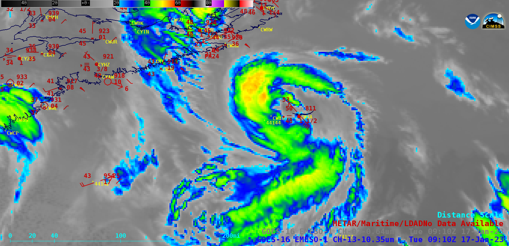
230112_1943utc_goes16_ir_ctt_compare_2.png
2023-01-13 22:08
341K
230112_1931utc_goes16_infrared_visible_glmFlashExtentDensity_AL_anim.gif
2023-01-19 20:08
1.3M
230112_1846z_ps.png
2023-01-15 03:58
1.2M
230112_1844utc_noaa20_infraredWindow_nearInfraredSnowIce_AL_zoom_anim.mp4
2023-01-13 03:34
1.4M
230112_1844utc_noaa20_infraredWindow_nearInfraredSnowIce_AL_zoom_anim.gif
2023-01-13 03:34
1.1M
230112_1844utc_noaa20_infraredWindow_nearInfraredSnowIce_AL_anim.mp4
2023-01-13 00:04
2.1M
230112_1844utc_noaa20_infraredWindow_nearInfraredSnowIce_AL_anim.gif
2023-01-13 00:04
2.2M
230112_1843utc_noaa20_infraredWindow_nearInfraredSnowIce_AL_zoom_anim.mp4
2023-01-13 17:50
1.4M
230112_1843utc_noaa20_infraredWindow_nearInfraredSnowIce_AL_zoom_anim.gif
2023-01-13 17:50
1.1M
230112_1843utc_noaa20_goes16_infrared_Autauga_County_AL_anim.gif
2023-01-13 22:01
636K
230112_1843utc_goes16_ir_ctt_compare_2.png
2023-01-14 03:53
882K
230112_1200utc_kbmx_raob.png
2023-01-13 22:08
82K
230111_goes18_infrared_waterVapor_visible_toalPrecipitableWater_cimss_mimicTotalPrecipitableWater_East_Pacific_small_anim.mp4
2023-01-12 14:32
12M
230111_goes18_infrared_waterVapor_visible_toalPrecipitableWater_cimss_mimicTotalPrecipitableWater_East_Pacific_anim.mp4
2023-01-12 14:32
52M
230111_goes18_infrared_waterVapor_visible_toalPrecipitableWater_cimss_mimicTotalPrecipitableWater_East_Pacific_anim.gif
2023-01-12 14:32
275M
230110_goes18_waterVapor_infrared_HI_anim.mp4
2023-01-11 03:50
5.1M
230110_goes18_waterVapor_infrared_HI_anim.gif
2023-01-11 03:50
87M
230110_goes16_visible_MSN_fog_frozen_lakes_anim.mp4
2023-01-10 16:16
2.8M
230110_goes16_visible_MSN_fog_frozen_lakes_anim.gif
2023-01-10 16:16
36M
230110_1200utc_phto_waterVapor_weightingFunctions.png
2023-01-11 03:50
391K
230109_goes18_waterVapor_infrared_HI_anim.mp4
2023-01-10 04:10
7.0M
230109_goes18_waterVapor_infrared_HI_anim.gif
2023-01-10 04:10
101M
230109_goes16_waterVapor_infrared_visible_pireps_CO_anim.mp4
2023-01-09 18:03
11M
230109_goes16_waterVapor_infrared_visible_pireps_CO_anim.gif
2023-01-09 18:03
61M
230109_1738utc_landsat8_falseColorRGB_Denver_anim.gif
2023-01-09 23:13
2.3M
230106_surface_analyses_Northern_Plains_anim.gif
2023-01-08 03:24
3.1M
230106_rtp.text
2023-01-08 03:49
9.6K
230106_goes18_airMassRGB_East_Pacific_low_anim.mp4
2023-01-06 20:55
14M
230106_goes18_airMassRGB_East_Pacific_low_anim.gif
2023-01-06 20:55
94M
230106_goes16_visible_dayCloudPhaseDistinctionRGB_daySnowFogRGB_ceilingVisibility_MT_ND_MN_SD_fog_stratus_small_anim.mp4
2023-01-07 01:50
15M
230106_goes16_visible_dayCloudPhaseDistinctionRGB_daySnowFogRGB_ceilingVisibility_MT_ND_MN_SD_fog_stratus_anim.mp4
2023-01-07 01:09
23M
230106_goes16_visible_dayCloudPhaseDistinctionRGB_daySnowFogRGB_ceilingVisibility_MT_ND_MN_SD_fog_stratus_anim.gif
2023-01-07 01:50
332M
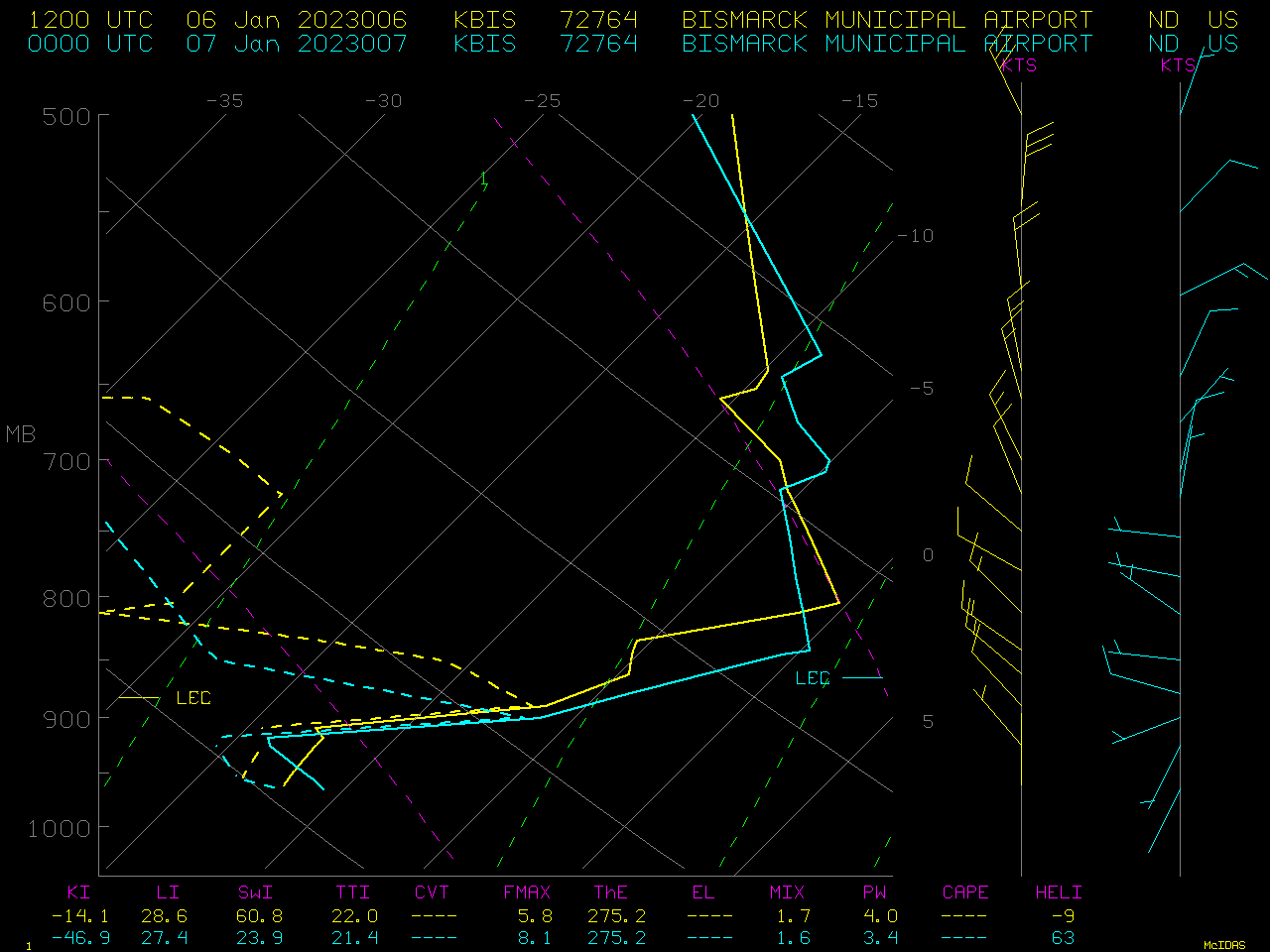
230106_KBIS_RAOBS.GIF
2023-01-08 22:32
32K
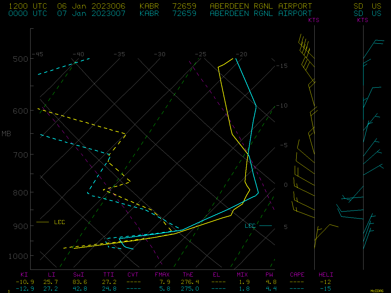
230106_KBIS_KABR_RAOB_DATA.TEXT
2023-01-08 22:36
36K
230106_KABR_RAOBS.GIF
2023-01-08 22:32
32K
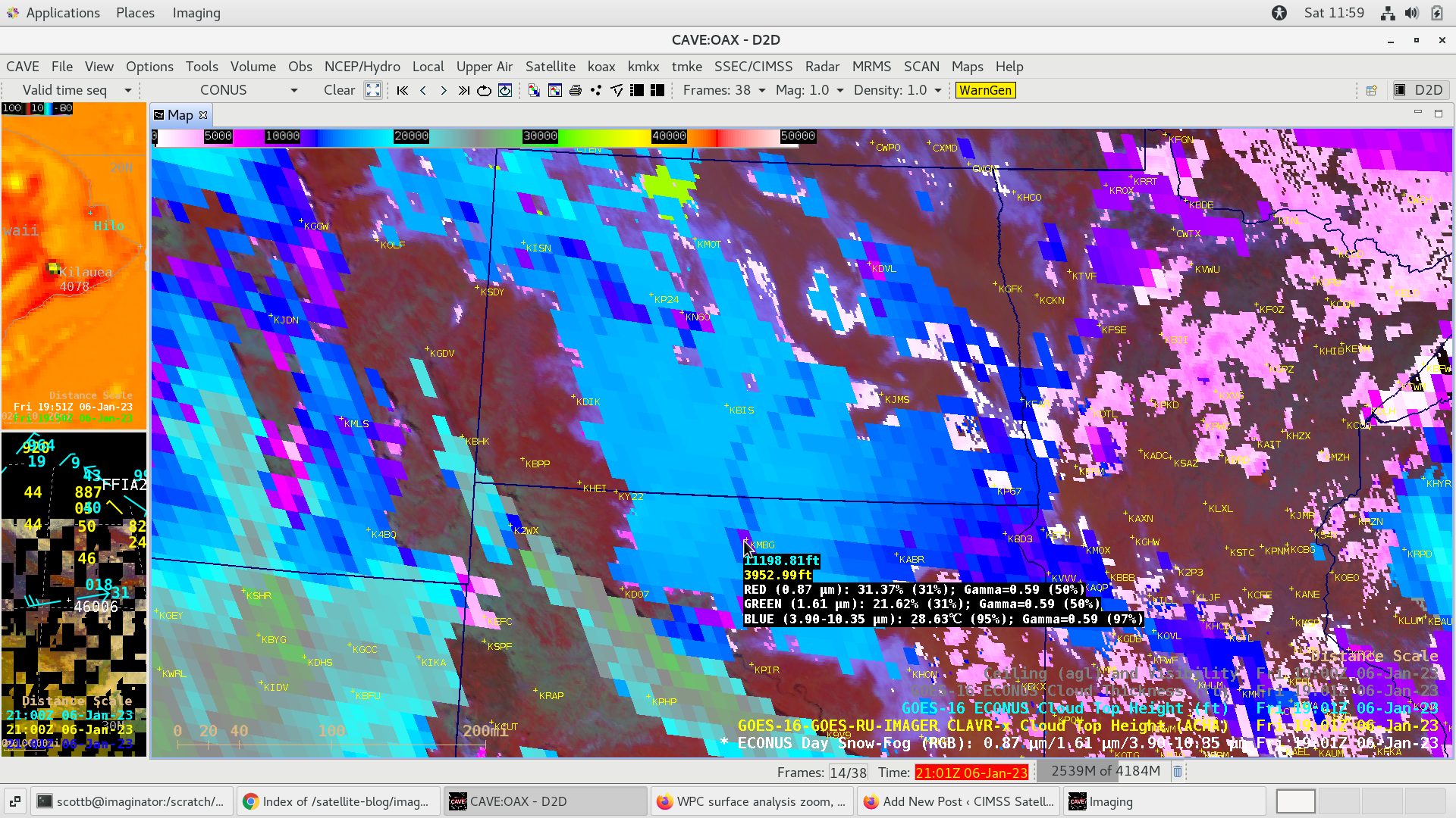
230106_1901utc_rgb_clavrxCTH_operCTH_kmbg.png
2023-01-09 02:58
1.1M
230106_1901utc_rgb_clavrxCTH_operCTH_kdvl.png
2023-01-09 02:58
1.1M
230106_1901utc_rgb_clavrxCTH_operCTH_kbis.png
2023-01-09 02:58
1.2M
230106_1901utc_rgb_clavrxCTH_operCTH_kabr.png
2023-01-09 02:58
1.2M
230106_1901utc_rgb_clavrxCTH_operCTH_flsCLDTHK_kbis.png
2023-01-09 02:58
1.2M
230106_1901utc_goes16_daySnowFogRGB_clavrx_vs_operational_CloudTopHeight_anim.gif
2023-01-09 19:28
2.7M
230105_00z_sfc_epac.png
2023-01-06 03:51
581K
230104_wpc_storm_summary.text
2023-01-06 15:36
15K
230104_goes17_goes18_nighttimeMicrophysicsRGB_trueColorRGB_anim.mp4
2023-01-04 18:46
487K
230104_goes17_goes18_nighttimeMicrophysicsRGB_trueColorRGB_anim.gif
2023-01-04 18:46
2.8M
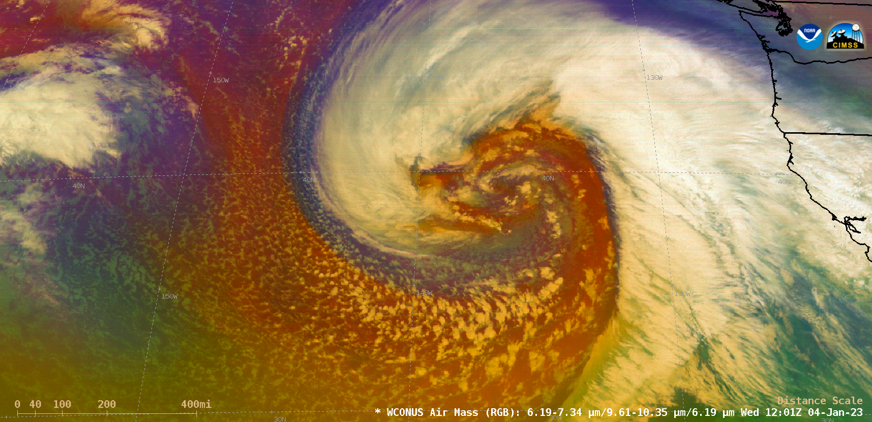
230104_goes17_airMassRGB_East_Pacific_v2_anim.mp4
2023-01-04 21:44
6.8M
230104_goes17_airMassRGB_East_Pacific_v2_anim.gif
2023-01-04 21:44
42M
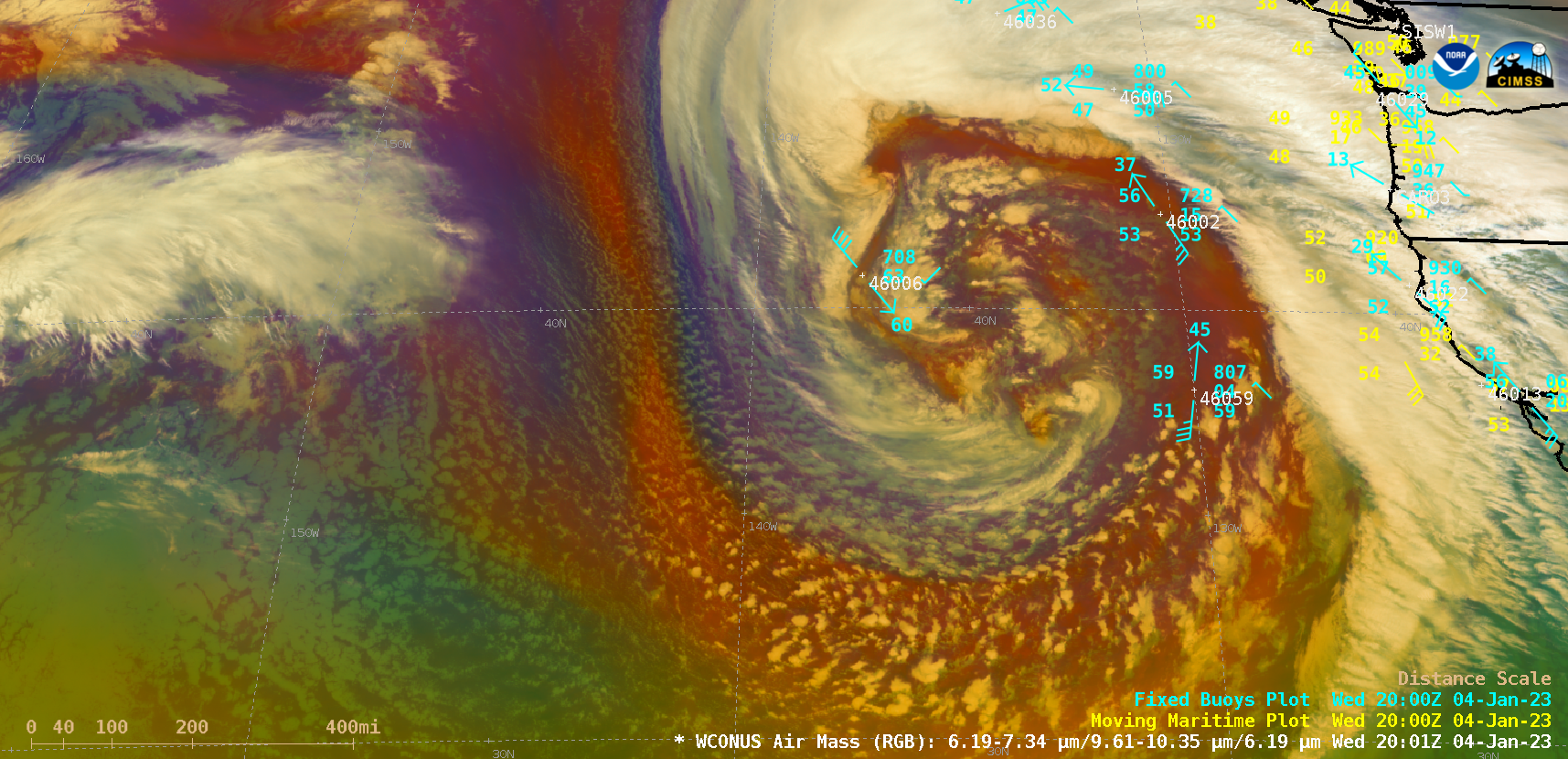
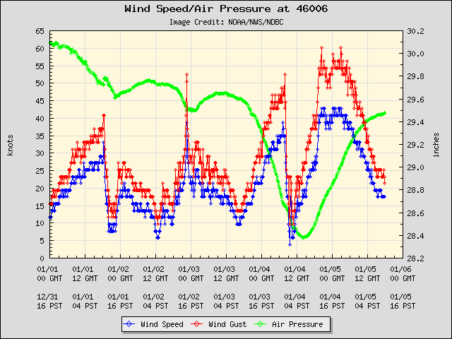
230104_buoy46006_winds_pressure.png
2023-01-06 01:20
22K
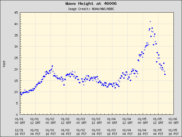
230104_buoy46006_wave_height.png
2023-01-06 01:20
9.5K
230103_surface_analyses_CONUS_anim.gif
2023-01-06 18:07
4.5M
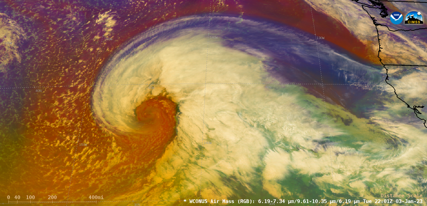
230103_goes17_airMassRGB_EastPacific_cyclone_anim.mp4
2023-01-04 04:59
16M
230103_goes17_airMassRGB_EastPacific_cyclone_anim.gif
2023-01-04 04:59
155M
230103_goes16_waterVapor_glmFlashExtentDensity_NE_IA_SD_MN_anim.mp4
2023-01-03 22:11
19M
230103_goes16_waterVapor_glmFlashExtentDensity_NE_IA_SD_MN_anim.gif
2023-01-03 22:11
86M
230103_goes16_visible_spcStormReports_Deep_South_v2_anim.mp4
2023-01-04 02:40
118M
230103_goes16_visible_spcStormReports_Deep_South_small_anim.mp4
2023-01-04 01:25
14M
230103_goes16_visible_spcStormReports_Deep_South_anim.mp4
2023-01-04 02:40
64M
230103_goes16_visible_spcStormReports_Deep_South_anim.gif
2023-01-04 02:40
485M
230103_goes16_infrared_spcStormReports_Deep_South_anim.mp4
2023-01-06 16:32
99M
230103_goes16_infrared_spcStormReports_Deep_South_anim.gif
2023-01-06 16:31
410M
230103_230105_East_Pacific_surface_analyses_anim.gif
2023-01-05 17:53
2.1M
230103_230104_goes17_goes18_airMassRGB_East_Pacific_cyclone_anim.mp4
2023-01-06 01:10
75M
230103_230104_goes17_goes18_airMassRGB_East_Pacific_cyclone_anim.gif
2023-01-06 01:10
474M
130531_g14_vis_OKC_anim.mp4
2023-01-11 19:53
8.6M
130531_g14_vis_OKC_anim.gif
2023-01-11 19:53
27M
1808x1808_FD_GOES-8_VIS_ONLY_MED_BIG_NOMAP_12-Jun-1995_1745_UTC.GIF
2023-01-03 17:07
862K