This website works best with a newer web browser such as Chrome, Firefox, Safari or Microsoft Edge. Internet Explorer is not supported by this website.

Tag: VIIRS

California’s Record Snowpack and Brimming Reservoirs

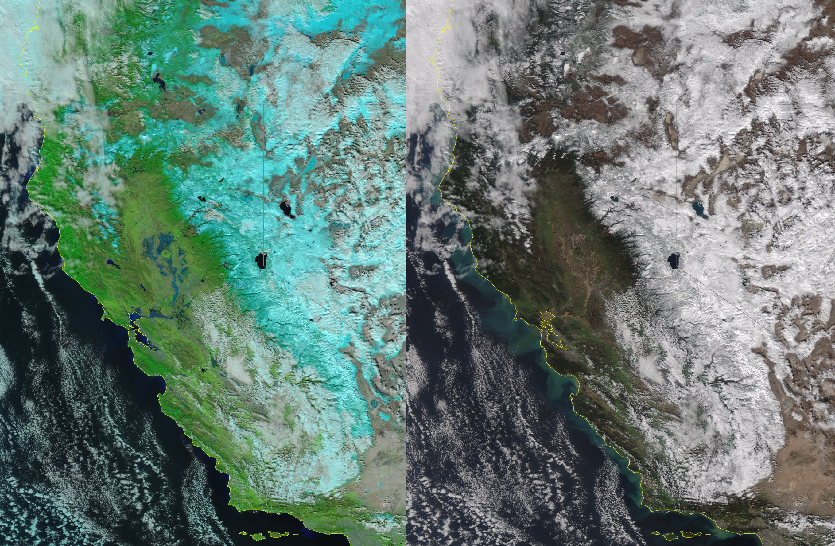
A multi-week “parade of storms” over the Pacific Ocean featuring a persistent atmospheric river pattern and numerous winter storms pounding the U.S. west coast has resulted in record snowpack in the Sierra Nevadas with water equivalency at 205% of normal for mid-January in the northern Sierras, 255% central, and... Read More

2022 Satellite Highlights via Polar-Orbiting Imagery

This post features 2022 highlights from a polar-orbiting perspective, with a focus on U.S. scenes, most acquired by the Visible Infrared Imaging Radiometer Suite (VIIRS) flying on the Suomi-NPP and NOAA-20 satellites. Also in 2022: NOAA’s Joint Polar Satellite System (JPSS) launched the JPSS-2 satellite, renamed NOAA-21. First light imagery... Read More

Labor Day Weekend Aurora Borealis via VIIRS Day Night Band

The recent 3-day weekend was a 3-night extravaganza for Aurora enthusiasts with an active Aurora Borealis lighting up the sky for 3 nights in a row.  The VIIRS (Visible Infrared Imaging Radiometer Suite) Day Night Band Sensor flying on the Suomi-NPP and NOAA-20 polar-orbiting satellites captured stunning snapshots of the... Read More