Lake-Effect Snow over North Dakota
When you hear about the lake effect, you almost always think about the Great Lakes, whose impacts on local weather and climate are well-known across the upper Midwest and into the northeast. It may, then, seem odd to consider a lake effect event in North Dakota. However, if conditions are right, smaller bodies of water can also create lake effect snow.
Lake Sakakawea is a reservoir that was formed in the 1950s when the two-mile long Garrison Dam was built across the Missouri River for flood control and hydroelectric purposes. While it’s the country’s third largest reservoir by volume, its long, narrow shape lends it the form of a very wide river more than a traditional lake.
With a polar air mass plunging southward from Canada, surface temperatures in central North Dakota were very cold on the afternoon of 1 December 2025. Even though it was daytime on the first day of December, surface temperatures were in the single digits and numerous stations had the potential to set new records for lowest daily maximum temperature. This was a sharp contrast to a little over a week earlier; on the 23rd of November, the high temperature at Garrison was 57 F.
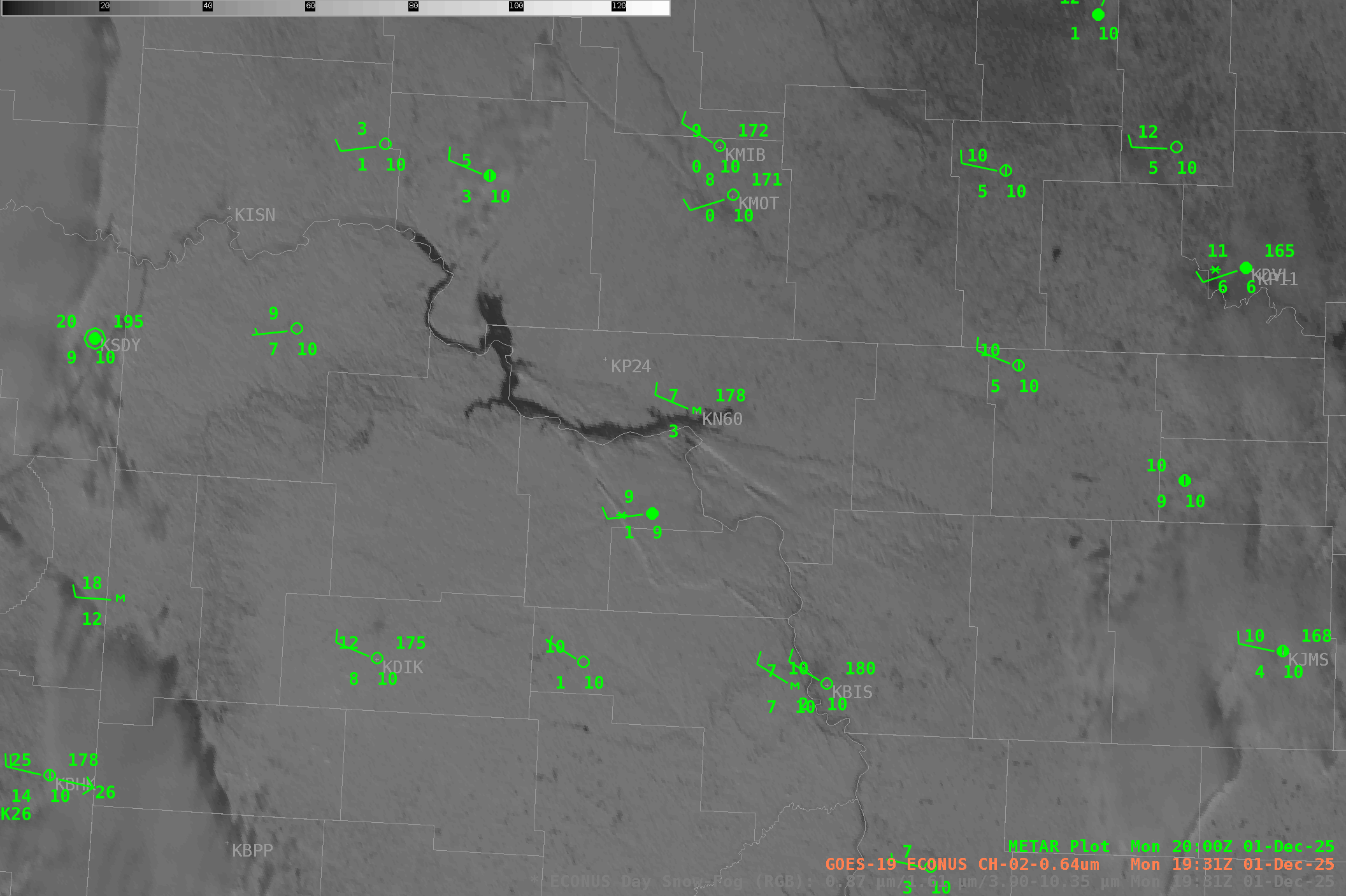
Therefore, while the land surface was very cold, the lake was still relatively warm as its large thermal mass inhibited its heat loss. This made for a perfect set up for a lake effect event as the following visible animation from GOES-19 shows. Lake Sakakawea is the dark snake-like form in the middle of the image, and clouds can be streaming to the southeast from the southern portion of the lake. Note that the winds in the region are largely westerly, ensuring enough fetch along the lake to produce the effect.
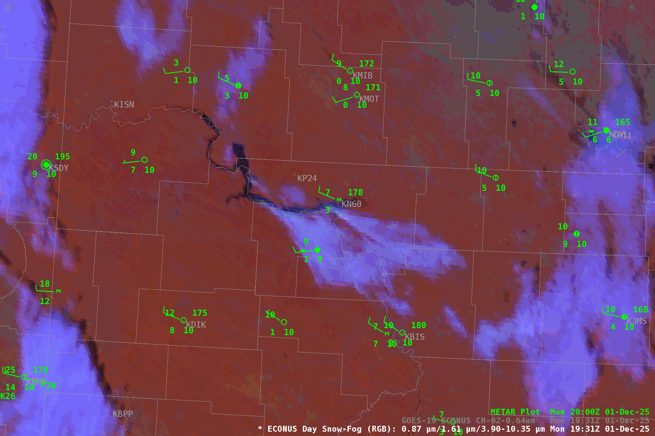
Recent snows over the region had previously blanketed the area in white, meaning there was very little visible contrast between the clouds and the snow. Since these clouds are also very shallow, they have very little thermal contrast with the surrounding land, and thus the clouds are very difficult to discern using single channel infrared imagery as well. However, certain RGB products are well-suited to discriminating between snow and cloud, as can be seen in this view of the Day Snow-Fog product. Here, the lavender of the low clouds pops against the red of the snow-covered land.
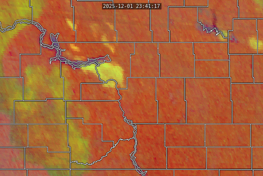
It’s important to note that, as its name suggests, this product can only be used during the day. This is because of its dependence on multiple shortwave channels. At night, the 0.87 and 1.61 micron channels have no reflectance, and the interpretation of the 3.9 micron channel changes from reflectance to emission. These animations were recorded late in the day and wold soon become unreliable for further interpretation. A better product to use after sunset is the Night Microphysics RGB seen below. In this case the land has cooled even further with sunset; the temperature at Garrison on the northeastern edge of the lake dropped to 1 F at the time of this animation. This served to deepen the lake/land temperature gradient and further enhance the lake-induced dynamics.
Throughout this blog post, this has been called a lake effect snow event. However, there is no radar evidence that any precipitation formed from this. This animation from the Bismarck NEXRAD radar covers the area were we’d expect to see snow, but there’s nothing there beyond the expected ground clutter.
However, observers are reporting snow downwind of the lake. That’s visible in the station plots depicted in the GOES-19 animations at the start of this blog post. The asterisk in the station plot for Hazel, ND, indicates that snow was being observed at the same time that one of these lake-enhanced clouds was directly overhead.

So why are weather observers reporting snow when the radar says that it is clear? The answer is simple: lake effect snow events are shallow, and these highly localized lake effect events are even shallower. The radar beam gets higher above the ground the further away you get from the radar because of the tilt of the radar beam and the curvature of the earth. It’s approximately 60 miles from the NEXRAD in Bismarck to the shores of Lake Sakakawea, which means the beam is roughly 4500 feet above the ground at that distance. These shallow clouds easily slip beneath the lowest radar beam and produce snow that is undetected by the radar.