|
Imagining features of a weather map by interpretating a single satellite image |
|
 |
|
|
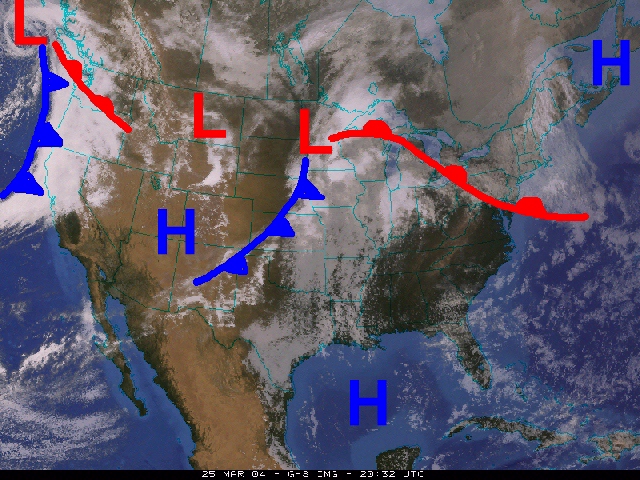
Along with showing us where the clouds are (the white and grey areas) this satellite image suggests that precipitation is occuring in the Pacific Northwest and much of the Midwest. Notice how the cold fronts, warm fronts, and areas of High and Low pressure align with the clouds on the satellite image. |
|