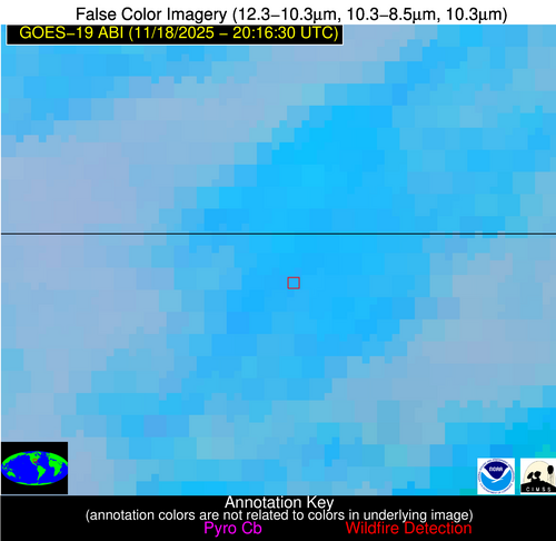
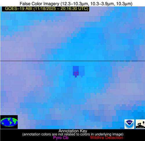
Wildfire Alert Report
| Date: | 2025-11-18 |
|---|---|
| Time: | 20:16:17 |
| Production Date and Time: | 2025-11-18 20:21:23 UTC |
| Primary Instrument: | GOES-19 ABI |
| Wmo Spacecraft Id: | 666 |
| Location/orbit: | GEO |
| L1 File: | OR_ABI-L1b-RadC-M6C14_G19_s20253222016177_e20253222018550_c20253222019040.nc |
| L1 File(s) - Temporal | OR_ABI-L1b-RadC-M6C14_G19_s20253222011177_e20253222013550_c20253222014004.nc |
| Number Of Thermal Anomaly Alerts: | 5 |
Possible Wildfire
| Basic Information | |
|---|---|
| State/Province(s) | ND |
| Country/Countries | United States |
| County/Locality(s) | Ransom County, ND |
| NWS WFO | Grand Forks ND |
| Identification Method | Enhanced Contextual (Cloud) |
| Mean Object Date/Time | 2025-11-18 20:16:20UTC |
| Radiative Center (Lat, Lon): | 46.548332°, -97.735001° |
| Nearby Counties (meeting alert criteria): |
|
| Total Radiative Power Anomaly | n/a |
| Total Radiative Power | 35.18 MW |
| Map: | |
| Additional Information | |
| Alert Status | New Feature |
| Type of Event | Nominal Risk |
| Event Priority Ranking | 4 |
| Maximum Observed BT (3.9 um) | 296.10 K |
| Observed - Background BT (3.9 um) | 10.60 K |
| BT Anomaly (3.9 um) | 13.14 K |
| Maximum Observed - Clear RTM BT (3.9 um) | 19.40 K |
| Maximum Observed BTD (3.9-10/11/12 um) | 18.91 K |
| Observed - Background BTD (3.9-10/11/12 um) | 11.45 K |
| BTD Anomaly (3.9-10/11/12 um) | 9.33 K |
| Similar Pixel Count | 0 |
| BT Time Tendency (3.9 um) | 6.30 K |
| Image Interval | 5.00 minutes |
| Fraction of Surrounding LWIR Pixels that are Colder | 0.52 |
| Fraction of Surrounding Red Channel Pixels that are Brighter | 1.00 |
| Maximum Radiative Power | 35.18 MW |
| Maximum Radiative Power Uncertainty | 0.00 MW |
| Total Radiative Power Uncertainty | 0.00 MW |
| Mean Viewing Angle | 58.30° |
| Mean Solar Zenith Angle | 70.90° |
| Mean Glint Angle | 103.40° |
| Water Fraction | 0.00 |
| Total Pixel Area | 7.60 km2 |
| Latest Satellite Imagery: | |
| View all event imagery » | |
Possible Wildfire
| Basic Information | |
|---|---|
| State/Province(s) | MN |
| Country/Countries | United States |
| County/Locality(s) | Wilkin County, MN |
| NWS WFO | Grand Forks ND |
| Identification Method | Enhanced Contextual (Clear) |
| Mean Object Date/Time | 2025-11-18 20:16:20UTC |
| Radiative Center (Lat, Lon): | 46.285831°, -96.348610° |
| Nearby Counties (meeting alert criteria): |
|
| Total Radiative Power Anomaly | n/a |
| Total Radiative Power | 40.26 MW |
| Map: | |
| Additional Information | |
| Alert Status | New Feature |
| Type of Event | Nominal Risk |
| Event Priority Ranking | 4 |
| Maximum Observed BT (3.9 um) | 295.77 K |
| Observed - Background BT (3.9 um) | 8.72 K |
| BT Anomaly (3.9 um) | 10.96 K |
| Maximum Observed - Clear RTM BT (3.9 um) | 19.47 K |
| Maximum Observed BTD (3.9-10/11/12 um) | 13.94 K |
| Observed - Background BTD (3.9-10/11/12 um) | 7.38 K |
| BTD Anomaly (3.9-10/11/12 um) | 22.19 K |
| Similar Pixel Count | 4 |
| BT Time Tendency (3.9 um) | 2.60 K |
| Image Interval | 5.00 minutes |
| Fraction of Surrounding LWIR Pixels that are Colder | 0.98 |
| Fraction of Surrounding Red Channel Pixels that are Brighter | 1.00 |
| Maximum Radiative Power | 40.26 MW |
| Maximum Radiative Power Uncertainty | 0.00 MW |
| Total Radiative Power Uncertainty | 0.00 MW |
| Mean Viewing Angle | 57.50° |
| Mean Solar Zenith Angle | 71.20° |
| Mean Glint Angle | 103.30° |
| Water Fraction | 0.00 |
| Total Pixel Area | 14.90 km2 |
| Latest Satellite Imagery: | |
| View all event imagery » | |
Possible Wildfire
| Basic Information | |
|---|---|
| State/Province(s) | ND |
| Country/Countries | United States |
| County/Locality(s) | Richland County, ND |
| NWS WFO | Grand Forks ND |
| Identification Method | Enhanced Contextual (Clear) |
| Mean Object Date/Time | 2025-11-18 20:16:20UTC |
| Radiative Center (Lat, Lon): | 45.976112°, -97.146942° |
| Nearby Counties (meeting alert criteria): |
|
| Total Radiative Power Anomaly | n/a |
| Total Radiative Power | 10.39 MW |
| Map: | |
| Additional Information | |
| Alert Status | New Feature |
| Type of Event | Nominal Risk |
| Event Priority Ranking | 4 |
| Maximum Observed BT (3.9 um) | 287.93 K |
| Observed - Background BT (3.9 um) | 2.14 K |
| BT Anomaly (3.9 um) | 2.44 K |
| Maximum Observed - Clear RTM BT (3.9 um) | 11.19 K |
| Maximum Observed BTD (3.9-10/11/12 um) | 9.07 K |
| Observed - Background BTD (3.9-10/11/12 um) | 2.40 K |
| BTD Anomaly (3.9-10/11/12 um) | 6.64 K |
| Similar Pixel Count | 25 |
| BT Time Tendency (3.9 um) | 1.00 K |
| Image Interval | 5.00 minutes |
| Fraction of Surrounding LWIR Pixels that are Colder | 0.32 |
| Fraction of Surrounding Red Channel Pixels that are Brighter | 1.00 |
| Maximum Radiative Power | 10.39 MW |
| Maximum Radiative Power Uncertainty | 0.00 MW |
| Total Radiative Power Uncertainty | 0.00 MW |
| Mean Viewing Angle | 57.50° |
| Mean Solar Zenith Angle | 70.60° |
| Mean Glint Angle | 102.60° |
| Water Fraction | 0.00 |
| Total Pixel Area | 14.90 km2 |
| Latest Satellite Imagery: | |
| View all event imagery » | |
Possible Wildfire
| Basic Information | |
|---|---|
| State/Province(s) | AL |
| Country/Countries | United States |
| County/Locality(s) | Pickens County, AL |
| NWS WFO | Birmingham AL |
| Identification Method | Enhanced Contextual (Clear) |
| Mean Object Date/Time | 2025-11-18 20:17:21UTC |
| Radiative Center (Lat, Lon): | 33.195278°, -88.220558° |
| Nearby Counties (meeting alert criteria): |
|
| Total Radiative Power Anomaly | n/a |
| Total Radiative Power | 46.73 MW |
| Map: | |
| Additional Information | |
| Alert Status | New Feature |
| Type of Event | Nominal Risk |
| Event Priority Ranking | 4 |
| Maximum Observed BT (3.9 um) | 303.46 K |
| Observed - Background BT (3.9 um) | 7.74 K |
| BT Anomaly (3.9 um) | 7.32 K |
| Maximum Observed - Clear RTM BT (3.9 um) | 10.05 K |
| Maximum Observed BTD (3.9-10/11/12 um) | 16.70 K |
| Observed - Background BTD (3.9-10/11/12 um) | 8.17 K |
| BTD Anomaly (3.9-10/11/12 um) | 4.98 K |
| Similar Pixel Count | 4 |
| BT Time Tendency (3.9 um) | 5.30 K |
| Image Interval | 5.00 minutes |
| Fraction of Surrounding LWIR Pixels that are Colder | 0.39 |
| Fraction of Surrounding Red Channel Pixels that are Brighter | 0.47 |
| Maximum Radiative Power | 23.59 MW |
| Maximum Radiative Power Uncertainty | 0.00 MW |
| Total Radiative Power Uncertainty | 0.00 MW |
| Mean Viewing Angle | 41.30° |
| Mean Solar Zenith Angle | 64.40° |
| Mean Glint Angle | 85.90° |
| Water Fraction | 0.00 |
| Total Pixel Area | 10.60 km2 |
| Latest Satellite Imagery: | |
| View all event imagery » | |
Possible Wildfire
| Basic Information | |
|---|---|
| State/Province(s) | LA |
| Country/Countries | United States |
| County/Locality(s) | Morehouse Parish, LA |
| NWS WFO | Jackson MS |
| Identification Method | Enhanced Contextual (Cloud) |
| Mean Object Date/Time | 2025-11-18 20:17:20UTC |
| Radiative Center (Lat, Lon): | 32.944443°, -91.480835° |
| Nearby Counties (meeting alert criteria): |
|
| Total Radiative Power Anomaly | n/a |
| Total Radiative Power | 83.52 MW |
| Map: | |
| Additional Information | |
| Alert Status | New Feature |
| Type of Event | Nominal Risk |
| Event Priority Ranking | 4 |
| Maximum Observed BT (3.9 um) | 311.99 K |
| Observed - Background BT (3.9 um) | 13.49 K |
| BT Anomaly (3.9 um) | 12.36 K |
| Maximum Observed - Clear RTM BT (3.9 um) | 15.39 K |
| Maximum Observed BTD (3.9-10/11/12 um) | 23.28 K |
| Observed - Background BTD (3.9-10/11/12 um) | 12.76 K |
| BTD Anomaly (3.9-10/11/12 um) | 16.75 K |
| Similar Pixel Count | 0 |
| BT Time Tendency (3.9 um) | 8.50 K |
| Image Interval | 5.00 minutes |
| Fraction of Surrounding LWIR Pixels that are Colder | 0.85 |
| Fraction of Surrounding Red Channel Pixels that are Brighter | 0.55 |
| Maximum Radiative Power | 51.07 MW |
| Maximum Radiative Power Uncertainty | 0.00 MW |
| Total Radiative Power Uncertainty | 0.00 MW |
| Mean Viewing Angle | 42.40° |
| Mean Solar Zenith Angle | 62.40° |
| Mean Glint Angle | 83.50° |
| Water Fraction | 0.00 |
| Total Pixel Area | 10.80 km2 |
| Latest Satellite Imagery: | |
| View all event imagery » | |


