10 Jan 2026: Notice to users: ongoing data center construction may unexpectedly interrupt NGFS product generation.
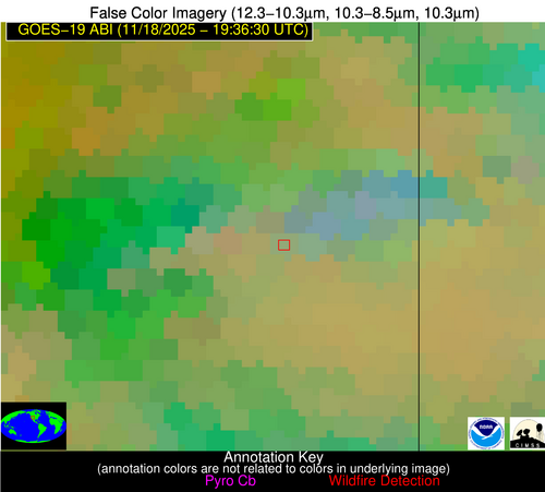
Wildfire Alert Report
| Date: | 2025-11-18 |
|---|---|
| Time: | 19:36:17 |
| Production Date and Time: | 2025-11-18 19:41:30 UTC |
| Primary Instrument: | GOES-19 ABI |
| Wmo Spacecraft Id: | 666 |
| Location/orbit: | GEO |
| L1 File: | OR_ABI-L1b-RadC-M6C14_G19_s20253221936177_e20253221938550_c20253221939037.nc |
| L1 File(s) - Temporal | OR_ABI-L1b-RadC-M6C14_G19_s20253221931177_e20253221933550_c20253221934054.nc |
| Number Of Thermal Anomaly Alerts: | 6 |
Possible Wildfire
| Basic Information | |
|---|---|
| State/Province(s) | UT |
| Country/Countries | United States |
| County/Locality(s) | San Juan County, UT |
| NWS WFO | Grand Junction CO |
| Identification Method | Enhanced Contextual (Clear) |
| Mean Object Date/Time | 2025-11-18 19:36:49UTC |
| Radiative Center (Lat, Lon): | 38.002777°, -109.208611° |
| Nearby Counties (meeting alert criteria): |
|
| Total Radiative Power Anomaly | n/a |
| Total Radiative Power | 60.05 MW |
| Map: | |
| Additional Information | |
| Alert Status | New Feature |
| Type of Event | Nominal Risk, Known Incident: East Canyon RX (HIGH, tdiff=0.97873 days, Point) |
| Event Priority Ranking | 4 |
| Maximum Observed BT (3.9 um) | 292.61 K |
| Observed - Background BT (3.9 um) | 8.99 K |
| BT Anomaly (3.9 um) | 10.38 K |
| Maximum Observed - Clear RTM BT (3.9 um) | 15.97 K |
| Maximum Observed BTD (3.9-10/11/12 um) | 27.36 K |
| Observed - Background BTD (3.9-10/11/12 um) | 7.46 K |
| BTD Anomaly (3.9-10/11/12 um) | 5.91 K |
| Similar Pixel Count | 20 |
| BT Time Tendency (3.9 um) | 10.00 K |
| Image Interval | 5.00 minutes |
| Fraction of Surrounding LWIR Pixels that are Colder | 0.95 |
| Fraction of Surrounding Red Channel Pixels that are Brighter | 0.96 |
| Maximum Radiative Power | 60.05 MW |
| Maximum Radiative Power Uncertainty | 0.00 MW |
| Total Radiative Power Uncertainty | 0.00 MW |
| Mean Viewing Angle | 56.80° |
| Mean Solar Zenith Angle | 57.50° |
| Mean Glint Angle | 95.00° |
| Water Fraction | 0.00 |
| Total Pixel Area | 7.30 km2 |
| Latest Satellite Imagery: | |
| View all event imagery » | |
Possible Wildfire
| Basic Information | |
|---|---|
| State/Province(s) | AR |
| Country/Countries | United States |
| County/Locality(s) | Clay County, AR |
| NWS WFO | Memphis TN |
| Identification Method | Enhanced Contextual (Clear) |
| Mean Object Date/Time | 2025-11-18 19:36:51UTC |
| Radiative Center (Lat, Lon): | 36.364166°, -90.736389° |
| Nearby Counties (meeting alert criteria): |
|
| Total Radiative Power Anomaly | n/a |
| Total Radiative Power | 25.86 MW |
| Map: | |
| Additional Information | |
| Alert Status | New Feature |
| Type of Event | Nominal Risk |
| Event Priority Ranking | 4 |
| Maximum Observed BT (3.9 um) | 306.41 K |
| Observed - Background BT (3.9 um) | 7.62 K |
| BT Anomaly (3.9 um) | 9.28 K |
| Maximum Observed - Clear RTM BT (3.9 um) | 17.41 K |
| Maximum Observed BTD (3.9-10/11/12 um) | 16.47 K |
| Observed - Background BTD (3.9-10/11/12 um) | 7.99 K |
| BTD Anomaly (3.9-10/11/12 um) | 5.69 K |
| Similar Pixel Count | 6 |
| BT Time Tendency (3.9 um) | 7.20 K |
| Image Interval | 5.00 minutes |
| Fraction of Surrounding LWIR Pixels that are Colder | 0.56 |
| Fraction of Surrounding Red Channel Pixels that are Brighter | 0.44 |
| Maximum Radiative Power | 25.86 MW |
| Maximum Radiative Power Uncertainty | 0.00 MW |
| Total Radiative Power Uncertainty | 0.00 MW |
| Mean Viewing Angle | 45.50° |
| Mean Solar Zenith Angle | 61.00° |
| Mean Glint Angle | 91.20° |
| Water Fraction | 0.00 |
| Total Pixel Area | 5.70 km2 |
| Latest Satellite Imagery: | |
| View all event imagery » | |
Possible Wildfire
| Basic Information | |
|---|---|
| State/Province(s) | AR |
| Country/Countries | United States |
| County/Locality(s) | Randolph County, AR |
| NWS WFO | Little Rock AR |
| Identification Method | Enhanced Contextual (Clear) |
| Mean Object Date/Time | 2025-11-18 19:36:51UTC |
| Radiative Center (Lat, Lon): | 36.291389°, -90.841667° |
| Nearby Counties (meeting alert criteria): |
|
| Total Radiative Power Anomaly | n/a |
| Total Radiative Power | 21.79 MW |
| Map: | |
| Additional Information | |
| Alert Status | New Feature |
| Type of Event | Nominal Risk |
| Event Priority Ranking | 4 |
| Maximum Observed BT (3.9 um) | 304.25 K |
| Observed - Background BT (3.9 um) | 5.33 K |
| BT Anomaly (3.9 um) | 4.53 K |
| Maximum Observed - Clear RTM BT (3.9 um) | 15.18 K |
| Maximum Observed BTD (3.9-10/11/12 um) | 15.25 K |
| Observed - Background BTD (3.9-10/11/12 um) | 5.62 K |
| BTD Anomaly (3.9-10/11/12 um) | 3.37 K |
| Similar Pixel Count | 7 |
| BT Time Tendency (3.9 um) | 5.20 K |
| Image Interval | 5.00 minutes |
| Fraction of Surrounding LWIR Pixels that are Colder | 0.46 |
| Fraction of Surrounding Red Channel Pixels that are Brighter | 0.16 |
| Maximum Radiative Power | 21.79 MW |
| Maximum Radiative Power Uncertainty | 0.00 MW |
| Total Radiative Power Uncertainty | 0.00 MW |
| Mean Viewing Angle | 45.50° |
| Mean Solar Zenith Angle | 60.80° |
| Mean Glint Angle | 91.00° |
| Water Fraction | 0.00 |
| Total Pixel Area | 5.70 km2 |
| Latest Satellite Imagery: | |
| View all event imagery » | |
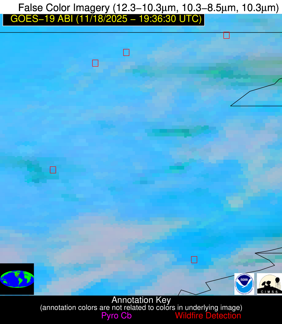
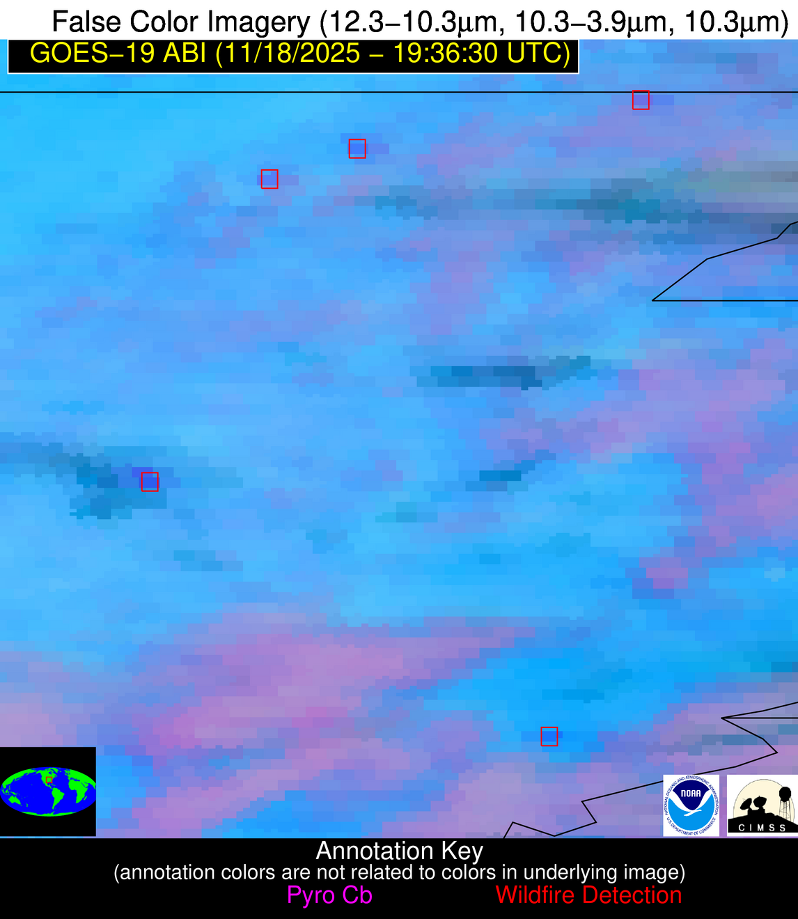
Possible Wildfire
| Basic Information | |
|---|---|
| State/Province(s) | AR |
| Country/Countries | United States |
| County/Locality(s) | St. Francis County, AR |
| NWS WFO | Memphis TN |
| Identification Method | Enhanced Contextual (Cloud) |
| Mean Object Date/Time | 2025-11-18 19:37:21UTC |
| Radiative Center (Lat, Lon): | 34.955555°, -90.506111° |
| Nearby Counties (meeting alert criteria): |
|
| Total Radiative Power Anomaly | n/a |
| Total Radiative Power | 27.39 MW |
| Map: | |
| Additional Information | |
| Alert Status | New Feature |
| Type of Event | Nominal Risk |
| Event Priority Ranking | 4 |
| Maximum Observed BT (3.9 um) | 306.96 K |
| Observed - Background BT (3.9 um) | 7.97 K |
| BT Anomaly (3.9 um) | 11.40 K |
| Maximum Observed - Clear RTM BT (3.9 um) | 12.82 K |
| Maximum Observed BTD (3.9-10/11/12 um) | 18.13 K |
| Observed - Background BTD (3.9-10/11/12 um) | 7.27 K |
| BTD Anomaly (3.9-10/11/12 um) | 11.21 K |
| Similar Pixel Count | 0 |
| BT Time Tendency (3.9 um) | 3.90 K |
| Image Interval | 5.00 minutes |
| Fraction of Surrounding LWIR Pixels that are Colder | 0.96 |
| Fraction of Surrounding Red Channel Pixels that are Brighter | 0.99 |
| Maximum Radiative Power | 27.39 MW |
| Maximum Radiative Power Uncertainty | 0.00 MW |
| Total Radiative Power Uncertainty | 0.00 MW |
| Mean Viewing Angle | 44.00° |
| Mean Solar Zenith Angle | 59.80° |
| Mean Glint Angle | 88.70° |
| Water Fraction | 0.00 |
| Total Pixel Area | 5.60 km2 |
| Latest Satellite Imagery: | |
| View all event imagery » | |
Possible Wildfire
| Basic Information | |
|---|---|
| State/Province(s) | LA |
| Country/Countries | United States |
| County/Locality(s) | Pointe Coupee Parish, LA |
| NWS WFO | New Orleans LA |
| Identification Method | Enhanced Contextual (Clear) |
| Mean Object Date/Time | 2025-11-18 19:37:20UTC |
| Radiative Center (Lat, Lon): | 30.978889°, -91.682503° |
| Nearby Counties (meeting alert criteria): |
|
| Total Radiative Power Anomaly | n/a |
| Total Radiative Power | 29.58 MW |
| Map: | |
| Additional Information | |
| Alert Status | New Feature |
| Type of Event | Nominal Risk |
| Event Priority Ranking | 4 |
| Maximum Observed BT (3.9 um) | 308.94 K |
| Observed - Background BT (3.9 um) | 8.65 K |
| BT Anomaly (3.9 um) | 4.93 K |
| Maximum Observed - Clear RTM BT (3.9 um) | 11.12 K |
| Maximum Observed BTD (3.9-10/11/12 um) | 18.81 K |
| Observed - Background BTD (3.9-10/11/12 um) | 7.95 K |
| BTD Anomaly (3.9-10/11/12 um) | 5.39 K |
| Similar Pixel Count | 11 |
| BT Time Tendency (3.9 um) | 5.60 K |
| Image Interval | 5.00 minutes |
| Fraction of Surrounding LWIR Pixels that are Colder | 0.83 |
| Fraction of Surrounding Red Channel Pixels that are Brighter | 0.49 |
| Maximum Radiative Power | 29.58 MW |
| Maximum Radiative Power Uncertainty | 0.00 MW |
| Total Radiative Power Uncertainty | 0.00 MW |
| Mean Viewing Angle | 40.50° |
| Mean Solar Zenith Angle | 55.90° |
| Mean Glint Angle | 80.90° |
| Water Fraction | 0.00 |
| Total Pixel Area | 5.30 km2 |
| Latest Satellite Imagery: | |
| View all event imagery » | |
Possible Wildfire
| Basic Information | |
|---|---|
| State/Province(s) | LA |
| Country/Countries | United States |
| County/Locality(s) | St. Mary Parish, LA |
| NWS WFO | Lake Charles LA |
| Identification Method | Enhanced Contextual (Cloud) |
| Mean Object Date/Time | 2025-11-18 19:37:50UTC |
| Radiative Center (Lat, Lon): | 29.899166°, -91.551941° |
| Nearby Counties (meeting alert criteria): |
|
| Total Radiative Power Anomaly | n/a |
| Total Radiative Power | 97.72 MW |
| Map: | |
| Additional Information | |
| Alert Status | New Feature |
| Type of Event | Nominal Risk |
| Event Priority Ranking | 4 |
| Maximum Observed BT (3.9 um) | 323.75 K |
| Observed - Background BT (3.9 um) | 22.65 K |
| BT Anomaly (3.9 um) | 12.07 K |
| Maximum Observed - Clear RTM BT (3.9 um) | 27.99 K |
| Maximum Observed BTD (3.9-10/11/12 um) | 32.52 K |
| Observed - Background BTD (3.9-10/11/12 um) | 21.68 K |
| BTD Anomaly (3.9-10/11/12 um) | 11.02 K |
| Similar Pixel Count | 0 |
| BT Time Tendency (3.9 um) | 19.50 K |
| Image Interval | 5.00 minutes |
| Fraction of Surrounding LWIR Pixels that are Colder | 0.98 |
| Fraction of Surrounding Red Channel Pixels that are Brighter | 0.72 |
| Maximum Radiative Power | 97.72 MW |
| Maximum Radiative Power Uncertainty | 0.00 MW |
| Total Radiative Power Uncertainty | 0.00 MW |
| Mean Viewing Angle | 39.40° |
| Mean Solar Zenith Angle | 55.00° |
| Mean Glint Angle | 78.90° |
| Water Fraction | 0.00 |
| Total Pixel Area | 5.20 km2 |
| Latest Satellite Imagery: | |
| View all event imagery » | |


