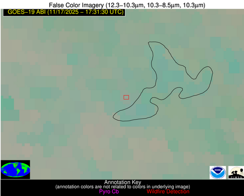
Wildfire Alert Report
| Date: | 2025-11-17 |
|---|---|
| Time: | 17:31:17 |
| Production Date and Time: | 2025-11-17 17:36:25 UTC |
| Primary Instrument: | GOES-19 ABI |
| Wmo Spacecraft Id: | 666 |
| Location/orbit: | GEO |
| L1 File: | OR_ABI-L1b-RadC-M6C14_G19_s20253211731176_e20253211733549_c20253211734030.nc |
| L1 File(s) - Temporal | OR_ABI-L1b-RadC-M6C14_G19_s20253211726176_e20253211728549_c20253211729049.nc |
| Number Of Thermal Anomaly Alerts: | 8 |
Possible Wildfire
| Basic Information | |
|---|---|
| State/Province(s) | Ontario |
| Country/Countries | Canada |
| County/Locality(s) | Kenora, Ontario |
| NWS WFO | N/A |
| Identification Method | Enhanced Contextual (Clear) |
| Mean Object Date/Time | 2025-11-17 17:31:21UTC |
| Radiative Center (Lat, Lon): | 49.033611°, -92.027222° |
| Nearby Counties (meeting alert criteria): |
|
| Total Radiative Power Anomaly | n/a |
| Total Radiative Power | 12.42 MW |
| Map: | |
| Additional Information | |
| Alert Status | New Feature |
| Type of Event | Nominal Risk |
| Event Priority Ranking | 4 |
| Maximum Observed BT (3.9 um) | 281.78 K |
| Observed - Background BT (3.9 um) | 6.89 K |
| BT Anomaly (3.9 um) | 13.88 K |
| Maximum Observed - Clear RTM BT (3.9 um) | 10.78 K |
| Maximum Observed BTD (3.9-10/11/12 um) | 10.22 K |
| Observed - Background BTD (3.9-10/11/12 um) | 6.40 K |
| BTD Anomaly (3.9-10/11/12 um) | 15.48 K |
| Similar Pixel Count | 3 |
| BT Time Tendency (3.9 um) | 4.70 K |
| Image Interval | 5.00 minutes |
| Fraction of Surrounding LWIR Pixels that are Colder | 0.69 |
| Fraction of Surrounding Red Channel Pixels that are Brighter | 1.00 |
| Maximum Radiative Power | 12.42 MW |
| Maximum Radiative Power Uncertainty | 0.00 MW |
| Total Radiative Power Uncertainty | 0.00 MW |
| Mean Viewing Angle | 58.90° |
| Mean Solar Zenith Angle | 67.90° |
| Mean Glint Angle | 124.50° |
| Water Fraction | 0.00 |
| Total Pixel Area | 7.70 km2 |
| Latest Satellite Imagery: | |
| View all event imagery » | |
Possible Wildfire
| Basic Information | |
|---|---|
| State/Province(s) | OH |
| Country/Countries | United States |
| County/Locality(s) | Athens County, OH |
| NWS WFO | Charleston WV |
| Identification Method | Enhanced Contextual (Clear) |
| Mean Object Date/Time | 2025-11-17 17:31:52UTC |
| Radiative Center (Lat, Lon): | 39.465000°, -82.154724° |
| Nearby Counties (meeting alert criteria): |
|
| Total Radiative Power Anomaly | n/a |
| Total Radiative Power | 3.58 MW |
| Map: | |
| Additional Information | |
| Alert Status | New Feature |
| Type of Event | Nominal Risk |
| Event Priority Ranking | 4 |
| Maximum Observed BT (3.9 um) | 289.52 K |
| Observed - Background BT (3.9 um) | 1.47 K |
| BT Anomaly (3.9 um) | 2.23 K |
| Maximum Observed - Clear RTM BT (3.9 um) | 10.43 K |
| Maximum Observed BTD (3.9-10/11/12 um) | 7.66 K |
| Observed - Background BTD (3.9-10/11/12 um) | 1.69 K |
| BTD Anomaly (3.9-10/11/12 um) | 9.52 K |
| Similar Pixel Count | 25 |
| BT Time Tendency (3.9 um) | 0.70 K |
| Image Interval | 5.00 minutes |
| Fraction of Surrounding LWIR Pixels that are Colder | 0.37 |
| Fraction of Surrounding Red Channel Pixels that are Brighter | 1.00 |
| Maximum Radiative Power | 3.58 MW |
| Maximum Radiative Power Uncertainty | 0.00 MW |
| Total Radiative Power Uncertainty | 0.00 MW |
| Mean Viewing Angle | 46.50° |
| Mean Solar Zenith Angle | 58.30° |
| Mean Glint Angle | 103.40° |
| Water Fraction | 0.00 |
| Total Pixel Area | 5.80 km2 |
| Latest Satellite Imagery: | |
| View all event imagery » | |
Possible Wildfire
| Basic Information | |
|---|---|
| State/Province(s) | IL |
| Country/Countries | United States |
| County/Locality(s) | Jefferson County, IL |
| NWS WFO | Paducah KY |
| Identification Method | Enhanced Contextual (Cloud) |
| Mean Object Date/Time | 2025-11-17 17:31:51UTC |
| Radiative Center (Lat, Lon): | 38.167500°, -88.781670° |
| Nearby Counties (meeting alert criteria): |
|
| Total Radiative Power Anomaly | n/a |
| Total Radiative Power | 46.05 MW |
| Map: | |
| Additional Information | |
| Alert Status | New Feature |
| Type of Event | Nominal Risk |
| Event Priority Ranking | 4 |
| Maximum Observed BT (3.9 um) | 308.05 K |
| Observed - Background BT (3.9 um) | 14.02 K |
| BT Anomaly (3.9 um) | 9.53 K |
| Maximum Observed - Clear RTM BT (3.9 um) | 21.91 K |
| Maximum Observed BTD (3.9-10/11/12 um) | 27.85 K |
| Observed - Background BTD (3.9-10/11/12 um) | 14.54 K |
| BTD Anomaly (3.9-10/11/12 um) | 6.87 K |
| Similar Pixel Count | 0 |
| BT Time Tendency (3.9 um) | 5.90 K |
| Image Interval | 5.00 minutes |
| Fraction of Surrounding LWIR Pixels that are Colder | 0.32 |
| Fraction of Surrounding Red Channel Pixels that are Brighter | 0.31 |
| Maximum Radiative Power | 46.05 MW |
| Maximum Radiative Power Uncertainty | 0.00 MW |
| Total Radiative Power Uncertainty | 0.00 MW |
| Mean Viewing Angle | 46.70° |
| Mean Solar Zenith Angle | 56.90° |
| Mean Glint Angle | 101.70° |
| Water Fraction | 0.00 |
| Total Pixel Area | 5.80 km2 |
| Latest Satellite Imagery: | |
| View all event imagery » | |
Possible Wildfire
| Basic Information | |
|---|---|
| State/Province(s) | MO |
| Country/Countries | United States |
| County/Locality(s) | Bollinger County, MO |
| NWS WFO | Paducah KY |
| Identification Method | Enhanced Contextual (Clear) |
| Mean Object Date/Time | 2025-11-17 17:31:51UTC |
| Radiative Center (Lat, Lon): | 37.057499°, -89.990555° |
| Nearby Counties (meeting alert criteria): |
|
| Total Radiative Power Anomaly | n/a |
| Total Radiative Power | 22.98 MW |
| Map: | |
| Additional Information | |
| Alert Status | New Feature |
| Type of Event | Nominal Risk |
| Event Priority Ranking | 4 |
| Maximum Observed BT (3.9 um) | 304.18 K |
| Observed - Background BT (3.9 um) | 9.24 K |
| BT Anomaly (3.9 um) | 3.82 K |
| Maximum Observed - Clear RTM BT (3.9 um) | 16.97 K |
| Maximum Observed BTD (3.9-10/11/12 um) | 17.51 K |
| Observed - Background BTD (3.9-10/11/12 um) | 8.51 K |
| BTD Anomaly (3.9-10/11/12 um) | 5.06 K |
| Similar Pixel Count | 5 |
| BT Time Tendency (3.9 um) | 3.70 K |
| Image Interval | 5.00 minutes |
| Fraction of Surrounding LWIR Pixels that are Colder | 0.80 |
| Fraction of Surrounding Red Channel Pixels that are Brighter | 0.22 |
| Maximum Radiative Power | 22.98 MW |
| Maximum Radiative Power Uncertainty | 0.00 MW |
| Total Radiative Power Uncertainty | 0.00 MW |
| Mean Viewing Angle | 45.90° |
| Mean Solar Zenith Angle | 55.90° |
| Mean Glint Angle | 99.70° |
| Water Fraction | 0.00 |
| Total Pixel Area | 5.80 km2 |
| Latest Satellite Imagery: | |
| View all event imagery » | |
Possible Wildfire
| Basic Information | |
|---|---|
| State/Province(s) | GA |
| Country/Countries | United States |
| County/Locality(s) | Jackson County, GA |
| NWS WFO | Peachtree City GA |
| Identification Method | Enhanced Contextual (Clear) |
| Mean Object Date/Time | 2025-11-17 17:32:21UTC |
| Radiative Center (Lat, Lon): | 34.165279°, -83.541115° |
| Nearby Counties (meeting alert criteria): |
|
| Total Radiative Power Anomaly | n/a |
| Total Radiative Power | 5.78 MW |
| Map: | |
| Additional Information | |
| Alert Status | New Feature |
| Type of Event | Nominal Risk |
| Event Priority Ranking | 4 |
| Maximum Observed BT (3.9 um) | 299.41 K |
| Observed - Background BT (3.9 um) | 1.83 K |
| BT Anomaly (3.9 um) | 3.00 K |
| Maximum Observed - Clear RTM BT (3.9 um) | 8.00 K |
| Maximum Observed BTD (3.9-10/11/12 um) | 7.29 K |
| Observed - Background BTD (3.9-10/11/12 um) | 2.13 K |
| BTD Anomaly (3.9-10/11/12 um) | 6.70 K |
| Similar Pixel Count | 23 |
| BT Time Tendency (3.9 um) | 0.60 K |
| Image Interval | 5.00 minutes |
| Fraction of Surrounding LWIR Pixels that are Colder | 0.19 |
| Fraction of Surrounding Red Channel Pixels that are Brighter | 1.00 |
| Maximum Radiative Power | 5.78 MW |
| Maximum Radiative Power Uncertainty | 0.00 MW |
| Total Radiative Power Uncertainty | 0.00 MW |
| Mean Viewing Angle | 40.90° |
| Mean Solar Zenith Angle | 53.00° |
| Mean Glint Angle | 92.30° |
| Water Fraction | 0.00 |
| Total Pixel Area | 5.30 km2 |
| Latest Satellite Imagery: | |
| View all event imagery » | |
Possible Wildfire
| Basic Information | |
|---|---|
| State/Province(s) | AL |
| Country/Countries | United States |
| County/Locality(s) | Lowndes County, AL |
| NWS WFO | Birmingham AL |
| Identification Method | Enhanced Contextual (Cloud) |
| Mean Object Date/Time | 2025-11-17 17:32:21UTC |
| Radiative Center (Lat, Lon): | 32.281666°, -86.584167° |
| Nearby Counties (meeting alert criteria): |
|
| Total Radiative Power Anomaly | n/a |
| Total Radiative Power | 44.45 MW |
| Map: | |
| Additional Information | |
| Alert Status | New Feature |
| Type of Event | Nominal Risk |
| Event Priority Ranking | 4 |
| Maximum Observed BT (3.9 um) | 310.40 K |
| Observed - Background BT (3.9 um) | 12.73 K |
| BT Anomaly (3.9 um) | 9.27 K |
| Maximum Observed - Clear RTM BT (3.9 um) | 15.62 K |
| Maximum Observed BTD (3.9-10/11/12 um) | 21.11 K |
| Observed - Background BTD (3.9-10/11/12 um) | 12.86 K |
| BTD Anomaly (3.9-10/11/12 um) | 12.37 K |
| Similar Pixel Count | 0 |
| BT Time Tendency (3.9 um) | 13.10 K |
| Image Interval | 5.00 minutes |
| Fraction of Surrounding LWIR Pixels that are Colder | 0.69 |
| Fraction of Surrounding Red Channel Pixels that are Brighter | 0.99 |
| Maximum Radiative Power | 44.45 MW |
| Maximum Radiative Power Uncertainty | 0.00 MW |
| Total Radiative Power Uncertainty | 0.00 MW |
| Mean Viewing Angle | 39.70° |
| Mean Solar Zenith Angle | 51.00° |
| Mean Glint Angle | 88.90° |
| Water Fraction | 0.00 |
| Total Pixel Area | 5.20 km2 |
| Latest Satellite Imagery: | |
| View all event imagery » | |
Possible Wildfire
| Basic Information | |
|---|---|
| State/Province(s) | AL |
| Country/Countries | United States |
| County/Locality(s) | Wilcox County, AL |
| NWS WFO | Mobile AL |
| Identification Method | Enhanced Contextual (Clear) |
| Mean Object Date/Time | 2025-11-17 17:32:21UTC |
| Radiative Center (Lat, Lon): | 32.206665°, -87.501945° |
| Nearby Counties (meeting alert criteria): |
|
| Total Radiative Power Anomaly | n/a |
| Total Radiative Power | 39.05 MW |
| Map: | |
| Additional Information | |
| Alert Status | New Feature |
| Type of Event | Nominal Risk |
| Event Priority Ranking | 4 |
| Maximum Observed BT (3.9 um) | 301.31 K |
| Observed - Background BT (3.9 um) | 4.14 K |
| BT Anomaly (3.9 um) | 2.96 K |
| Maximum Observed - Clear RTM BT (3.9 um) | 6.65 K |
| Maximum Observed BTD (3.9-10/11/12 um) | 11.08 K |
| Observed - Background BTD (3.9-10/11/12 um) | 3.85 K |
| BTD Anomaly (3.9-10/11/12 um) | 5.58 K |
| Similar Pixel Count | 10 |
| BT Time Tendency (3.9 um) | 2.50 K |
| Image Interval | 5.00 minutes |
| Fraction of Surrounding LWIR Pixels that are Colder | 0.66 |
| Fraction of Surrounding Red Channel Pixels that are Brighter | 1.00 |
| Maximum Radiative Power | 11.24 MW |
| Maximum Radiative Power Uncertainty | 0.00 MW |
| Total Radiative Power Uncertainty | 0.00 MW |
| Mean Viewing Angle | 40.00° |
| Mean Solar Zenith Angle | 50.90° |
| Mean Glint Angle | 89.00° |
| Water Fraction | 0.00 |
| Total Pixel Area | 20.90 km2 |
| Latest Satellite Imagery: | |
| View all event imagery » | |
Possible Wildfire
| Basic Information | |
|---|---|
| State/Province(s) | LA |
| Country/Countries | United States |
| County/Locality(s) | Red River Parish, LA |
| NWS WFO | Shreveport LA |
| Identification Method | Enhanced Contextual (Clear) |
| Mean Object Date/Time | 2025-11-17 17:32:20UTC |
| Radiative Center (Lat, Lon): | 32.073055°, -93.282219° |
| Nearby Counties (meeting alert criteria): |
|
| Total Radiative Power Anomaly | n/a |
| Total Radiative Power | 53.04 MW |
| Map: | |
| Additional Information | |
| Alert Status | New Feature |
| Type of Event | Nominal Risk |
| Event Priority Ranking | 4 |
| Maximum Observed BT (3.9 um) | 307.22 K |
| Observed - Background BT (3.9 um) | 5.90 K |
| BT Anomaly (3.9 um) | 2.99 K |
| Maximum Observed - Clear RTM BT (3.9 um) | 10.12 K |
| Maximum Observed BTD (3.9-10/11/12 um) | 19.93 K |
| Observed - Background BTD (3.9-10/11/12 um) | 5.37 K |
| BTD Anomaly (3.9-10/11/12 um) | 2.59 K |
| Similar Pixel Count | 18 |
| BT Time Tendency (3.9 um) | 6.30 K |
| Image Interval | 5.00 minutes |
| Fraction of Surrounding LWIR Pixels that are Colder | 0.77 |
| Fraction of Surrounding Red Channel Pixels that are Brighter | 0.87 |
| Maximum Radiative Power | 28.46 MW |
| Maximum Radiative Power Uncertainty | 0.00 MW |
| Total Radiative Power Uncertainty | 0.00 MW |
| Mean Viewing Angle | 42.40° |
| Mean Solar Zenith Angle | 51.20° |
| Mean Glint Angle | 91.10° |
| Water Fraction | 0.00 |
| Total Pixel Area | 10.80 km2 |
| Latest Satellite Imagery: | |
| View all event imagery » | |


