10 Jan 2026: Notice to users: ongoing data center construction may unexpectedly interrupt NGFS product generation.
Wildfire Alert Report
| Date: | 2025-11-12 |
|---|---|
| Time: | 20:51:17 |
| Production Date and Time: | 2025-11-12 20:56:18 UTC |
| Primary Instrument: | GOES-18 ABI |
| Wmo Spacecraft Id: | 665 |
| Location/orbit: | GEO |
| L1 File: | OR_ABI-L1b-RadC-M6C14_G18_s20253162051173_e20253162053547_c20253162054019.nc |
| L1 File(s) - Temporal | OR_ABI-L1b-RadC-M6C14_G18_s20253162046173_e20253162048547_c20253162049038.nc |
| Number Of Thermal Anomaly Alerts: | 4 |
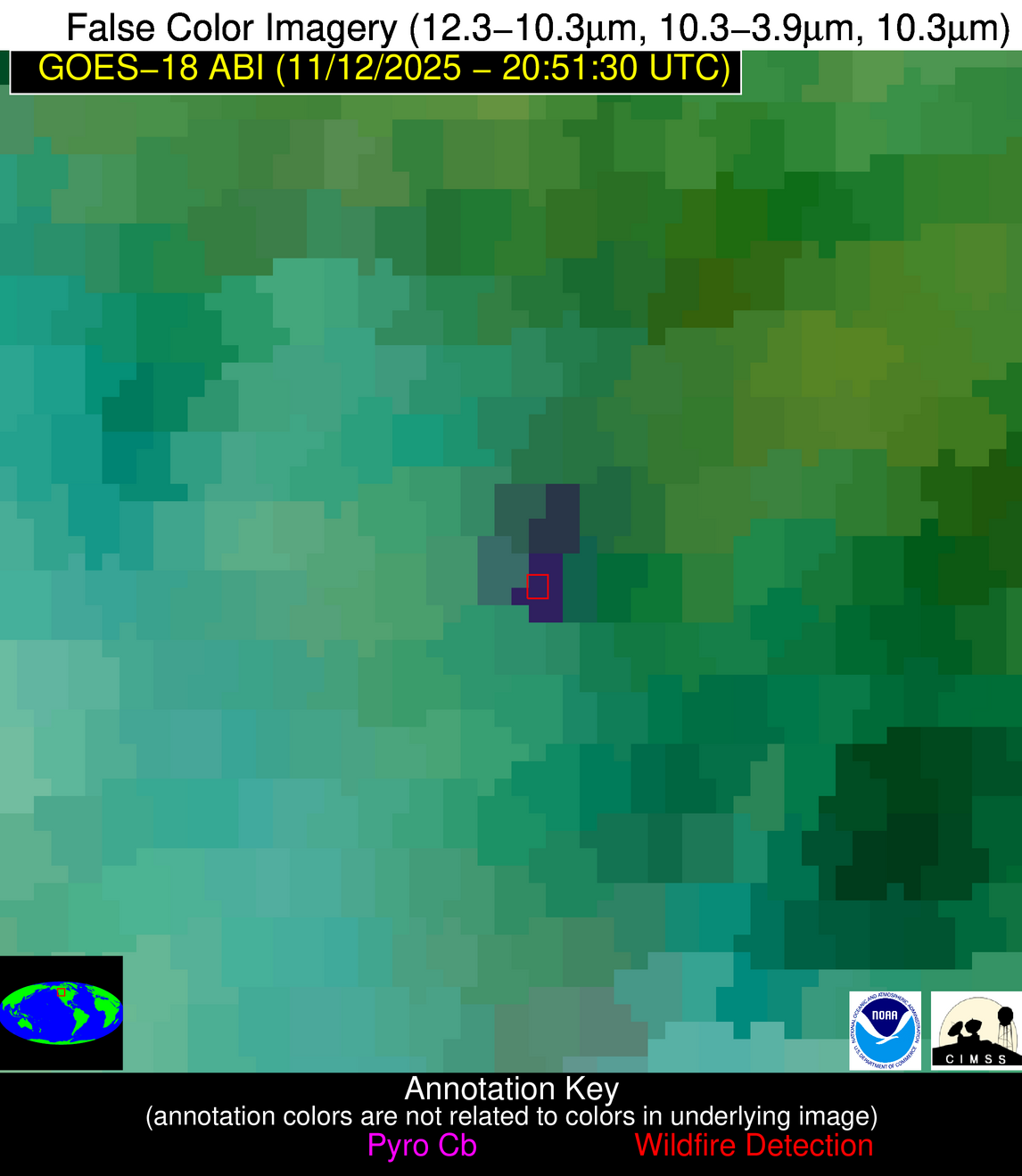
Possible Wildfire
| Basic Information | |
|---|---|
| State/Province(s) | British Columbia |
| Country/Countries | Canada |
| County/Locality(s) | East Kootenay, British Columbia |
| NWS WFO | N/A |
| Identification Method | Enhanced Contextual (Cloud) |
| Mean Object Date/Time | 2025-11-12 20:51:23UTC |
| Radiative Center (Lat, Lon): | 50.600277°, -115.744720° |
| Nearby Counties (meeting alert criteria): |
|
| Total Radiative Power Anomaly | n/a |
| Total Radiative Power | 40.05 MW |
| Map: | |
| Additional Information | |
| Alert Status | New Feature |
| Type of Event | Nominal Risk |
| Event Priority Ranking | 4 |
| Maximum Observed BT (3.9 um) | 287.21 K |
| Observed - Background BT (3.9 um) | 14.74 K |
| BT Anomaly (3.9 um) | 7.51 K |
| Maximum Observed - Clear RTM BT (3.9 um) | 15.29 K |
| Maximum Observed BTD (3.9-10/11/12 um) | 29.36 K |
| Observed - Background BTD (3.9-10/11/12 um) | 14.41 K |
| BTD Anomaly (3.9-10/11/12 um) | 9.11 K |
| Similar Pixel Count | 0 |
| BT Time Tendency (3.9 um) | 9.50 K |
| Image Interval | 5.00 minutes |
| Fraction of Surrounding LWIR Pixels that are Colder | 0.51 |
| Fraction of Surrounding Red Channel Pixels that are Brighter | 0.79 |
| Maximum Radiative Power | 40.05 MW |
| Maximum Radiative Power Uncertainty | 0.00 MW |
| Total Radiative Power Uncertainty | 0.00 MW |
| Mean Viewing Angle | 61.80° |
| Mean Solar Zenith Angle | 70.60° |
| Mean Glint Angle | 132.00° |
| Water Fraction | 0.00 |
| Total Pixel Area | 8.50 km2 |
| Latest Satellite Imagery: | |
| View all event imagery » | |
Possible Wildfire
| Basic Information | |
|---|---|
| State/Province(s) | ND |
| Country/Countries | United States |
| County/Locality(s) | Cavalier County, ND |
| NWS WFO | Grand Forks ND |
| Identification Method | Enhanced Contextual (Clear) |
| Mean Object Date/Time | 2025-11-12 20:51:24UTC |
| Radiative Center (Lat, Lon): | 48.633888°, -98.536110° |
| Nearby Counties (meeting alert criteria): |
|
| Total Radiative Power Anomaly | n/a |
| Total Radiative Power | 30.86 MW |
| Map: | |
| Additional Information | |
| Alert Status | New Feature |
| Type of Event | Nominal Risk |
| Event Priority Ranking | 4 |
| Maximum Observed BT (3.9 um) | 292.02 K |
| Observed - Background BT (3.9 um) | 7.66 K |
| BT Anomaly (3.9 um) | 7.46 K |
| Maximum Observed - Clear RTM BT (3.9 um) | 18.00 K |
| Maximum Observed BTD (3.9-10/11/12 um) | 15.88 K |
| Observed - Background BTD (3.9-10/11/12 um) | 7.54 K |
| BTD Anomaly (3.9-10/11/12 um) | 10.04 K |
| Similar Pixel Count | 2 |
| BT Time Tendency (3.9 um) | 6.30 K |
| Image Interval | 5.00 minutes |
| Fraction of Surrounding LWIR Pixels that are Colder | 0.54 |
| Fraction of Surrounding Red Channel Pixels that are Brighter | 0.99 |
| Maximum Radiative Power | 30.86 MW |
| Maximum Radiative Power Uncertainty | 0.00 MW |
| Total Radiative Power Uncertainty | 0.00 MW |
| Mean Viewing Angle | 67.30° |
| Mean Solar Zenith Angle | 74.40° |
| Mean Glint Angle | 140.70° |
| Water Fraction | 0.00 |
| Total Pixel Area | 10.40 km2 |
| Latest Satellite Imagery: | |
| View all event imagery » | |
Possible Wildfire
| Basic Information | |
|---|---|
| State/Province(s) | OR |
| Country/Countries | United States |
| County/Locality(s) | Wheeler County, OR |
| NWS WFO | Pendleton OR |
| Identification Method | Enhanced Contextual (Cloud) |
| Mean Object Date/Time | 2025-11-12 20:51:23UTC |
| Radiative Center (Lat, Lon): | 44.894722°, -119.986946° |
| Nearby Counties (meeting alert criteria): |
|
| Total Radiative Power Anomaly | n/a |
| Total Radiative Power | 29.97 MW |
| Map: | |
| Additional Information | |
| Alert Status | New Feature |
| Type of Event | Nominal Risk |
| Event Priority Ranking | 4 |
| Maximum Observed BT (3.9 um) | 297.44 K |
| Observed - Background BT (3.9 um) | 8.25 K |
| BT Anomaly (3.9 um) | 6.66 K |
| Maximum Observed - Clear RTM BT (3.9 um) | 15.99 K |
| Maximum Observed BTD (3.9-10/11/12 um) | 23.71 K |
| Observed - Background BTD (3.9-10/11/12 um) | 7.77 K |
| BTD Anomaly (3.9-10/11/12 um) | 6.25 K |
| Similar Pixel Count | 0 |
| BT Time Tendency (3.9 um) | 5.80 K |
| Image Interval | 5.00 minutes |
| Fraction of Surrounding LWIR Pixels that are Colder | 0.95 |
| Fraction of Surrounding Red Channel Pixels that are Brighter | 0.99 |
| Maximum Radiative Power | 29.97 MW |
| Maximum Radiative Power Uncertainty | 0.00 MW |
| Total Radiative Power Uncertainty | 0.00 MW |
| Mean Viewing Angle | 54.70° |
| Mean Solar Zenith Angle | 64.20° |
| Mean Glint Angle | 118.70° |
| Water Fraction | 0.00 |
| Total Pixel Area | 6.90 km2 |
| Latest Satellite Imagery: | |
| View all event imagery » | |
Possible Wildfire
| Basic Information | |
|---|---|
| State/Province(s) | WY |
| Country/Countries | United States |
| County/Locality(s) | Washakie County, WY |
| NWS WFO | Riverton WY |
| Identification Method | Enhanced Contextual (Cloud) |
| Mean Object Date/Time | 2025-11-12 20:51:24UTC |
| Radiative Center (Lat, Lon): | 43.639168°, -107.231110° |
| Nearby Counties (meeting alert criteria): |
|
| Total Radiative Power Anomaly | n/a |
| Total Radiative Power | 67.64 MW |
| Map: | |
| Additional Information | |
| Alert Status | New Feature |
| Type of Event | Nominal Risk |
| Event Priority Ranking | 4 |
| Maximum Observed BT (3.9 um) | 305.88 K |
| Observed - Background BT (3.9 um) | 10.53 K |
| BT Anomaly (3.9 um) | 5.82 K |
| Maximum Observed - Clear RTM BT (3.9 um) | 26.60 K |
| Maximum Observed BTD (3.9-10/11/12 um) | 19.16 K |
| Observed - Background BTD (3.9-10/11/12 um) | 10.22 K |
| BTD Anomaly (3.9-10/11/12 um) | 18.39 K |
| Similar Pixel Count | 0 |
| BT Time Tendency (3.9 um) | 7.40 K |
| Image Interval | 5.00 minutes |
| Fraction of Surrounding LWIR Pixels that are Colder | 0.64 |
| Fraction of Surrounding Red Channel Pixels that are Brighter | 1.00 |
| Maximum Radiative Power | 67.64 MW |
| Maximum Radiative Power Uncertainty | 0.00 MW |
| Total Radiative Power Uncertainty | 0.00 MW |
| Mean Viewing Angle | 58.90° |
| Mean Solar Zenith Angle | 66.90° |
| Mean Glint Angle | 125.10° |
| Water Fraction | 0.00 |
| Total Pixel Area | 15.50 km2 |
| Latest Satellite Imagery: | |
| View all event imagery » | |


