Wildfire Alert Report
| Date: | 2025-11-12 |
|---|---|
| Time: | 14:31:17 |
| Production Date and Time: | 2025-11-12 14:36:19 UTC |
| Primary Instrument: | GOES-19 ABI |
| Wmo Spacecraft Id: | 666 |
| Location/orbit: | GEO |
| L1 File: | OR_ABI-L1b-RadC-M6C14_G19_s20253161431171_e20253161433544_c20253161434037.nc |
| L1 File(s) - Temporal | OR_ABI-L1b-RadC-M6C14_G19_s20253161426171_e20253161428544_c20253161429042.nc |
| Number Of Thermal Anomaly Alerts: | 7 |
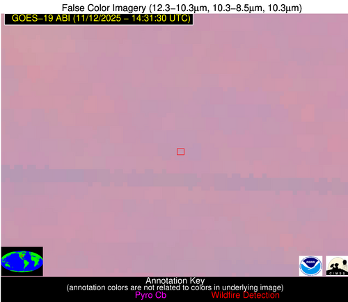
Possible Wildfire
| Basic Information | |
|---|---|
| State/Province(s) | NE |
| Country/Countries | United States |
| County/Locality(s) | Otoe County, NE |
| NWS WFO | Omaha/Valley NE |
| Identification Method | Enhanced Contextual (Clear) |
| Mean Object Date/Time | 2025-11-12 14:31:50UTC |
| Radiative Center (Lat, Lon): | 40.540279°, -96.397781° |
| Nearby Counties (meeting alert criteria): |
|
| Total Radiative Power Anomaly | n/a |
| Total Radiative Power | 4.51 MW |
| Map: | |
| Additional Information | |
| Alert Status | New Feature |
| Type of Event | Nominal Risk |
| Event Priority Ranking | 4 |
| Maximum Observed BT (3.9 um) | 283.11 K |
| Observed - Background BT (3.9 um) | 3.13 K |
| BT Anomaly (3.9 um) | 4.88 K |
| Maximum Observed - Clear RTM BT (3.9 um) | 1.84 K |
| Maximum Observed BTD (3.9-10/11/12 um) | 5.02 K |
| Observed - Background BTD (3.9-10/11/12 um) | 2.59 K |
| BTD Anomaly (3.9-10/11/12 um) | 10.65 K |
| Similar Pixel Count | 2 |
| BT Time Tendency (3.9 um) | 1.60 K |
| Image Interval | 5.00 minutes |
| Fraction of Surrounding LWIR Pixels that are Colder | 0.89 |
| Fraction of Surrounding Red Channel Pixels that are Brighter | 0.96 |
| Maximum Radiative Power | 4.51 MW |
| Maximum Radiative Power Uncertainty | 0.00 MW |
| Total Radiative Power Uncertainty | 0.00 MW |
| Mean Viewing Angle | 52.00° |
| Mean Solar Zenith Angle | 77.00° |
| Mean Glint Angle | 124.90° |
| Water Fraction | 0.00 |
| Total Pixel Area | 6.50 km2 |
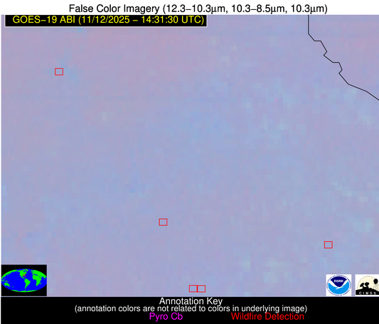
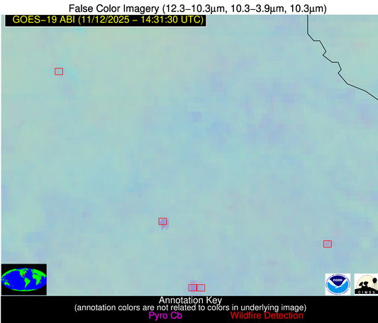
| Latest Satellite Imagery: | |
| View all event imagery » | |
Possible Wildfire
| Basic Information | |
|---|---|
| State/Province(s) | TN |
| Country/Countries | United States |
| County/Locality(s) | Madison County, TN |
| NWS WFO | Memphis TN |
| Identification Method | Enhanced Contextual (Clear) |
| Mean Object Date/Time | 2025-11-12 14:32:21UTC |
| Radiative Center (Lat, Lon): | 35.705002°, -88.794724° |
| Nearby Counties (meeting alert criteria): |
|
| Total Radiative Power Anomaly | n/a |
| Total Radiative Power | 2.51 MW |
| Map: | |
| Additional Information | |
| Alert Status | New Feature |
| Type of Event | Nominal Risk |
| Event Priority Ranking | 4 |
| Maximum Observed BT (3.9 um) | 287.29 K |
| Observed - Background BT (3.9 um) | 1.99 K |
| BT Anomaly (3.9 um) | 4.05 K |
| Maximum Observed - Clear RTM BT (3.9 um) | 6.16 K |
| Maximum Observed BTD (3.9-10/11/12 um) | 4.54 K |
| Observed - Background BTD (3.9-10/11/12 um) | 1.67 K |
| BTD Anomaly (3.9-10/11/12 um) | 4.92 K |
| Similar Pixel Count | 12 |
| BT Time Tendency (3.9 um) | 1.50 K |
| Image Interval | 5.00 minutes |
| Fraction of Surrounding LWIR Pixels that are Colder | 0.85 |
| Fraction of Surrounding Red Channel Pixels that are Brighter | 1.00 |
| Maximum Radiative Power | 2.51 MW |
| Maximum Radiative Power Uncertainty | 0.00 MW |
| Total Radiative Power Uncertainty | 0.00 MW |
| Mean Viewing Angle | 44.10° |
| Mean Solar Zenith Angle | 69.30° |
| Mean Glint Angle | 109.40° |
| Water Fraction | 0.00 |
| Total Pixel Area | 5.60 km2 |
| Latest Satellite Imagery: | |
| View all event imagery » | |
Possible Wildfire
| Basic Information | |
|---|---|
| State/Province(s) | GA |
| Country/Countries | United States |
| County/Locality(s) | Baldwin County, GA |
| NWS WFO | Peachtree City GA |
| Identification Method | Enhanced Contextual (Clear) |
| Mean Object Date/Time | 2025-11-12 14:32:21UTC |
| Radiative Center (Lat, Lon): | 33.174168°, -83.291664° |
| Nearby Counties (meeting alert criteria): |
|
| Total Radiative Power Anomaly | n/a |
| Total Radiative Power | 3.45 MW |
| Map: | |
| Additional Information | |
| Alert Status | New Feature |
| Type of Event | Nominal Risk |
| Event Priority Ranking | 4 |
| Maximum Observed BT (3.9 um) | 287.03 K |
| Observed - Background BT (3.9 um) | 2.97 K |
| BT Anomaly (3.9 um) | 3.80 K |
| Maximum Observed - Clear RTM BT (3.9 um) | 7.00 K |
| Maximum Observed BTD (3.9-10/11/12 um) | 5.00 K |
| Observed - Background BTD (3.9-10/11/12 um) | 2.42 K |
| BTD Anomaly (3.9-10/11/12 um) | 6.42 K |
| Similar Pixel Count | 5 |
| BT Time Tendency (3.9 um) | 0.80 K |
| Image Interval | 5.00 minutes |
| Fraction of Surrounding LWIR Pixels that are Colder | 0.88 |
| Fraction of Surrounding Red Channel Pixels that are Brighter | 1.00 |
| Maximum Radiative Power | 3.45 MW |
| Maximum Radiative Power Uncertainty | 0.00 MW |
| Total Radiative Power Uncertainty | 0.00 MW |
| Mean Viewing Angle | 39.70° |
| Mean Solar Zenith Angle | 64.30° |
| Mean Glint Angle | 99.50° |
| Water Fraction | 0.00 |
| Total Pixel Area | 5.20 km2 |
| Latest Satellite Imagery: | |
| View all event imagery » | |
Possible Wildfire
| Basic Information | |
|---|---|
| State/Province(s) | GA |
| Country/Countries | United States |
| County/Locality(s) | Bulloch County, GA |
| NWS WFO | Charleston SC |
| Identification Method | Enhanced Contextual (Clear) |
| Mean Object Date/Time | 2025-11-12 14:32:22UTC |
| Radiative Center (Lat, Lon): | 32.372501°, -81.824997° |
| Nearby Counties (meeting alert criteria): |
|
| Total Radiative Power Anomaly | n/a |
| Total Radiative Power | 8.26 MW |
| Map: | |
| Additional Information | |
| Alert Status | New Feature |
| Type of Event | VIIRS 375m static sources 2013_2018 |
| Event Priority Ranking | 5 |
| Maximum Observed BT (3.9 um) | 291.30 K |
| Observed - Background BT (3.9 um) | 4.73 K |
| BT Anomaly (3.9 um) | 5.11 K |
| Maximum Observed - Clear RTM BT (3.9 um) | 10.40 K |
| Maximum Observed BTD (3.9-10/11/12 um) | 8.38 K |
| Observed - Background BTD (3.9-10/11/12 um) | 4.68 K |
| BTD Anomaly (3.9-10/11/12 um) | 9.48 K |
| Similar Pixel Count | 2 |
| BT Time Tendency (3.9 um) | 3.90 K |
| Image Interval | 5.00 minutes |
| Fraction of Surrounding LWIR Pixels that are Colder | 0.58 |
| Fraction of Surrounding Red Channel Pixels that are Brighter | 1.00 |
| Maximum Radiative Power | 8.26 MW |
| Maximum Radiative Power Uncertainty | 0.00 MW |
| Total Radiative Power Uncertainty | 0.00 MW |
| Mean Viewing Angle | 38.50° |
| Mean Solar Zenith Angle | 62.80° |
| Mean Glint Angle | 96.70° |
| Water Fraction | 0.00 |
| Total Pixel Area | 5.10 km2 |
| Latest Satellite Imagery: | |
| View all event imagery » | |
Possible Wildfire
| Basic Information | |
|---|---|
| State/Province(s) | FL |
| Country/Countries | United States |
| County/Locality(s) | Jackson County, FL |
| NWS WFO | Tallahassee FL |
| Identification Method | Enhanced Contextual (Clear) |
| Mean Object Date/Time | 2025-11-12 14:32:21UTC |
| Radiative Center (Lat, Lon): | 30.632500°, -85.285553° |
| Nearby Counties (meeting alert criteria): |
|
| Total Radiative Power Anomaly | n/a |
| Total Radiative Power | 9.82 MW |
| Map: | |
| Additional Information | |
| Alert Status | New Feature |
| Type of Event | Nominal Risk |
| Event Priority Ranking | 4 |
| Maximum Observed BT (3.9 um) | 291.36 K |
| Observed - Background BT (3.9 um) | 5.06 K |
| BT Anomaly (3.9 um) | 5.85 K |
| Maximum Observed - Clear RTM BT (3.9 um) | 9.61 K |
| Maximum Observed BTD (3.9-10/11/12 um) | 8.02 K |
| Observed - Background BTD (3.9-10/11/12 um) | 5.38 K |
| BTD Anomaly (3.9-10/11/12 um) | 12.99 K |
| Similar Pixel Count | 1 |
| BT Time Tendency (3.9 um) | 3.60 K |
| Image Interval | 5.00 minutes |
| Fraction of Surrounding LWIR Pixels that are Colder | 0.32 |
| Fraction of Surrounding Red Channel Pixels that are Brighter | 1.00 |
| Maximum Radiative Power | 9.82 MW |
| Maximum Radiative Power Uncertainty | 0.00 MW |
| Total Radiative Power Uncertainty | 0.00 MW |
| Mean Viewing Angle | 37.50° |
| Mean Solar Zenith Angle | 63.70° |
| Mean Glint Angle | 97.60° |
| Water Fraction | 0.00 |
| Total Pixel Area | 5.00 km2 |
| Latest Satellite Imagery: | |
| View all event imagery » | |
Possible Wildfire
| Basic Information | |
|---|---|
| State/Province(s) | FL |
| Country/Countries | United States |
| County/Locality(s) | Glades County, FL |
| NWS WFO | Miami FL |
| Identification Method | Enhanced Contextual (Clear) |
| Mean Object Date/Time | 2025-11-12 14:32:52UTC |
| Radiative Center (Lat, Lon): | 26.908056°, -81.382774° |
| Nearby Counties (meeting alert criteria): |
|
| Total Radiative Power Anomaly | n/a |
| Total Radiative Power | 9.53 MW |
| Map: | |
| Additional Information | |
| Alert Status | New Feature |
| Type of Event | Nominal Risk |
| Event Priority Ranking | 4 |
| Maximum Observed BT (3.9 um) | 295.81 K |
| Observed - Background BT (3.9 um) | 3.51 K |
| BT Anomaly (3.9 um) | 3.36 K |
| Maximum Observed - Clear RTM BT (3.9 um) | 10.86 K |
| Maximum Observed BTD (3.9-10/11/12 um) | 6.32 K |
| Observed - Background BTD (3.9-10/11/12 um) | 3.09 K |
| BTD Anomaly (3.9-10/11/12 um) | 7.07 K |
| Similar Pixel Count | 4 |
| BT Time Tendency (3.9 um) | 2.80 K |
| Image Interval | 5.00 minutes |
| Fraction of Surrounding LWIR Pixels that are Colder | 0.70 |
| Fraction of Surrounding Red Channel Pixels that are Brighter | 0.99 |
| Maximum Radiative Power | 9.53 MW |
| Maximum Radiative Power Uncertainty | 0.00 MW |
| Total Radiative Power Uncertainty | 0.00 MW |
| Mean Viewing Angle | 32.30° |
| Mean Solar Zenith Angle | 58.60° |
| Mean Glint Angle | 87.00° |
| Water Fraction | 0.00 |
| Total Pixel Area | 9.50 km2 |
| Latest Satellite Imagery: | |
| View all event imagery » | |
Possible Wildfire
| Basic Information | |
|---|---|
| State/Province(s) | FL |
| Country/Countries | United States |
| County/Locality(s) | Hendry County, FL |
| NWS WFO | Miami FL |
| Identification Method | Enhanced Contextual (Cloud) |
| Mean Object Date/Time | 2025-11-12 14:32:52UTC |
| Radiative Center (Lat, Lon): | 26.665833°, -80.889442° |
| Nearby Counties (meeting alert criteria): |
|
| Total Radiative Power Anomaly | n/a |
| Total Radiative Power | 582.06 MW |
| Map: | |
| Additional Information | |
| Alert Status | New Feature |
| Type of Event | Nominal Risk |
| Event Priority Ranking | 4 |
| Maximum Observed BT (3.9 um) | 354.06 K |
| Observed - Background BT (3.9 um) | 60.67 K |
| BT Anomaly (3.9 um) | 32.97 K |
| Maximum Observed - Clear RTM BT (3.9 um) | 67.24 K |
| Maximum Observed BTD (3.9-10/11/12 um) | 62.09 K |
| Observed - Background BTD (3.9-10/11/12 um) | 58.08 K |
| BTD Anomaly (3.9-10/11/12 um) | 61.77 K |
| Similar Pixel Count | 0 |
| BT Time Tendency (3.9 um) | 58.30 K |
| Image Interval | 5.00 minutes |
| Fraction of Surrounding LWIR Pixels that are Colder | 1.00 |
| Fraction of Surrounding Red Channel Pixels that are Brighter | 0.69 |
| Maximum Radiative Power | 405.22 MW |
| Maximum Radiative Power Uncertainty | 0.00 MW |
| Total Radiative Power Uncertainty | 0.00 MW |
| Mean Viewing Angle | 31.90° |
| Mean Solar Zenith Angle | 58.20° |
| Mean Glint Angle | 86.10° |
| Water Fraction | 0.00 |
| Total Pixel Area | 14.10 km2 |
| Latest Satellite Imagery: | |
| View all event imagery » | |


