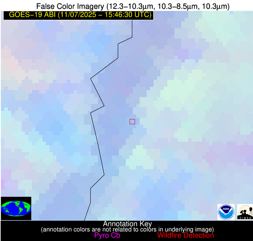
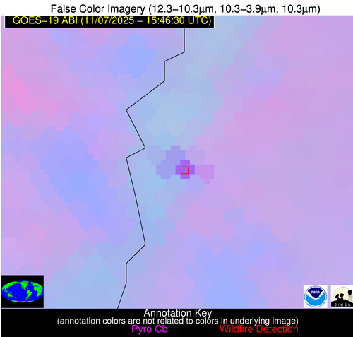
Wildfire Alert Report
| Date: | 2025-11-07 |
|---|---|
| Time: | 15:46:18 |
| Production Date and Time: | 2025-11-07 15:51:28 UTC |
| Primary Instrument: | GOES-19 ABI |
| Wmo Spacecraft Id: | 666 |
| Location/orbit: | GEO |
| L1 File: | OR_ABI-L1b-RadC-M6C14_G19_s20253111546180_e20253111548553_c20253111549036.nc |
| L1 File(s) - Temporal | OR_ABI-L1b-RadC-M6C14_G19_s20253111541180_e20253111543553_c20253111544017.nc |
| Number Of Thermal Anomaly Alerts: | 6 |
Possible Wildfire
| Basic Information | |
|---|---|
| State/Province(s) | Ontario |
| Country/Countries | Canada |
| County/Locality(s) | Kenora, Ontario |
| NWS WFO | N/A |
| Identification Method | Enhanced Contextual (Cloud) |
| Mean Object Date/Time | 2025-11-07 15:46:22UTC |
| Radiative Center (Lat, Lon): | 50.207779°, -91.485832° |
| Nearby Counties (meeting alert criteria): |
|
| Total Radiative Power Anomaly | n/a |
| Total Radiative Power | 83.18 MW |
| Map: | |
| Additional Information | |
| Alert Status | New Feature |
| Type of Event | Nominal Risk |
| Event Priority Ranking | 4 |
| Maximum Observed BT (3.9 um) | 296.97 K |
| Observed - Background BT (3.9 um) | 24.51 K |
| BT Anomaly (3.9 um) | 5.19 K |
| Maximum Observed - Clear RTM BT (3.9 um) | 29.46 K |
| Maximum Observed BTD (3.9-10/11/12 um) | 35.54 K |
| Observed - Background BTD (3.9-10/11/12 um) | 24.62 K |
| BTD Anomaly (3.9-10/11/12 um) | 4.27 K |
| Similar Pixel Count | 0 |
| BT Time Tendency (3.9 um) | 1.40 K |
| Image Interval | 5.00 minutes |
| Fraction of Surrounding LWIR Pixels that are Colder | 0.71 |
| Fraction of Surrounding Red Channel Pixels that are Brighter | 0.56 |
| Maximum Radiative Power | 83.18 MW |
| Maximum Radiative Power Uncertainty | 0.00 MW |
| Total Radiative Power Uncertainty | 0.00 MW |
| Mean Viewing Angle | 59.90° |
| Mean Solar Zenith Angle | 71.60° |
| Mean Glint Angle | 130.50° |
| Water Fraction | 0.00 |
| Total Pixel Area | 8.00 km2 |
| Latest Satellite Imagery: | |
| View all event imagery » | |
Possible Wildfire
| Basic Information | |
|---|---|
| State/Province(s) | Ontario |
| Country/Countries | Canada |
| County/Locality(s) | Kenora, Ontario |
| NWS WFO | N/A |
| Identification Method | Enhanced Contextual (Clear) |
| Mean Object Date/Time | 2025-11-07 15:46:22UTC |
| Radiative Center (Lat, Lon): | 49.972221°, -92.632774° |
| Nearby Counties (meeting alert criteria): |
|
| Total Radiative Power Anomaly | n/a |
| Total Radiative Power | 56.50 MW |
| Map: | |
| Additional Information | |
| Alert Status | New Feature |
| Type of Event | Nominal Risk |
| Event Priority Ranking | 4 |
| Maximum Observed BT (3.9 um) | 294.55 K |
| Observed - Background BT (3.9 um) | 13.95 K |
| BT Anomaly (3.9 um) | 4.55 K |
| Maximum Observed - Clear RTM BT (3.9 um) | 27.72 K |
| Maximum Observed BTD (3.9-10/11/12 um) | 33.12 K |
| Observed - Background BTD (3.9-10/11/12 um) | 13.63 K |
| BTD Anomaly (3.9-10/11/12 um) | 3.39 K |
| Similar Pixel Count | 8 |
| BT Time Tendency (3.9 um) | 10.80 K |
| Image Interval | 5.00 minutes |
| Fraction of Surrounding LWIR Pixels that are Colder | 0.58 |
| Fraction of Surrounding Red Channel Pixels that are Brighter | 0.88 |
| Maximum Radiative Power | 56.50 MW |
| Maximum Radiative Power Uncertainty | 0.00 MW |
| Total Radiative Power Uncertainty | 0.00 MW |
| Mean Viewing Angle | 60.00° |
| Mean Solar Zenith Angle | 71.80° |
| Mean Glint Angle | 130.80° |
| Water Fraction | 0.00 |
| Total Pixel Area | 8.00 km2 |
| Latest Satellite Imagery: | |
| View all event imagery » | |
Possible Wildfire
| Basic Information | |
|---|---|
| State/Province(s) | GA |
| Country/Countries | United States |
| County/Locality(s) | Washington County, GA |
| NWS WFO | Peachtree City GA |
| Identification Method | Enhanced Contextual (Clear) |
| Mean Object Date/Time | 2025-11-07 15:47:23UTC |
| Radiative Center (Lat, Lon): | 32.997223°, -82.575554° |
| Nearby Counties (meeting alert criteria): |
|
| Total Radiative Power Anomaly | n/a |
| Total Radiative Power | 6.56 MW |
| Map: | |
| Additional Information | |
| Alert Status | New Feature |
| Type of Event | Nominal Risk |
| Event Priority Ranking | 4 |
| Maximum Observed BT (3.9 um) | 298.78 K |
| Observed - Background BT (3.9 um) | 1.92 K |
| BT Anomaly (3.9 um) | 1.27 K |
| Maximum Observed - Clear RTM BT (3.9 um) | 6.84 K |
| Maximum Observed BTD (3.9-10/11/12 um) | 8.06 K |
| Observed - Background BTD (3.9-10/11/12 um) | 2.12 K |
| BTD Anomaly (3.9-10/11/12 um) | 2.79 K |
| Similar Pixel Count | 22 |
| BT Time Tendency (3.9 um) | 1.00 K |
| Image Interval | 5.00 minutes |
| Fraction of Surrounding LWIR Pixels that are Colder | 0.25 |
| Fraction of Surrounding Red Channel Pixels that are Brighter | 1.00 |
| Maximum Radiative Power | 6.56 MW |
| Maximum Radiative Power Uncertainty | 0.00 MW |
| Total Radiative Power Uncertainty | 0.00 MW |
| Mean Viewing Angle | 39.40° |
| Mean Solar Zenith Angle | 53.30° |
| Mean Glint Angle | 91.90° |
| Water Fraction | 0.00 |
| Total Pixel Area | 5.20 km2 |
| Latest Satellite Imagery: | |
| View all event imagery » | |
Possible Wildfire
| Basic Information | |
|---|---|
| State/Province(s) | AZ |
| Country/Countries | United States |
| County/Locality(s) | La Paz County, AZ |
| NWS WFO | Phoenix AZ |
| Identification Method | Enhanced Contextual (Clear) |
| Mean Object Date/Time | 2025-11-07 15:47:19UTC |
| Radiative Center (Lat, Lon): | 33.828609°, -114.432503° |
| Nearby Counties (meeting alert criteria): |
|
| Total Radiative Power Anomaly | n/a |
| Total Radiative Power | 110.57 MW |
| Map: | |
| Additional Information | |
| Alert Status | New Feature |
| Type of Event | Nominal Risk |
| Event Priority Ranking | 4 |
| Maximum Observed BT (3.9 um) | 306.87 K |
| Observed - Background BT (3.9 um) | 10.58 K |
| BT Anomaly (3.9 um) | 6.08 K |
| Maximum Observed - Clear RTM BT (3.9 um) | 11.05 K |
| Maximum Observed BTD (3.9-10/11/12 um) | 16.89 K |
| Observed - Background BTD (3.9-10/11/12 um) | 10.10 K |
| BTD Anomaly (3.9-10/11/12 um) | 12.24 K |
| Similar Pixel Count | 1 |
| BT Time Tendency (3.9 um) | 11.60 K |
| Image Interval | 5.00 minutes |
| Fraction of Surrounding LWIR Pixels that are Colder | 0.69 |
| Fraction of Surrounding Red Channel Pixels that are Brighter | 0.81 |
| Maximum Radiative Power | 110.57 MW |
| Maximum Radiative Power Uncertainty | 0.00 MW |
| Total Radiative Power Uncertainty | 0.00 MW |
| Mean Viewing Angle | 57.50° |
| Mean Solar Zenith Angle | 71.50° |
| Mean Glint Angle | 129.00° |
| Water Fraction | 0.00 |
| Total Pixel Area | 7.50 km2 |
| Latest Satellite Imagery: | |
| View all event imagery » | |
Possible Wildfire
| Basic Information | |
|---|---|
| State/Province(s) | GA |
| Country/Countries | United States |
| County/Locality(s) | Randolph County, GA |
| NWS WFO | Tallahassee FL |
| Identification Method | Enhanced Contextual (Clear) |
| Mean Object Date/Time | 2025-11-07 15:47:22UTC |
| Radiative Center (Lat, Lon): | 31.779444°, -84.741669° |
| Nearby Counties (meeting alert criteria): |
|
| Total Radiative Power Anomaly | n/a |
| Total Radiative Power | 7.86 MW |
| Map: | |
| Additional Information | |
| Alert Status | New Feature |
| Type of Event | Nominal Risk |
| Event Priority Ranking | 4 |
| Maximum Observed BT (3.9 um) | 301.54 K |
| Observed - Background BT (3.9 um) | 2.87 K |
| BT Anomaly (3.9 um) | 1.68 K |
| Maximum Observed - Clear RTM BT (3.9 um) | 9.08 K |
| Maximum Observed BTD (3.9-10/11/12 um) | 9.13 K |
| Observed - Background BTD (3.9-10/11/12 um) | 2.71 K |
| BTD Anomaly (3.9-10/11/12 um) | 3.27 K |
| Similar Pixel Count | 24 |
| BT Time Tendency (3.9 um) | 0.70 K |
| Image Interval | 5.00 minutes |
| Fraction of Surrounding LWIR Pixels that are Colder | 0.61 |
| Fraction of Surrounding Red Channel Pixels that are Brighter | 0.86 |
| Maximum Radiative Power | 7.86 MW |
| Maximum Radiative Power Uncertainty | 0.00 MW |
| Total Radiative Power Uncertainty | 0.00 MW |
| Mean Viewing Angle | 38.60° |
| Mean Solar Zenith Angle | 53.10° |
| Mean Glint Angle | 91.10° |
| Water Fraction | 0.00 |
| Total Pixel Area | 5.10 km2 |
| Latest Satellite Imagery: | |
| View all event imagery » | |
Possible Wildfire
| Basic Information | |
|---|---|
| State/Province(s) | FL |
| Country/Countries | United States |
| County/Locality(s) | Lafayette County, FL |
| NWS WFO | Tallahassee FL |
| Identification Method | Enhanced Contextual (Clear) |
| Mean Object Date/Time | 2025-11-07 15:47:22UTC |
| Radiative Center (Lat, Lon): | 30.076944°, -83.191109° |
| Nearby Counties (meeting alert criteria): |
|
| Total Radiative Power Anomaly | n/a |
| Total Radiative Power | 11.93 MW |
| Map: | |
| Additional Information | |
| Alert Status | New Feature |
| Type of Event | Nominal Risk |
| Event Priority Ranking | 4 |
| Maximum Observed BT (3.9 um) | 307.48 K |
| Observed - Background BT (3.9 um) | 5.85 K |
| BT Anomaly (3.9 um) | 2.12 K |
| Maximum Observed - Clear RTM BT (3.9 um) | 14.17 K |
| Maximum Observed BTD (3.9-10/11/12 um) | 12.71 K |
| Observed - Background BTD (3.9-10/11/12 um) | 5.33 K |
| BTD Anomaly (3.9-10/11/12 um) | 3.06 K |
| Similar Pixel Count | 10 |
| BT Time Tendency (3.9 um) | 2.60 K |
| Image Interval | 5.00 minutes |
| Fraction of Surrounding LWIR Pixels that are Colder | 0.68 |
| Fraction of Surrounding Red Channel Pixels that are Brighter | 0.47 |
| Maximum Radiative Power | 11.93 MW |
| Maximum Radiative Power Uncertainty | 0.00 MW |
| Total Radiative Power Uncertainty | 0.00 MW |
| Mean Viewing Angle | 36.30° |
| Mean Solar Zenith Angle | 51.00° |
| Mean Glint Angle | 86.60° |
| Water Fraction | 0.00 |
| Total Pixel Area | 5.00 km2 |
| Latest Satellite Imagery: | |
| View all event imagery » | |


